Property Record
Highway 212 Sw, Conyers, GA 30094

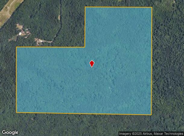

This Property Is For Sale
NEARBY LISTINGS FOR SALE OR LEASE
Property Detail
Highway 212 Sw
Atlanta-Sandy Springs-Roswell, GA
Rural
012-0-01-0017
N/SIDE HWY 212
Agriculturalland
Rockdale
X
Georgia
13247C0089D
130.85 AC
2024
I-20 East/Conyers
2025
Atlanta
060411
DEMOGRAPHICS near Highway 212 Sw
1 Mile
3 Mile
5 Mile
2024 Total Population
747
22,403
60,360
2029 Population
780
22,804
61,595
Pop Growth 2024-2029
+ 4.42%
+ 1.79%
+ 2.05%
Average Age
41
40
39
2024 Total Households
249
8,129
22,408
HH Growth 2024-2029
+ 4.42%
+ 1.71%
+ 1.90%
Median Household Inc
$88,175
$73,848
$65,678
Avg Household Size
2.90
2.70
2.60
2024 Avg HH Vehicles
3.00
2.00
2.00
Median Home Value
$211,856
$226,330
$227,831
Median Year Built
2001
1997
1992
Nearby Places
Map Layers
Map Styles
 Street
 Aerial
- Restaurants
- Banks
- Shops
- Fitness
- Groceries
PUBLIC TRANSPORTATION
AIRPORT
Hartsfield - Jackson Atlanta International
DRIVE
WALK
Distance
Hartsfield - Jackson Atlanta International
44 min
28.7 mi
Freight Ports
Georgia Ports - Savannah
DRIVE
WALK
Distance
Georgia Ports - Savannah
277 min
240.1 mi
Nearby Properties
Address
Land Use
TOTAL SIZE
Lot Size
Zoning
Address
Land Use
TOTAL SIZE
Lot Size
Zoning
224,892 SF
17.81 AC
RM100
Address
Land Use
TOTAL SIZE
Lot Size
Zoning
257,807 SF
29.13 AC
RM100
Address
Land Use
TOTAL SIZE
Lot Size
Zoning
2,782 SF
29.51 AC
R3/C
Address
Land Use
TOTAL SIZE
Lot Size
Zoning
88,314 SF
107.40 AC
AR
Address
Land Use
TOTAL SIZE
Lot Size
Zoning
20,964 SF
25.29 AC
R3/C
Address
Land Use
TOTAL SIZE
Lot Size
Zoning
216,855 SF
42.21 AC
AR
Address
Land Use
TOTAL SIZE
Lot Size
Zoning
69,417 SF
13.85 AC
C1/C
Address
Land Use
TOTAL SIZE
Lot Size
Zoning
113,548 SF
15 AC
AR
Address
Land Use
TOTAL SIZE
Lot Size
Zoning
2,910 SF
51.75 AC
AR
Address
Land Use
TOTAL SIZE
Lot Size
Zoning
81,201 SF
17.48 AC
R1
Address
Land Use
TOTAL SIZE
Lot Size
Zoning
9.10 AC
C1
Address
Land Use
TOTAL SIZE
Lot Size
Zoning
9.10 AC
C1
Address
Land Use
TOTAL SIZE
Lot Size
Zoning
2,636 SF
110.71 AC
AR
Address
Land Use
TOTAL SIZE
Lot Size
Zoning
14,900 SF
1.83 AC
X
Address
Land Use
TOTAL SIZE
Lot Size
Zoning
9.90 AC
R85
Address
Land Use
TOTAL SIZE
Lot Size
Zoning
21,249 SF
33.78 AC
AR
Address
Land Use
TOTAL SIZE
Lot Size
Zoning
95.60 AC
OI
Address
Land Use
TOTAL SIZE
Lot Size
Zoning
113.51 AC
AR/R1/C
Address
Land Use
TOTAL SIZE
Lot Size
Zoning
79.88 AC
R85
Address
Land Use
TOTAL SIZE
Lot Size
Zoning
14,412 SF
36.40 AC
AR/R1
Address
Land Use
TOTAL SIZE
Lot Size
Zoning
3,621 SF
1.25 AC
C1
Address
Land Use
TOTAL SIZE
Lot Size
Zoning
38,110 SF
16.02 AC
R1
Address
Land Use
TOTAL SIZE
Lot Size
Zoning
2,978 SF
1.03 AC
C1
Address
Land Use
TOTAL SIZE
Lot Size
Zoning
10,998 SF
1.81 AC
X
Address
Land Use
TOTAL SIZE
Lot Size
Zoning
58.11 AC
AR
Address
Land Use
TOTAL SIZE
Lot Size
Zoning
100.69 AC
X
Address
Land Use
TOTAL SIZE
Lot Size
Zoning
5,670 SF
2.49 AC
OI/COND
Address
Land Use
TOTAL SIZE
Lot Size
Zoning
4,140 SF
2.04 AC
C1
Address
Land Use
TOTAL SIZE
Lot Size
Zoning
9,600 SF
0.65 AC
OI
Address
Land Use
TOTAL SIZE
Lot Size
Zoning
13,960 SF
3.04 AC
OI/C
The World's #1 Commercial Real Estate Marketplace
Connect with us
© 2025 CoStar Group
The information above has been obtained from sources believed reliable. While we do not doubt its accuracy we have not verified it and make no guarantee, warranty or representation about it. It is your responsibility to independently confirm its accuracy and completeness. Any projections, opinions, assumptions, or estimates used are for example only and do not represent the current or future performance of the property. The value of this transaction to you depends on tax and other factors which should be evaluated by your tax, financial, and legal advisors. You and your advisors should conduct a careful, independent investigation of the property to determine to your satisfaction the suitability of the property for your needs.