Property Record
Highway 36, Rosenberg, TX 77471
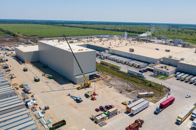

Property Detail
Highway 36
Houston-Pasadena-The Woodlands, TX
0377 YANDELL FERRIS, ACRES 20.722 (HLA)
0377-00-016-0009-901
FORT BEND
Industrialgeneral
Texas
B and X Area of moderate flood hazard, usually the area between the limits of the 100-year and 500-year floods.
20.72 AC
2024
Sugar Land
2025
Houston
675300
NEARBY LISTINGS FOR SALE OR LEASE
-
-
View all Rosenberg listings for sale on LoopNet.com
DEMOGRAPHICS near Highway 36
1 mile
3 mile
5 mile
2025 Total Population
9
840
24,086
2030 Population
11
969
27,463
Pop Growth 2025-2030
+ 22.22%
+ 15.36%
+ 14.02%
Average Age
27
38
37
2025 Total Households
3
266
7,936
HH Growth 2025-2030
0.00%
+ 15.41%
+ 14.39%
Median Household Inc
$0
$74,273
$71,040
Avg Household Size
2.50
3.20
3.00
2025 Avg HH Vehicles
2.00
2.00
2.00
Median Home Value
$299,999
$425,862
$247,058
Median Year Built
2011
1989
1992
Nearby Places
Map Layers
Map Styles
 Street
 Aerial
Layers
 Traffic
 Biking
Places
Listings with unknown addresses are not visible on the map
- Restaurants
- Banks
- Shops
- Fitness
- Groceries
Nearby Properties
Address
Land Use
TOTAL SIZE
Lot Size
Zoning
Address
Land Use
TOTAL SIZE
Lot Size
Zoning
672,112 SF
81.77 AC
YHN
Address
Land Use
TOTAL SIZE
Lot Size
Zoning
54.25 AC
L
Address
Land Use
TOTAL SIZE
Lot Size
Zoning
37.08 AC
Address
Land Use
TOTAL SIZE
Lot Size
Zoning
19.57 AC
OY
Address
Land Use
TOTAL SIZE
Lot Size
Zoning
9.51 AC
Address
Land Use
TOTAL SIZE
Lot Size
Zoning
105,350 SF
11.50 AC
R
Address
Land Use
TOTAL SIZE
Lot Size
Zoning
220,453 SF
142.24 AC
SQ
Address
Land Use
TOTAL SIZE
Lot Size
Zoning
85,000 SF
19.49 AC
SN
Address
Land Use
TOTAL SIZE
Lot Size
Zoning
21,110 SF
4 AC
S
Address
Land Use
TOTAL SIZE
Lot Size
Zoning
51,250 SF
10.01 AC
S
Address
Land Use
TOTAL SIZE
Lot Size
Zoning
175.10 AC
Address
Land Use
TOTAL SIZE
Lot Size
Zoning
67.93 AC
Address
Land Use
TOTAL SIZE
Lot Size
Zoning
139,047 SF
49.85 AC
Address
Land Use
TOTAL SIZE
Lot Size
Zoning
6,740 SF
77.56 AC
Address
Land Use
TOTAL SIZE
Lot Size
Zoning
20,785 SF
10 AC
QS
Address
Land Use
TOTAL SIZE
Lot Size
Zoning
68.41 AC
Y
Address
Land Use
TOTAL SIZE
Lot Size
Zoning
1.47 AC
L
Address
Land Use
TOTAL SIZE
Lot Size
Zoning
53,005 SF
3.25 AC
Address
Land Use
TOTAL SIZE
Lot Size
Zoning
1,260 SF
36.99 AC
YOQT
Address
Land Use
TOTAL SIZE
Lot Size
Zoning
Address
Land Use
TOTAL SIZE
Lot Size
Zoning
66.88 AC
Address
Land Use
TOTAL SIZE
Lot Size
Zoning
94,450 SF
7.16 AC
S
Address
Land Use
TOTAL SIZE
Lot Size
Zoning
177,887 SF
37 AC
YQM
Address
Land Use
TOTAL SIZE
Lot Size
Zoning
4,104 SF
3.77 AC
M
Address
Land Use
TOTAL SIZE
Lot Size
Zoning
51,364 SF
15.99 AC
SQ
Address
Land Use
TOTAL SIZE
Lot Size
Zoning
78 AC
SO
Address
Land Use
TOTAL SIZE
Lot Size
Zoning
11.50 AC
Address
Land Use
TOTAL SIZE
Lot Size
Zoning
11,232 SF
2.31 AC
Address
Land Use
TOTAL SIZE
Lot Size
Zoning
1,100 SF
6.21 AC
M
Address
Land Use
TOTAL SIZE
Lot Size
Zoning
1,112 SF
124.60 AC
OYNQ
The World's #1 Commercial Real Estate Marketplace
Connect with us
© 2026 CoStar Group
The information above has been obtained from sources believed reliable. While we do not doubt its accuracy we have not verified it and make no guarantee, warranty or representation about it. It is your responsibility to independently confirm its accuracy and completeness. Any projections, opinions, assumptions, or estimates used are for example only and do not represent the current or future performance of the property. The value of this transaction to you depends on tax and other factors which should be evaluated by your tax, financial, and legal advisors. You and your advisors should conduct a careful, independent investigation of the property to determine to your satisfaction the suitability of the property for your needs.