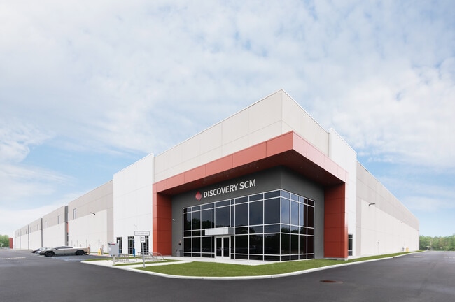
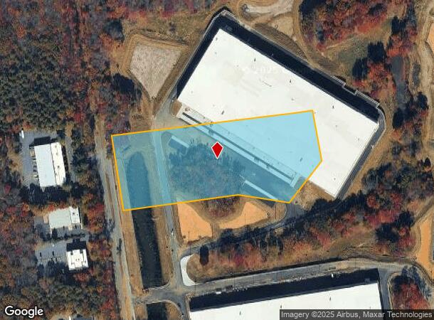
Property Record
Highway 9, Old Bridge, NJ 08857
NEARBY LISTINGS FOR SALE OR LEASE
Property Detail
Highway 9
New York-Jersey City-White Plains, NY-NJ
5.98AC
15-09000-0000-00041-12-QFARM
Middlesex
Farms
New Jersey
X
41.12
34023C0162F
5.98 AC
2024
Perth Amboy/GSP
2025
Northern New Jersey
007805
DEMOGRAPHICS near Highway 9
1 Mile
3 Mile
5 Mile
2024 Total Population
7,694
56,481
189,899
2029 Population
7,683
56,100
188,781
Pop Growth 2024-2029
(0.14%)
(0.67%)
(0.59%)
Average Age
41
41
41
2024 Total Households
3,210
20,752
69,393
HH Growth 2024-2029
(0.25%)
(0.81%)
(0.70%)
Median Household Inc
$78,859
$94,983
$103,593
Avg Household Size
2.40
2.70
2.70
2024 Avg HH Vehicles
2.00
2.00
2.00
Median Home Value
$419,646
$411,532
$399,164
Median Year Built
1966
1974
1972
Nearby Places
Map Layers
Map Styles
 Street
 Aerial
- Restaurants
- Banks
- Shops
- Fitness
- Groceries
PUBLIC TRANSPORTATION
COMMUTER RAIL
Aberdeen Matawan (North Jersey Coast Line - NJ Transit Commuter Rail (NJ Transit))
DRIVE
WALK
Distance
Aberdeen Matawan (North Jersey Coast Line - NJ Transit Commuter Rail (NJ Transit))
12 min
6.2 mi
South Amboy (North Jersey Coast Line - NJ Transit Commuter Rail (NJ Transit))
DRIVE
WALK
Distance
South Amboy (North Jersey Coast Line - NJ Transit Commuter Rail (NJ Transit))
14 min
7.8 mi
AIRPORT
Newark Liberty International
DRIVE
WALK
Distance
Newark Liberty International
40 min
31.3 mi
Trenton Mercer
DRIVE
WALK
Distance
Trenton Mercer
56 min
38.5 mi
Freight Ports
New York Container Terminal
DRIVE
WALK
Distance
New York Container Terminal
34 min
23.5 mi
Nearby Properties
Address
Land Use
TOTAL SIZE
Lot Size
Zoning
Address
Land Use
TOTAL SIZE
Lot Size
Zoning
176.53 AC
G1
Address
Land Use
TOTAL SIZE
Lot Size
Zoning
0.17 AC
R15
Address
Land Use
TOTAL SIZE
Lot Size
Zoning
7,902 SF
47.49 AC
TCD
Address
Land Use
TOTAL SIZE
Lot Size
Zoning
7,902 SF
62.41 AC
R20
Address
Land Use
TOTAL SIZE
Lot Size
Zoning
7,904 SF
39.92 AC
TCD
Address
Land Use
TOTAL SIZE
Lot Size
Zoning
7,904 SF
38.30 AC
AF
Address
Land Use
TOTAL SIZE
Lot Size
Zoning
7,804 SF
12.82 AC
OG3
Address
Land Use
TOTAL SIZE
Lot Size
Zoning
329.22 AC
I
Address
Land Use
TOTAL SIZE
Lot Size
Zoning
Address
Land Use
TOTAL SIZE
Lot Size
Zoning
7,905 SF
26.55 AC
CC
Address
Land Use
TOTAL SIZE
Lot Size
Zoning
7,904 SF
30 AC
AF
Address
Land Use
TOTAL SIZE
Lot Size
Zoning
7,801 SF
39.88 AC
AF
Address
Land Use
TOTAL SIZE
Lot Size
Zoning
7,801 SF
30.77 AC
AF
Address
Land Use
TOTAL SIZE
Lot Size
Zoning
7,801 SF
33.28 AC
AF
Address
Land Use
TOTAL SIZE
Lot Size
Zoning
7,904 SF
14.66 AC
R15
Address
Land Use
TOTAL SIZE
Lot Size
Zoning
7,804 SF
6.71 AC
OG1
Address
Land Use
TOTAL SIZE
Lot Size
Zoning
19.97 AC
P
Address
Land Use
TOTAL SIZE
Lot Size
Zoning
15.92 AC
R20
Address
Land Use
TOTAL SIZE
Lot Size
Zoning
7,904 SF
69.62 AC
AF
Address
Land Use
TOTAL SIZE
Lot Size
Zoning
7,801 SF
9.26 AC
CN
Address
Land Use
TOTAL SIZE
Lot Size
Zoning
47.57 AC
SED
Address
Land Use
TOTAL SIZE
Lot Size
Zoning
12.01 AC
Address
Land Use
TOTAL SIZE
Lot Size
Zoning
0.45 AC
CBD
Address
Land Use
TOTAL SIZE
Lot Size
Zoning
48.54 AC
Address
Land Use
TOTAL SIZE
Lot Size
Zoning
7,702 SF
23 AC
AF
Address
Land Use
TOTAL SIZE
Lot Size
Zoning
7,904 SF
26 AC
AF
Address
Land Use
TOTAL SIZE
Lot Size
Zoning
27.73 AC
I
Address
Land Use
TOTAL SIZE
Lot Size
Zoning
Address
Land Use
TOTAL SIZE
Lot Size
Zoning
7,702 SF
20.75 AC
AF
Address
Land Use
TOTAL SIZE
Lot Size
Zoning
7,803 SF
16.70 AC
R6
The World's #1 Commercial Real Estate Marketplace
Connect with us
© 2025 CoStar Group
The information above has been obtained from sources believed reliable. While we do not doubt its accuracy we have not verified it and make no guarantee, warranty or representation about it. It is your responsibility to independently confirm its accuracy and completeness. Any projections, opinions, assumptions, or estimates used are for example only and do not represent the current or future performance of the property. The value of this transaction to you depends on tax and other factors which should be evaluated by your tax, financial, and legal advisors. You and your advisors should conduct a careful, independent investigation of the property to determine to your satisfaction the suitability of the property for your needs.