Property Record
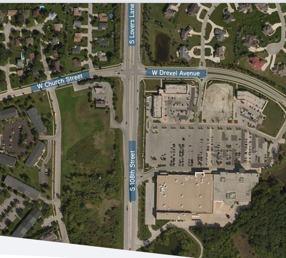
7730 S Lovers Lane Rd, Franklin, WI 53132

NEARBY LISTINGS FOR SALE OR LEASE
Property Detail
7730 S Lovers Lane Rd
Milwaukee-Waukesha-West Allis, WI
Certified
794-9999-007
CERTIFIED SURVEY MAP NO. 8567, SE 1/4 SEC 8-5-21, LOT 2
Commercialnec
Milwaukee
X
Wisconsin
55133C0375G
2
2024
1.61 AC
2024
SW Outlying Milwaukee
150303
Milwaukee/Madison
DEMOGRAPHICS near 7730 S Lovers Lane Rd
1 Mile
3 Mile
5 Mile
2024 Total Population
4,860
37,393
109,563
2029 Population
4,736
36,704
107,757
Pop Growth 2024-2029
(2.55%)
(1.84%)
(1.65%)
Average Age
45
44
43
2024 Total Households
2,095
15,016
45,274
HH Growth 2024-2029
(2.67%)
(1.98%)
(1.76%)
Median Household Inc
$98,100
$95,835
$85,736
Avg Household Size
2.30
2.30
2.30
2024 Avg HH Vehicles
2.00
2.00
2.00
Median Home Value
$298,332
$297,779
$288,377
Median Year Built
1986
1981
1977
Nearby Places
Map Layers
Map Styles
 Street
 Aerial
- Restaurants
- Banks
- Shops
- Fitness
- Groceries
PUBLIC TRANSPORTATION
COMMUTER RAIL
DRIVE
WALK
Distance
19 min
8.0 mi
AIRPORT
General Mitchell International
DRIVE
WALK
Distance
General Mitchell International
19 min
9.0 mi
Freight Ports
Port Milwaukee
DRIVE
WALK
Distance
Port Milwaukee
20 min
11.8 mi
SALE & LEASE HISTORY
LISTING DATE
SALE/LEASE

Sep 25, 2016
For Lease
Sep 24, 2016
For Sale
Sep 24, 2016
For Sale
Oct 10, 2019
For Sale
Aug 10, 2017
For Sale
Nearby Properties
Address
Land Use
TOTAL SIZE
Lot Size
Zoning
Address
Land Use
TOTAL SIZE
Lot Size
Zoning
27.11 AC
Address
Land Use
TOTAL SIZE
Lot Size
Zoning
Address
Land Use
TOTAL SIZE
Lot Size
Zoning
17.46 AC
Address
Land Use
TOTAL SIZE
Lot Size
Zoning
370,169 SF
23.69 AC
RM1
Address
Land Use
TOTAL SIZE
Lot Size
Zoning
5.74 AC
Address
Land Use
TOTAL SIZE
Lot Size
Zoning
174,869 SF
17.40 AC
RM1
Address
Land Use
TOTAL SIZE
Lot Size
Zoning
33.48 AC
Address
Land Use
TOTAL SIZE
Lot Size
Zoning
15.78 AC
Address
Land Use
TOTAL SIZE
Lot Size
Zoning
Address
Land Use
TOTAL SIZE
Lot Size
Zoning
14.95 AC
Address
Land Use
TOTAL SIZE
Lot Size
Zoning
Address
Land Use
TOTAL SIZE
Lot Size
Zoning
Address
Land Use
TOTAL SIZE
Lot Size
Zoning
65,227 SF
4.29 AC
Address
Land Use
TOTAL SIZE
Lot Size
Zoning
Address
Land Use
TOTAL SIZE
Lot Size
Zoning
10.98 AC
Address
Land Use
TOTAL SIZE
Lot Size
Zoning
Address
Land Use
TOTAL SIZE
Lot Size
Zoning
Address
Land Use
TOTAL SIZE
Lot Size
Zoning
Address
Land Use
TOTAL SIZE
Lot Size
Zoning
9.13 AC
Address
Land Use
TOTAL SIZE
Lot Size
Zoning
1.57 AC
Address
Land Use
TOTAL SIZE
Lot Size
Zoning
8.83 AC
Address
Land Use
TOTAL SIZE
Lot Size
Zoning
3.49 AC
Address
Land Use
TOTAL SIZE
Lot Size
Zoning
57,720 SF
7.06 AC
Address
Land Use
TOTAL SIZE
Lot Size
Zoning
2.84 AC
Address
Land Use
TOTAL SIZE
Lot Size
Zoning
125,028 SF
9.69 AC
Address
Land Use
TOTAL SIZE
Lot Size
Zoning
Address
Land Use
TOTAL SIZE
Lot Size
Zoning
162,366 SF
18.99 AC
Address
Land Use
TOTAL SIZE
Lot Size
Zoning
131,004 SF
6.88 AC
Address
Land Use
TOTAL SIZE
Lot Size
Zoning
100,386 SF
14.57 AC
Address
Land Use
TOTAL SIZE
Lot Size
Zoning
0.98 AC
The World's #1 Commercial Real Estate Marketplace
Connect with us
© 2025 CoStar Group
The information above has been obtained from sources believed reliable. While we do not doubt its accuracy we have not verified it and make no guarantee, warranty or representation about it. It is your responsibility to independently confirm its accuracy and completeness. Any projections, opinions, assumptions, or estimates used are for example only and do not represent the current or future performance of the property. The value of this transaction to you depends on tax and other factors which should be evaluated by your tax, financial, and legal advisors. You and your advisors should conduct a careful, independent investigation of the property to determine to your satisfaction the suitability of the property for your needs.