Property Record
Highway 92 Hwy, , GA

NEARBY LISTINGS FOR SALE OR LEASE
Property Detail
Highway 92 Hwy
Atlanta-Sandy Springs-Roswell, GA
Cherokee Office Center
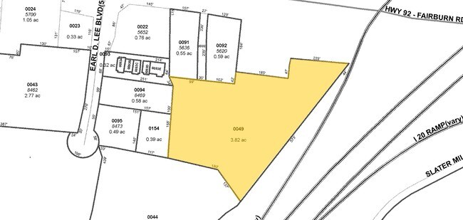
3015-00-5-0-049
V/3.6289 ACRES, OFF GA HWY 92
Commercialnec
Douglas
X
Georgia
13097C0152D
3.63 AC
2024
Douglasville/Lithia Springs
2024
Atlanta
080301
DEMOGRAPHICS near Highway 92 Hwy
1 Mile
3 Mile
5 Mile
2024 Total Population
5,505
43,773
98,052
2029 Population
5,806
46,265
103,856
Pop Growth 2024-2029
+ 5.47%
+ 5.69%
+ 5.92%
Average Age
36
37
38
2024 Total Households
1,994
15,482
34,417
HH Growth 2024-2029
+ 5.52%
+ 5.77%
+ 5.98%
Median Household Inc
$39,956
$61,447
$65,434
Avg Household Size
2.60
2.70
2.80
2024 Avg HH Vehicles
2.00
2.00
2.00
Median Home Value
$172,969
$204,595
$197,563
Median Year Built
1982
1991
1992
Nearby Places
- Restaurants
- Banks
- Shops
- Fitness
- Groceries
PUBLIC TRANSPORTATION
AIRPORT
Hartsfield - Jackson Atlanta International
DRIVE
WALK
Distance
Hartsfield - Jackson Atlanta International
38 min
28.4 mi
Freight Ports
Georgia Ports - Savannah
DRIVE
WALK
Distance
Georgia Ports - Savannah
301 min
267.7 mi
SALE & LEASE HISTORY
LISTING DATE
SALE/LEASE

Dec 04, 2017
For Sale
Aug 27, 2019
For Sale
Nearby Properties
Address
Land Use
TOTAL SIZE
Lot Size
Zoning
Address
Land Use
TOTAL SIZE
Lot Size
Zoning
247,203 SF
18.74 AC
DCD
Address
Land Use
TOTAL SIZE
Lot Size
Zoning
331,774 SF
37.68 AC
DCD
Address
Land Use
TOTAL SIZE
Lot Size
Zoning
263,326 SF
24.07 AC
CG
Address
Land Use
TOTAL SIZE
Lot Size
Zoning
449,595 SF
10.93 AC
R-2
Address
Land Use
TOTAL SIZE
Lot Size
Zoning
165,730 SF
17.35 AC
R-6
Address
Land Use
TOTAL SIZE
Lot Size
Zoning
181,768 SF
25 AC
R-MF
Address
Land Use
TOTAL SIZE
Lot Size
Zoning
167,376 SF
16.53 AC
R-6
Address
Land Use
TOTAL SIZE
Lot Size
Zoning
102,252 SF
8.68 AC
R-2
Address
Land Use
TOTAL SIZE
Lot Size
Zoning
224,137 SF
22.83 AC
CG
Address
Land Use
TOTAL SIZE
Lot Size
Zoning
100,462 SF
10.21 AC
CG
Address
Land Use
TOTAL SIZE
Lot Size
Zoning
87,669 SF
9.44 AC
CG
Address
Land Use
TOTAL SIZE
Lot Size
Zoning
170,778 SF
14.30 AC
R-2
Address
Land Use
TOTAL SIZE
Lot Size
Zoning
72,268 SF
7.26 AC
Address
Land Use
TOTAL SIZE
Lot Size
Zoning
26,274 SF
2.42 AC
OI-L
Address
Land Use
TOTAL SIZE
Lot Size
Zoning
45,088 SF
3.23 AC
OI-L
Address
Land Use
TOTAL SIZE
Lot Size
Zoning
110,489 SF
10.71 AC
R-6
Address
Land Use
TOTAL SIZE
Lot Size
Zoning
134,175 SF
15.99 AC
001
Address
Land Use
TOTAL SIZE
Lot Size
Zoning
135,300 SF
16.13 AC
CG
Address
Land Use
TOTAL SIZE
Lot Size
Zoning
58,854 SF
3.07 AC
OI-L
Address
Land Use
TOTAL SIZE
Lot Size
Zoning
87,472 SF
9.10 AC
DCD
Address
Land Use
TOTAL SIZE
Lot Size
Zoning
55,232 SF
4.28 AC
DCD
Address
Land Use
TOTAL SIZE
Lot Size
Zoning
49,148 SF
3.38 AC
CG
Address
Land Use
TOTAL SIZE
Lot Size
Zoning
41,925 SF
3.77 AC
DCD
Address
Land Use
TOTAL SIZE
Lot Size
Zoning
86,140 SF
10.88 AC
CG
Address
Land Use
TOTAL SIZE
Lot Size
Zoning
103,676 SF
7.36 AC
CG
Address
Land Use
TOTAL SIZE
Lot Size
Zoning
42,200 SF
2.96 AC
DCD
Address
Land Use
TOTAL SIZE
Lot Size
Zoning
129,646 SF
9.80 AC
CG
Address
Land Use
TOTAL SIZE
Lot Size
Zoning
41,584 SF
3.90 AC
DCD
Address
Land Use
TOTAL SIZE
Lot Size
Zoning
95,854 SF
17.75 AC
LI
Address
Land Use
TOTAL SIZE
Lot Size
Zoning
115,200 SF
8.74 AC
LI
The World's #1 Commercial Real Estate Marketplace
Connect with us
© 2025 CoStar Group
The information above has been obtained from sources believed reliable. While we do not doubt its accuracy we have not verified it and make no guarantee, warranty or representation about it. It is your responsibility to independently confirm its accuracy and completeness. Any projections, opinions, assumptions, or estimates used are for example only and do not represent the current or future performance of the property. The value of this transaction to you depends on tax and other factors which should be evaluated by your tax, financial, and legal advisors. You and your advisors should conduct a careful, independent investigation of the property to determine to your satisfaction the suitability of the property for your needs.