Property Record
Johnson Ave, Ronkonkoma, NY 11779

Save to a Folder
{{folder.Name}}
{{folder.ListingIds.length}} Properties
{{folder.ListingIds.length}} Property
Create a New Folder
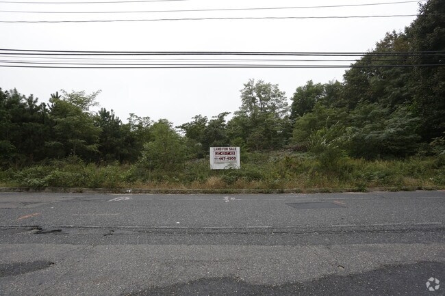
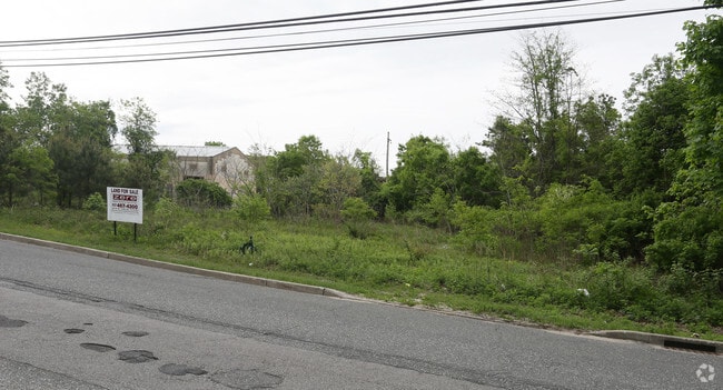
Property Detail
Johnson Ave
Nassau County-Suffolk County, NY
LAKE RONK ESTS 8 40 B 49 4 & 5 & AB
0200-798-00-02-00-052-004
SUFFOLK
Commercialacreage
New York
B and X Area of moderate flood hazard, usually the area between the limits of the 100-year and 500-year floods.
500
2024
0.16 AC
2025
Central Suffolk
158608
Long Island (New York)
NEARBY LISTINGS FOR SALE OR LEASE
DEMOGRAPHICS near Johnson Ave
1 mile
3 mile
5 mile
2025 Total Population
10,639
73,870
227,059
2030 Population
10,717
73,437
226,101
Pop Growth 2025-2030
+ 0.73%
(0.59%)
(0.42%)
Average Age
40
42
42
2025 Total Households
3,445
24,785
77,422
HH Growth 2025-2030
+ 0.78%
(0.77%)
(0.53%)
Median Household Inc
$131,810
$125,527
$126,473
Avg Household Size
3.00
2.90
2.80
2025 Avg HH Vehicles
2.00
2.00
2.00
Median Home Value
$540,584
$568,307
$596,229
Median Year Built
1970
1970
1971
Nearby Places
Map Layers
Map Styles
 Street
 Aerial
Layers
 Traffic
 Biking
Places
Listings with unknown addresses are not visible on the map
- Restaurants
- Banks
- Shops
- Fitness
- Groceries
PUBLIC TRANSPORTATION
COMMUTER RAIL
Ronkonkoma (Ronkonkoma Branch - Long Island Rail Road)
Drive
Walk
Distance
Ronkonkoma (Ronkonkoma Branch - Long Island Rail Road)
4 min
1.2 mi
Central Islip (Ronkonkoma Branch - Long Island Rail Road)
Drive
Walk
Distance
Central Islip (Ronkonkoma Branch - Long Island Rail Road)
10 min
5.1 mi
AIRPORT
Long Island MacArthur
Drive
Walk
Distance
Long Island MacArthur
8 min
3.2 mi
Freight Ports
Port of New Haven
Drive
Walk
Distance
Port of New Haven
131 min
50.9 mi
Nearby Properties
Address
Land Use
TOTAL SIZE
Lot Size
Zoning
Address
Land Use
TOTAL SIZE
Lot Size
Zoning
1,207.60 AC
Address
Land Use
TOTAL SIZE
Lot Size
Zoning
69.90 AC
AA
Address
Land Use
TOTAL SIZE
Lot Size
Zoning
49.54 AC
CA
Address
Land Use
TOTAL SIZE
Lot Size
Zoning
8.18 AC
NULL
Address
Land Use
TOTAL SIZE
Lot Size
Zoning
170.87 AC
AAA
Address
Land Use
TOTAL SIZE
Lot Size
Zoning
95.19 AC
Address
Land Use
TOTAL SIZE
Lot Size
Zoning
5.32 AC
BUS3
Address
Land Use
TOTAL SIZE
Lot Size
Zoning
51.59 AC
AA
Address
Land Use
TOTAL SIZE
Lot Size
Zoning
360.60 AC
AAA
Address
Land Use
TOTAL SIZE
Lot Size
Zoning
23.50 AC
AA
Address
Land Use
TOTAL SIZE
Lot Size
Zoning
13.06 AC
BUS3
Address
Land Use
TOTAL SIZE
Lot Size
Zoning
18.68 AC
IND1
Address
Land Use
TOTAL SIZE
Lot Size
Zoning
97.24 AC
AAA
Address
Land Use
TOTAL SIZE
Lot Size
Zoning
23.08 AC
AA
Address
Land Use
TOTAL SIZE
Lot Size
Zoning
200.70 AC
AAA
Address
Land Use
TOTAL SIZE
Lot Size
Zoning
5.53 AC
ICD
Address
Land Use
TOTAL SIZE
Lot Size
Zoning
45.71 AC
NULL
Address
Land Use
TOTAL SIZE
Lot Size
Zoning
152.10 AC
AA
Address
Land Use
TOTAL SIZE
Lot Size
Zoning
11.19 AC
Address
Land Use
TOTAL SIZE
Lot Size
Zoning
16.90 AC
AA
Address
Land Use
TOTAL SIZE
Lot Size
Zoning
5.40 AC
ICD
Address
Land Use
TOTAL SIZE
Lot Size
Zoning
9.60 AC
Address
Land Use
TOTAL SIZE
Lot Size
Zoning
14.48 AC
IND1
Address
Land Use
TOTAL SIZE
Lot Size
Zoning
6.50 AC
GSE
Address
Land Use
TOTAL SIZE
Lot Size
Zoning
Address
Land Use
TOTAL SIZE
Lot Size
Zoning
26.18 AC
IND1
Address
Land Use
TOTAL SIZE
Lot Size
Zoning
11.17 AC
Address
Land Use
TOTAL SIZE
Lot Size
Zoning
15.80 AC
ICD
Address
Land Use
TOTAL SIZE
Lot Size
Zoning
12.20 AC
IND1
Address
Land Use
TOTAL SIZE
Lot Size
Zoning
10.99 AC
The World's #1 Commercial Real Estate Marketplace
Connect with us
© 2026 CoStar Group
The information above has been obtained from sources believed reliable. While we do not doubt its accuracy we have not verified it and make no guarantee, warranty or representation about it. It is your responsibility to independently confirm its accuracy and completeness. Any projections, opinions, assumptions, or estimates used are for example only and do not represent the current or future performance of the property. The value of this transaction to you depends on tax and other factors which should be evaluated by your tax, financial, and legal advisors. You and your advisors should conduct a careful, independent investigation of the property to determine to your satisfaction the suitability of the property for your needs.