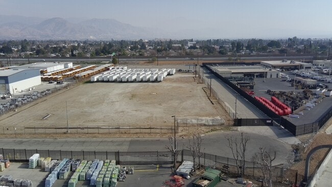
Property Record
Lincoln Dr, San Bernardino, CA 92411


Current Lease Availabilities
NEARBY LISTINGS FOR SALE OR LEASE
Property Detail
Lincoln Dr
Riverside-San Bernardino-Ontario, CA
Rancho San Bernardino
0144-101-31
MAP 201 36 589 PAR NO 3 AKA THAT PORTION OF LOTS 1 AND 2, BLOCK 53, RANCHO SAN BERNARDINO, IN THE CITY OF SAN BERNARDINO, COUNTY OF SAN BERNARDINO, STATE OF CALIFORNIA, AS PER PLAT RECORDED IN BOOK 7, PAGE 2, OF MAPS, RECORDS OF SAID COUNTY, DESCRIBE
Vacantlandnec
San Bernardino
X
California
06071C7945H
1,2
0
5.38 AC
2025
San Bernardino
004202
Inland Empire (California)
DEMOGRAPHICS near Lincoln Dr
1 Mile
3 Mile
5 Mile
2024 Total Population
23,778
161,149
354,428
2029 Population
24,129
163,446
359,523
Pop Growth 2024-2029
+ 1.48%
+ 1.43%
+ 1.44%
Average Age
33
34
34
2024 Total Households
6,375
45,025
97,303
HH Growth 2024-2029
+ 1.47%
+ 1.52%
+ 1.49%
Median Household Inc
$51,866
$52,143
$59,983
Avg Household Size
3.60
3.40
3.50
2024 Avg HH Vehicles
2.00
2.00
2.00
Median Home Value
$288,872
$316,104
$345,256
Median Year Built
1955
1961
1968
Nearby Places
Map Layers
Map Styles
 Street
 Aerial
- Restaurants
- Banks
- Shops
- Fitness
- Groceries
PUBLIC TRANSPORTATION
COMMUTER RAIL
San Bernardino (Inland Empire-Orange County Line - Southern California Regional Rail Authority (Metrolink), San Bernardino Line - Southern California Regional Rail Authority (Metrolink))
DRIVE
WALK
Distance
San Bernardino (Inland Empire-Orange County Line - Southern California Regional Rail Authority (Metrolink), San Bernardino Line - Southern California Regional Rail Authority (Metrolink))
7 min
3.4 mi
DRIVE
WALK
Distance
8 min
3.8 mi
AIRPORT
Ontario International
DRIVE
WALK
Distance
Ontario International
34 min
24.6 mi
Nearby Properties
Address
Land Use
TOTAL SIZE
Lot Size
Zoning
Address
Land Use
TOTAL SIZE
Lot Size
Zoning
778,653 SF
19.31 AC
Address
Land Use
TOTAL SIZE
Lot Size
Zoning
379,299 SF
19.97 AC
Address
Land Use
TOTAL SIZE
Lot Size
Zoning
801,377 SF
20.81 AC
Address
Land Use
TOTAL SIZE
Lot Size
Zoning
178,926 SF
9.12 AC
IC
Address
Land Use
TOTAL SIZE
Lot Size
Zoning
277,822 SF
13.65 AC
Address
Land Use
TOTAL SIZE
Lot Size
Zoning
335,000 SF
8.44 AC
Address
Land Use
TOTAL SIZE
Lot Size
Zoning
151,859 SF
7.23 AC
Address
Land Use
TOTAL SIZE
Lot Size
Zoning
415,405 SF
18.43 AC
IC
Address
Land Use
TOTAL SIZE
Lot Size
Zoning
354,108 SF
16.93 AC
Address
Land Use
TOTAL SIZE
Lot Size
Zoning
599,690 SF
17.08 AC
IC
Address
Land Use
TOTAL SIZE
Lot Size
Zoning
24.24 AC
Address
Land Use
TOTAL SIZE
Lot Size
Zoning
413,953 SF
19.58 AC
Address
Land Use
TOTAL SIZE
Lot Size
Zoning
159,956 SF
9.20 AC
Address
Land Use
TOTAL SIZE
Lot Size
Zoning
350,939 SF
6.29 AC
Address
Land Use
TOTAL SIZE
Lot Size
Zoning
Address
Land Use
TOTAL SIZE
Lot Size
Zoning
8,200 SF
11.29 AC
Address
Land Use
TOTAL SIZE
Lot Size
Zoning
448,460 SF
24.10 AC
Address
Land Use
TOTAL SIZE
Lot Size
Zoning
55,432 SF
5.31 AC
Address
Land Use
TOTAL SIZE
Lot Size
Zoning
170,272 SF
12.36 AC
Address
Land Use
TOTAL SIZE
Lot Size
Zoning
954 SF
9.34 AC
IC
Address
Land Use
TOTAL SIZE
Lot Size
Zoning
138,474 SF
10.55 AC
Address
Land Use
TOTAL SIZE
Lot Size
Zoning
217,418 SF
7.45 AC
Address
Land Use
TOTAL SIZE
Lot Size
Zoning
73,864 SF
5.44 AC
R1
Address
Land Use
TOTAL SIZE
Lot Size
Zoning
73,308 SF
4.76 AC
Address
Land Use
TOTAL SIZE
Lot Size
Zoning
60,384 SF
2.81 AC
Address
Land Use
TOTAL SIZE
Lot Size
Zoning
87,733 SF
4.65 AC
Address
Land Use
TOTAL SIZE
Lot Size
Zoning
117,253 SF
7.39 AC
Address
Land Use
TOTAL SIZE
Lot Size
Zoning
66,180 SF
3.07 AC
Address
Land Use
TOTAL SIZE
Lot Size
Zoning
91,086 SF
4.16 AC
Address
Land Use
TOTAL SIZE
Lot Size
Zoning
38,150 SF
4.18 AC
The World's #1 Commercial Real Estate Marketplace
Connect with us
© 2026 CoStar Group
The information above has been obtained from sources believed reliable. While we do not doubt its accuracy we have not verified it and make no guarantee, warranty or representation about it. It is your responsibility to independently confirm its accuracy and completeness. Any projections, opinions, assumptions, or estimates used are for example only and do not represent the current or future performance of the property. The value of this transaction to you depends on tax and other factors which should be evaluated by your tax, financial, and legal advisors. You and your advisors should conduct a careful, independent investigation of the property to determine to your satisfaction the suitability of the property for your needs.