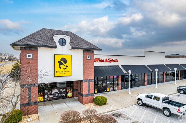
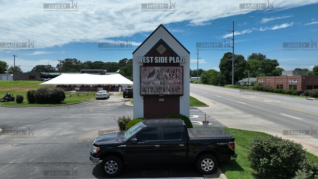
Property Record
830 W Mount Vernon St, Nixa, MO 65714
NEARBY LISTINGS FOR SALE OR LEASE
Property Detail
830 W Mount Vernon St
Springfield, MO
Magers Sub
10-0.6-14-003-001-033.000
LOTS 1,2, & 3 MAGERS SUB
Commercialnec
Christian
X
Missouri
29043C0066D
1,2
2023
13.82 AC
2024
West Christian County
020205
Springfield
24,282 SF
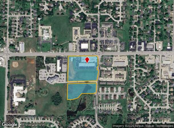
DEMOGRAPHICS near 830 W Mount Vernon St
1 Mile
3 Mile
5 Mile
2024 Total Population
6,973
32,288
51,377
2029 Population
7,874
36,495
57,432
Pop Growth 2024-2029
+ 12.92%
+ 13.03%
+ 11.79%
Average Age
42
39
40
2024 Total Households
2,760
12,368
19,517
HH Growth 2024-2029
+ 13.01%
+ 13.07%
+ 11.89%
Median Household Inc
$69,887
$72,260
$74,393
Avg Household Size
2.50
2.60
2.60
2024 Avg HH Vehicles
2.00
2.00
2.00
Median Home Value
$215,985
$227,254
$242,674
Median Year Built
1996
1997
1998
Nearby Places
Map Layers
Map Styles
 Street
 Aerial
- Restaurants
- Banks
- Shops
- Fitness
- Groceries
PUBLIC TRANSPORTATION
AIRPORT
Springfield-Branson Ntl
DRIVE
WALK
Distance
Springfield-Branson Ntl
39 min
21.4 mi
SALE & LEASE HISTORY
LISTING DATE
SALE/LEASE

Sep 25, 2016
For Lease
Jun 25, 2025
For Sale
Jul 16, 2025
For Lease
Nearby Properties
Address
Land Use
TOTAL SIZE
Lot Size
Zoning
Address
Land Use
TOTAL SIZE
Lot Size
Zoning
62.43 AC
Address
Land Use
TOTAL SIZE
Lot Size
Zoning
26.20 AC
Address
Land Use
TOTAL SIZE
Lot Size
Zoning
310,792 SF
12.27 AC
Address
Land Use
TOTAL SIZE
Lot Size
Zoning
10,720 SF
9.71 AC
Address
Land Use
TOTAL SIZE
Lot Size
Zoning
39.87 AC
Address
Land Use
TOTAL SIZE
Lot Size
Zoning
30,049 SF
5.01 AC
Address
Land Use
TOTAL SIZE
Lot Size
Zoning
73,140 SF
10.80 AC
Address
Land Use
TOTAL SIZE
Lot Size
Zoning
19.78 AC
Address
Land Use
TOTAL SIZE
Lot Size
Zoning
3,080 SF
24.20 AC
Address
Land Use
TOTAL SIZE
Lot Size
Zoning
19,682 SF
7.17 AC
Address
Land Use
TOTAL SIZE
Lot Size
Zoning
13,750 SF
6.56 AC
Address
Land Use
TOTAL SIZE
Lot Size
Zoning
18.56 AC
Address
Land Use
TOTAL SIZE
Lot Size
Zoning
107,194 SF
39.40 AC
Address
Land Use
TOTAL SIZE
Lot Size
Zoning
23,660 SF
10 AC
Address
Land Use
TOTAL SIZE
Lot Size
Zoning
43,194 SF
18 AC
Address
Land Use
TOTAL SIZE
Lot Size
Zoning
31,570 SF
3.99 AC
Address
Land Use
TOTAL SIZE
Lot Size
Zoning
77,022 SF
9.46 AC
Address
Land Use
TOTAL SIZE
Lot Size
Zoning
13,836 SF
5.81 AC
Address
Land Use
TOTAL SIZE
Lot Size
Zoning
36,110 SF
7 AC
Address
Land Use
TOTAL SIZE
Lot Size
Zoning
22,920 SF
8.51 AC
Address
Land Use
TOTAL SIZE
Lot Size
Zoning
51,498 SF
39.26 AC
Address
Land Use
TOTAL SIZE
Lot Size
Zoning
12,012 SF
9.93 AC
Address
Land Use
TOTAL SIZE
Lot Size
Zoning
13,940 SF
3.43 AC
Address
Land Use
TOTAL SIZE
Lot Size
Zoning
18,966 SF
4.71 AC
Address
Land Use
TOTAL SIZE
Lot Size
Zoning
200,000 SF
10 AC
Address
Land Use
TOTAL SIZE
Lot Size
Zoning
8,100 SF
6.95 AC
Address
Land Use
TOTAL SIZE
Lot Size
Zoning
40,726 SF
4.54 AC
Address
Land Use
TOTAL SIZE
Lot Size
Zoning
2,000 SF
3 AC
Address
Land Use
TOTAL SIZE
Lot Size
Zoning
15,774 SF
10 AC
Address
Land Use
TOTAL SIZE
Lot Size
Zoning
22,150 SF
7.41 AC
The World's #1 Commercial Real Estate Marketplace
Connect with us
© 2026 CoStar Group
The information above has been obtained from sources believed reliable. While we do not doubt its accuracy we have not verified it and make no guarantee, warranty or representation about it. It is your responsibility to independently confirm its accuracy and completeness. Any projections, opinions, assumptions, or estimates used are for example only and do not represent the current or future performance of the property. The value of this transaction to you depends on tax and other factors which should be evaluated by your tax, financial, and legal advisors. You and your advisors should conduct a careful, independent investigation of the property to determine to your satisfaction the suitability of the property for your needs.