Property Record
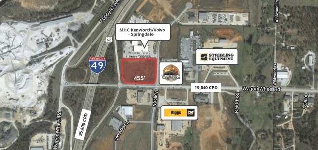
N 45Th St, Springdale, AR 72762

Property Detail
N 45Th St
Fayetteville-Springdale-Rogers, AR
PLAT 10/23/08 2008-589
21-02353-000
BENTON
Commercialacreage
Arkansas
B and X Area of moderate flood hazard, usually the area between the limits of the 100-year and 500-year floods.
8
2025
4.57 AC
2025
Greater Springdale
010518
Fayetteville/Springdale/Rogers
NEARBY LISTINGS FOR SALE OR LEASE
DEMOGRAPHICS near N 45Th St
1 mile
3 mile
5 mile
2025 Total Population
1,433
34,810
103,075
2030 Population
1,579
37,685
111,858
Pop Growth 2025-2030
+ 10.19%
+ 8.26%
+ 8.52%
Average Age
33
36
36
2025 Total Households
475
11,131
34,522
HH Growth 2025-2030
+ 10.53%
+ 8.53%
+ 8.86%
Median Household Inc
$146,370
$89,663
$83,513
Avg Household Size
3.00
3.00
2.90
2025 Avg HH Vehicles
2.00
2.00
2.00
Median Home Value
$296,609
$338,065
$359,111
Median Year Built
2006
1999
2000
Nearby Places
Map Layers
Map Styles
 Street
 Aerial
Layers
 Traffic
 Biking
Places
Listings with unknown addresses are not visible on the map
- Restaurants
- Banks
- Shops
- Fitness
- Groceries
PUBLIC TRANSPORTATION
AIRPORT
Northwest Arkansas Ntl
Drive
Walk
Distance
Northwest Arkansas Ntl
27 min
12.8 mi
Freight Ports
Tulsa Port of Inola
Drive
Walk
Distance
Tulsa Port of Inola
102 min
87.6 mi
SALE & LEASE HISTORY
LISTING DATE
SALE/LEASE

Sep 08, 2023
For Sale
May 03, 2017
For Sale
Nearby Properties
Address
Land Use
TOTAL SIZE
Lot Size
Zoning
Address
Land Use
TOTAL SIZE
Lot Size
Zoning
367,076 SF
57.31 AC
Address
Land Use
TOTAL SIZE
Lot Size
Zoning
251,508 SF
30 AC
Address
Land Use
TOTAL SIZE
Lot Size
Zoning
132,494 SF
21.56 AC
Address
Land Use
TOTAL SIZE
Lot Size
Zoning
306,148 SF
48.89 AC
Address
Land Use
TOTAL SIZE
Lot Size
Zoning
196,657 SF
18.82 AC
Address
Land Use
TOTAL SIZE
Lot Size
Zoning
191,100 SF
10.03 AC
Address
Land Use
TOTAL SIZE
Lot Size
Zoning
75,610 SF
5.62 AC
Address
Land Use
TOTAL SIZE
Lot Size
Zoning
292,470 SF
17.27 AC
Address
Land Use
TOTAL SIZE
Lot Size
Zoning
348,916 SF
24.69 AC
Address
Land Use
TOTAL SIZE
Lot Size
Zoning
127,043 SF
6.82 AC
Address
Land Use
TOTAL SIZE
Lot Size
Zoning
12,882 SF
12.33 AC
Address
Land Use
TOTAL SIZE
Lot Size
Zoning
31,150 SF
3.74 AC
C1
Address
Land Use
TOTAL SIZE
Lot Size
Zoning
182,415 SF
68.93 AC
Address
Land Use
TOTAL SIZE
Lot Size
Zoning
182,415 SF
12.04 AC
Address
Land Use
TOTAL SIZE
Lot Size
Zoning
73,711 SF
3.59 AC
Address
Land Use
TOTAL SIZE
Lot Size
Zoning
61,012 SF
18.96 AC
Address
Land Use
TOTAL SIZE
Lot Size
Zoning
147,762 SF
Address
Land Use
TOTAL SIZE
Lot Size
Zoning
123,740 SF
13.96 AC
Address
Land Use
TOTAL SIZE
Lot Size
Zoning
170,442 SF
12.62 AC
Address
Land Use
TOTAL SIZE
Lot Size
Zoning
160,570 SF
20.31 AC
Address
Land Use
TOTAL SIZE
Lot Size
Zoning
40,456 SF
14.17 AC
Address
Land Use
TOTAL SIZE
Lot Size
Zoning
65,200 SF
9.26 AC
Address
Land Use
TOTAL SIZE
Lot Size
Zoning
58,500 SF
3.45 AC
Address
Land Use
TOTAL SIZE
Lot Size
Zoning
73,714 SF
2.48 AC
Address
Land Use
TOTAL SIZE
Lot Size
Zoning
51,376 SF
5.86 AC
Address
Land Use
TOTAL SIZE
Lot Size
Zoning
49,059 SF
2.42 AC
Address
Land Use
TOTAL SIZE
Lot Size
Zoning
49,800 SF
5.65 AC
Address
Land Use
TOTAL SIZE
Lot Size
Zoning
68,099 SF
17.38 AC
Address
Land Use
TOTAL SIZE
Lot Size
Zoning
55,135 SF
10.22 AC
Address
Land Use
TOTAL SIZE
Lot Size
Zoning
64,932 SF
9.29 AC
The World's #1 Commercial Real Estate Marketplace
Connect with us
© 2026 CoStar Group
The information above has been obtained from sources believed reliable. While we do not doubt its accuracy we have not verified it and make no guarantee, warranty or representation about it. It is your responsibility to independently confirm its accuracy and completeness. Any projections, opinions, assumptions, or estimates used are for example only and do not represent the current or future performance of the property. The value of this transaction to you depends on tax and other factors which should be evaluated by your tax, financial, and legal advisors. You and your advisors should conduct a careful, independent investigation of the property to determine to your satisfaction the suitability of the property for your needs.