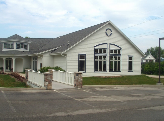
Property Record
N22w27847 Edgewater Dr, Pewaukee, WI 53072

NEARBY LISTINGS FOR SALE OR LEASE
Property Detail
N22w27847 Edgewater Dr
Milwaukee-Waukesha-West Allis, WI
View Estate
PWC-0938-001
LOT 1 & W1/2 LOT 2 LAKE-VIEW ESTATES PT NW1/4 & SW1/4 SEC 19 T7N R19E EX R2162/562 DOC# 2709639
Commercialnec
Waukesha
X
Wisconsin
55133C0191H
1,2
2024
0.88 AC
2024
Central Waukesha
203305
Milwaukee/Madison
DEMOGRAPHICS near N22w27847 Edgewater Dr
1 Mile
3 Mile
5 Mile
2024 Total Population
1,941
27,278
82,458
2029 Population
1,987
27,786
84,581
Pop Growth 2024-2029
+ 2.37%
+ 1.86%
+ 2.57%
Average Age
43
43
42
2024 Total Households
745
11,246
34,992
HH Growth 2024-2029
+ 2.42%
+ 1.85%
+ 2.69%
Median Household Inc
$118,634
$97,018
$87,080
Avg Household Size
2.60
2.40
2.30
2024 Avg HH Vehicles
2.00
2.00
2.00
Median Home Value
$418,128
$366,003
$337,706
Median Year Built
1973
1988
1985
Nearby Places
Map Layers
Map Styles
 Street
 Aerial
- Restaurants
- Banks
- Shops
- Fitness
- Groceries
PUBLIC TRANSPORTATION
AIRPORT
General Mitchell International
DRIVE
WALK
Distance
General Mitchell International
40 min
27.0 mi
Freight Ports
Port Milwaukee
DRIVE
WALK
Distance
Port Milwaukee
33 min
23.5 mi
SALE & LEASE HISTORY
LISTING DATE
SALE/LEASE

Sep 14, 2017
For Lease
Jul 25, 2018
For Lease
Jul 16, 2018
For Sale
Nearby Properties
Address
Land Use
TOTAL SIZE
Lot Size
Zoning
Address
Land Use
TOTAL SIZE
Lot Size
Zoning
172.13 AC
M-2
Address
Land Use
TOTAL SIZE
Lot Size
Zoning
63,482 SF
39.53 AC
I-1
Address
Land Use
TOTAL SIZE
Lot Size
Zoning
51,676 SF
7.41 AC
RM-3(PUD)
Address
Land Use
TOTAL SIZE
Lot Size
Zoning
51,676 SF
6.96 AC
RM-3(PUD)
Address
Land Use
TOTAL SIZE
Lot Size
Zoning
129,059 SF
19.19 AC
RM-2(PUD)
Address
Land Use
TOTAL SIZE
Lot Size
Zoning
20.65 AC
Address
Land Use
TOTAL SIZE
Lot Size
Zoning
203,208 SF
41.18 AC
B-5,C-1
Address
Land Use
TOTAL SIZE
Lot Size
Zoning
65,803 SF
15.22 AC
RM-2(PUD),
Address
Land Use
TOTAL SIZE
Lot Size
Zoning
136.33 AC
M-2
Address
Land Use
TOTAL SIZE
Lot Size
Zoning
180,616 SF
10.46 AC
B-5(PUD)
Address
Land Use
TOTAL SIZE
Lot Size
Zoning
36,054 SF
10.62 AC
I-1
Address
Land Use
TOTAL SIZE
Lot Size
Zoning
81,796 SF
5.96 AC
B-5
Address
Land Use
TOTAL SIZE
Lot Size
Zoning
28.53 AC
Address
Land Use
TOTAL SIZE
Lot Size
Zoning
Address
Land Use
TOTAL SIZE
Lot Size
Zoning
Address
Land Use
TOTAL SIZE
Lot Size
Zoning
12.11 AC
Address
Land Use
TOTAL SIZE
Lot Size
Zoning
18.15 AC
Address
Land Use
TOTAL SIZE
Lot Size
Zoning
7.65 AC
RM-2
Address
Land Use
TOTAL SIZE
Lot Size
Zoning
104,151 SF
3.68 AC
B-5
Address
Land Use
TOTAL SIZE
Lot Size
Zoning
25,839 SF
6.28 AC
RM-2(PUD)
Address
Land Use
TOTAL SIZE
Lot Size
Zoning
7.10 AC
Address
Land Use
TOTAL SIZE
Lot Size
Zoning
Address
Land Use
TOTAL SIZE
Lot Size
Zoning
58,289 SF
6.70 AC
B-5(PUD)
Address
Land Use
TOTAL SIZE
Lot Size
Zoning
5.18 AC
Address
Land Use
TOTAL SIZE
Lot Size
Zoning
31,526 SF
3.77 AC
RM-2(PUD)
Address
Land Use
TOTAL SIZE
Lot Size
Zoning
23,178 SF
4.79 AC
RM-3(PUD)
Address
Land Use
TOTAL SIZE
Lot Size
Zoning
2.38 AC
B-5(PUD)
Address
Land Use
TOTAL SIZE
Lot Size
Zoning
57,538 SF
4.12 AC
B-5(PUD)
Address
Land Use
TOTAL SIZE
Lot Size
Zoning
33,804 SF
3.56 AC
RM-2(PUD)
Address
Land Use
TOTAL SIZE
Lot Size
Zoning
The World's #1 Commercial Real Estate Marketplace
Connect with us
© 2026 CoStar Group
The information above has been obtained from sources believed reliable. While we do not doubt its accuracy we have not verified it and make no guarantee, warranty or representation about it. It is your responsibility to independently confirm its accuracy and completeness. Any projections, opinions, assumptions, or estimates used are for example only and do not represent the current or future performance of the property. The value of this transaction to you depends on tax and other factors which should be evaluated by your tax, financial, and legal advisors. You and your advisors should conduct a careful, independent investigation of the property to determine to your satisfaction the suitability of the property for your needs.