Property Record
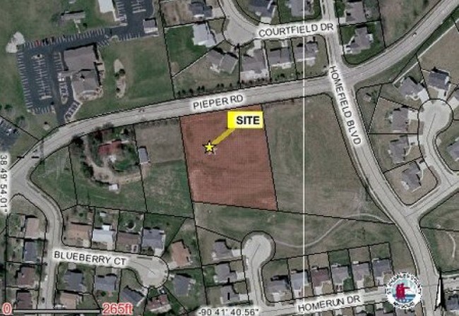
Pieper Rd, Ofallon, MO 63366


NEARBY LISTINGS FOR SALE OR LEASE
Property Detail
Pieper Rd
St. Louis, MO-IL
Woodcliff Estate 08 Resub
2-0041-S016-00-0006.3100000
PT SUR 1790 & PT FRL SEC 16
Taxexempt
St. Charles
X
Missouri
29183C0230G
6
0
1.75 AC
2025
St Charles County
311802
St. Louis
DEMOGRAPHICS near Pieper Rd
1 Mile
3 Mile
5 Mile
2024 Total Population
9,231
33,573
97,461
2029 Population
9,687
35,456
102,939
Pop Growth 2024-2029
+ 4.94%
+ 5.61%
+ 5.62%
Average Age
41
41
40
2024 Total Households
3,610
13,172
36,503
HH Growth 2024-2029
+ 5.01%
+ 5.65%
+ 5.66%
Median Household Inc
$85,558
$83,988
$92,804
Avg Household Size
2.50
2.50
2.60
2024 Avg HH Vehicles
2.00
2.00
2.00
Median Home Value
$250,135
$256,591
$266,406
Median Year Built
1999
1997
1995
Nearby Places
Map Layers
Map Styles
 Street
 Aerial
- Restaurants
- Banks
- Shops
- Fitness
- Groceries
PUBLIC TRANSPORTATION
AIRPORT
St Louis Lambert International
DRIVE
WALK
Distance
St Louis Lambert International
35 min
25.4 mi
SALE & LEASE HISTORY
LISTING DATE
SALE/LEASE

Sep 24, 2016
For Sale
Oct 07, 2016
For Sale
Jul 03, 2018
For Sale
Apr 04, 2017
For Sale
Nearby Properties
Address
Land Use
TOTAL SIZE
Lot Size
Zoning
Address
Land Use
TOTAL SIZE
Lot Size
Zoning
189,054 SF
24.92 AC
AA1
Address
Land Use
TOTAL SIZE
Lot Size
Zoning
71,908 SF
8.72 AC
Address
Land Use
TOTAL SIZE
Lot Size
Zoning
143,897 SF
7.17 AC
Address
Land Use
TOTAL SIZE
Lot Size
Zoning
28,215 SF
8.58 AC
AB6
Address
Land Use
TOTAL SIZE
Lot Size
Zoning
254,435 SF
16.57 AC
Address
Land Use
TOTAL SIZE
Lot Size
Zoning
342,840 SF
58.93 AC
AB6
Address
Land Use
TOTAL SIZE
Lot Size
Zoning
235,876 SF
11.35 AC
Address
Land Use
TOTAL SIZE
Lot Size
Zoning
46,388 SF
10.76 AC
Address
Land Use
TOTAL SIZE
Lot Size
Zoning
75.10 AC
AC7
Address
Land Use
TOTAL SIZE
Lot Size
Zoning
399,520 SF
16.98 AC
AB3
Address
Land Use
TOTAL SIZE
Lot Size
Zoning
591,516 SF
28.79 AC
AB2
Address
Land Use
TOTAL SIZE
Lot Size
Zoning
32.19 AC
AA1
Address
Land Use
TOTAL SIZE
Lot Size
Zoning
104,807 SF
9.34 AC
AB6
Address
Land Use
TOTAL SIZE
Lot Size
Zoning
36,438 SF
2.08 AC
AC4
Address
Land Use
TOTAL SIZE
Lot Size
Zoning
429,473 SF
82.18 AC
Address
Land Use
TOTAL SIZE
Lot Size
Zoning
562,434 SF
40.73 AC
AB3
Address
Land Use
TOTAL SIZE
Lot Size
Zoning
53,636 SF
Address
Land Use
TOTAL SIZE
Lot Size
Zoning
201,531 SF
22.28 AC
Address
Land Use
TOTAL SIZE
Lot Size
Zoning
197,791 SF
18.58 AC
Address
Land Use
TOTAL SIZE
Lot Size
Zoning
261,016 SF
15.27 AC
Address
Land Use
TOTAL SIZE
Lot Size
Zoning
129,472 SF
22 AC
AC2
Address
Land Use
TOTAL SIZE
Lot Size
Zoning
147,526 SF
7.51 AC
AE8
Address
Land Use
TOTAL SIZE
Lot Size
Zoning
40,804 SF
7.98 AC
Address
Land Use
TOTAL SIZE
Lot Size
Zoning
57.96 AC
Address
Land Use
TOTAL SIZE
Lot Size
Zoning
22,542 SF
3.64 AC
Address
Land Use
TOTAL SIZE
Lot Size
Zoning
49,680 SF
1.15 AC
Address
Land Use
TOTAL SIZE
Lot Size
Zoning
202,554 SF
10.72 AC
Address
Land Use
TOTAL SIZE
Lot Size
Zoning
116,243 SF
8.15 AC
Address
Land Use
TOTAL SIZE
Lot Size
Zoning
198,534 SF
8.87 AC
AB3
Address
Land Use
TOTAL SIZE
Lot Size
Zoning
9,890 SF
1.51 AC
The World's #1 Commercial Real Estate Marketplace
Connect with us
© 2025 CoStar Group
The information above has been obtained from sources believed reliable. While we do not doubt its accuracy we have not verified it and make no guarantee, warranty or representation about it. It is your responsibility to independently confirm its accuracy and completeness. Any projections, opinions, assumptions, or estimates used are for example only and do not represent the current or future performance of the property. The value of this transaction to you depends on tax and other factors which should be evaluated by your tax, financial, and legal advisors. You and your advisors should conduct a careful, independent investigation of the property to determine to your satisfaction the suitability of the property for your needs.