Property Record
Randall Rd, Algonquin, IL 60102
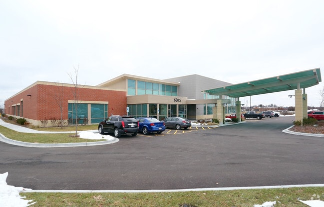

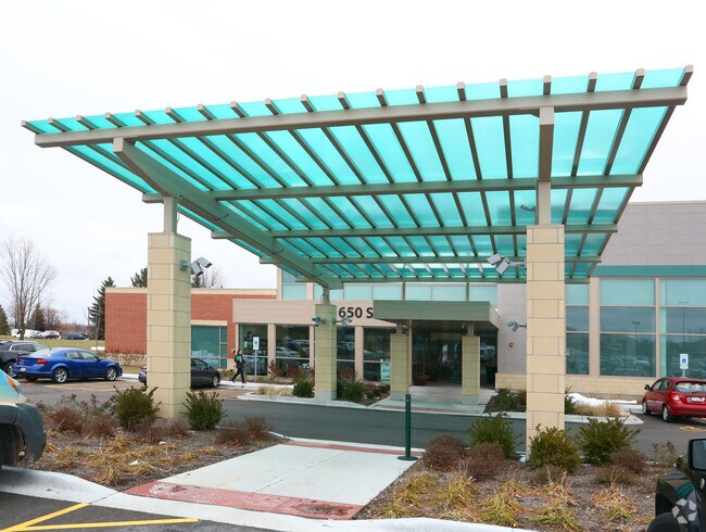
Property Detail
Randall Rd
Chicago-Naperville-Elgin, IL-IN
DOC 2017R0007629 LT 3 /EX DOC 2018R0008716/ OLSENS SECOND RESUB
19-31-227-024
MCHENRY
Commercialnec
Illinois
B and X Area of moderate flood hazard, usually the area between the limits of the 100-year and 500-year floods.
3
2024
6.20 AC
2024
Far Northwest
871310
Chicago
NEARBY LISTINGS FOR SALE OR LEASE
DEMOGRAPHICS near Randall Rd
1 mile
3 mile
5 mile
2025 Total Population
7,352
62,479
151,059
2030 Population
7,444
63,191
152,786
Pop Growth 2025-2030
+ 1.25%
+ 1.14%
+ 1.14%
Average Age
41
40
39
2025 Total Households
2,676
21,953
52,013
HH Growth 2025-2030
+ 1.31%
+ 1.18%
+ 1.19%
Median Household Inc
$123,584
$116,240
$111,158
Avg Household Size
2.70
2.80
2.90
2025 Avg HH Vehicles
2.00
2.00
2.00
Median Home Value
$352,476
$329,249
$319,159
Median Year Built
1997
1994
1993
Nearby Places
Map Layers
Map Styles
 Street
 Aerial
Layers
 Traffic
 Biking
Places
Listings with unknown addresses are not visible on the map
- Restaurants
- Banks
- Shops
- Fitness
- Groceries
PUBLIC TRANSPORTATION
COMMUTER RAIL
Pingree Road Station (Union Pacific Northwest Line - Northeast Illinois Regional Commuter Railroad (Metra))
Drive
Walk
Distance
Pingree Road Station (Union Pacific Northwest Line - Northeast Illinois Regional Commuter Railroad (Metra))
14 min
6.6 mi
Crystal Lake Station (Union Pacific Northwest Line - Northeast Illinois Regional Commuter Railroad (Metra))
Drive
Walk
Distance
Crystal Lake Station (Union Pacific Northwest Line - Northeast Illinois Regional Commuter Railroad (Metra))
13 min
6.6 mi
AIRPORT
Chicago O'Hare International
Drive
Walk
Distance
Chicago O'Hare International
44 min
34.6 mi
Freight Ports
Port of Baltimore
Drive
Walk
Distance
Port of Baltimore
1 min
646.1 mi
Nearby Properties
Address
Land Use
TOTAL SIZE
Lot Size
Zoning
Address
Land Use
TOTAL SIZE
Lot Size
Zoning
0.90 AC
Address
Land Use
TOTAL SIZE
Lot Size
Zoning
Address
Land Use
TOTAL SIZE
Lot Size
Zoning
Address
Land Use
TOTAL SIZE
Lot Size
Zoning
54,472 SF
21 AC
Address
Land Use
TOTAL SIZE
Lot Size
Zoning
147,496 SF
11.81 AC
Address
Land Use
TOTAL SIZE
Lot Size
Zoning
Address
Land Use
TOTAL SIZE
Lot Size
Zoning
Address
Land Use
TOTAL SIZE
Lot Size
Zoning
11.91 AC
Address
Land Use
TOTAL SIZE
Lot Size
Zoning
28.69 AC
Address
Land Use
TOTAL SIZE
Lot Size
Zoning
195,564 SF
18.76 AC
Address
Land Use
TOTAL SIZE
Lot Size
Zoning
8.32 AC
Address
Land Use
TOTAL SIZE
Lot Size
Zoning
175,185 SF
13 AC
Address
Land Use
TOTAL SIZE
Lot Size
Zoning
Address
Land Use
TOTAL SIZE
Lot Size
Zoning
9,614 SF
1.42 AC
Address
Land Use
TOTAL SIZE
Lot Size
Zoning
106,309 SF
12.96 AC
Address
Land Use
TOTAL SIZE
Lot Size
Zoning
Address
Land Use
TOTAL SIZE
Lot Size
Zoning
85,319 SF
12.04 AC
Address
Land Use
TOTAL SIZE
Lot Size
Zoning
Address
Land Use
TOTAL SIZE
Lot Size
Zoning
Address
Land Use
TOTAL SIZE
Lot Size
Zoning
184,440 SF
16 AC
Address
Land Use
TOTAL SIZE
Lot Size
Zoning
7.95 AC
Address
Land Use
TOTAL SIZE
Lot Size
Zoning
136,739 SF
15.07 AC
Address
Land Use
TOTAL SIZE
Lot Size
Zoning
134,523 SF
15.27 AC
Address
Land Use
TOTAL SIZE
Lot Size
Zoning
81,873 SF
9.38 AC
Address
Land Use
TOTAL SIZE
Lot Size
Zoning
Address
Land Use
TOTAL SIZE
Lot Size
Zoning
Address
Land Use
TOTAL SIZE
Lot Size
Zoning
Address
Land Use
TOTAL SIZE
Lot Size
Zoning
94,825 SF
0.50 AC
The World's #1 Commercial Real Estate Marketplace
Connect with us
© 2026 CoStar Group
The information above has been obtained from sources believed reliable. While we do not doubt its accuracy we have not verified it and make no guarantee, warranty or representation about it. It is your responsibility to independently confirm its accuracy and completeness. Any projections, opinions, assumptions, or estimates used are for example only and do not represent the current or future performance of the property. The value of this transaction to you depends on tax and other factors which should be evaluated by your tax, financial, and legal advisors. You and your advisors should conduct a careful, independent investigation of the property to determine to your satisfaction the suitability of the property for your needs.