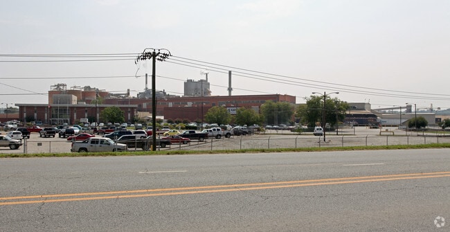
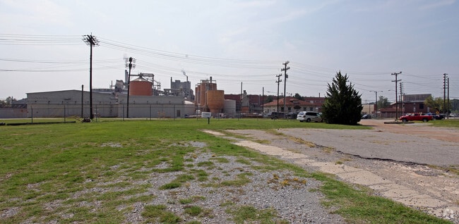
Property Record
Roanoke Ave, Roanoke Rapids, NC 27870

Property Detail
Roanoke Ave
09-00081
PLANT SITE/PARCEL 2 TRACT 1
Foundry
HALIFAX
RRI2
North Carolina
AE The base floodplain where base flood elevations are provided. AE Zones are now used on new format FIRMs instead of A1-A30 Zones.
196.49 AC
2024
North Carolina Northeast Area
2025
Other Market Areas
930501
Roanoke Rapids, NC
26,530 SF
NEARBY LISTINGS FOR SALE OR LEASE
-
-
View all Roanoke Rapids listings for sale on LoopNet.com
DEMOGRAPHICS near Roanoke Ave
1 mile
3 mile
5 mile
2025 Total Population
2,344
16,492
24,656
2030 Population
2,263
15,816
23,812
Pop Growth 2025-2030
(3.46%)
(4.10%)
(3.42%)
Average Age
39
41
42
2025 Total Households
907
6,978
10,525
HH Growth 2025-2030
(3.53%)
(4.20%)
(3.52%)
Median Household Inc
$67,963
$53,780
$47,616
Avg Household Size
2.50
2.30
2.30
2025 Avg HH Vehicles
2.00
2.00
2.00
Median Home Value
$151,764
$142,363
$130,103
Median Year Built
1958
1973
1975
Nearby Places
Map Layers
Map Styles
 Street
 Aerial
Layers
 Traffic
 Biking
Places
Listings with unknown addresses are not visible on the map
- Restaurants
- Banks
- Shops
- Fitness
- Groceries
Nearby Properties
Address
Land Use
TOTAL SIZE
Lot Size
Zoning
Address
Land Use
TOTAL SIZE
Lot Size
Zoning
97,735 SF
21.37 AC
RRR8
Address
Land Use
TOTAL SIZE
Lot Size
Zoning
3,600 SF
120.17 AC
LI
Address
Land Use
TOTAL SIZE
Lot Size
Zoning
94,328 SF
26.40 AC
RRR8
Address
Land Use
TOTAL SIZE
Lot Size
Zoning
122,670 SF
56.57 AC
AR
Address
Land Use
TOTAL SIZE
Lot Size
Zoning
110,678 SF
11.34 AC
RRB4
Address
Land Use
TOTAL SIZE
Lot Size
Zoning
13,794 SF
11.34 AC
RRR
Address
Land Use
TOTAL SIZE
Lot Size
Zoning
14,000 SF
13.66 AC
RRB4
Address
Land Use
TOTAL SIZE
Lot Size
Zoning
75,392 SF
4.22 AC
RRR
Address
Land Use
TOTAL SIZE
Lot Size
Zoning
60,043 SF
1.58 AC
RRR6
Address
Land Use
TOTAL SIZE
Lot Size
Zoning
69,793 SF
23.96 AC
Address
Land Use
TOTAL SIZE
Lot Size
Zoning
6,655 SF
10.02 AC
Address
Land Use
TOTAL SIZE
Lot Size
Zoning
38,176 SF
6.20 AC
RRR6
Address
Land Use
TOTAL SIZE
Lot Size
Zoning
75,353 SF
10 AC
RRR6
Address
Land Use
TOTAL SIZE
Lot Size
Zoning
14,400 SF
4.83 AC
RRI2
Address
Land Use
TOTAL SIZE
Lot Size
Zoning
87,165 SF
8.77 AC
RRB4
Address
Land Use
TOTAL SIZE
Lot Size
Zoning
46,948 SF
2.31 AC
RRB4
Address
Land Use
TOTAL SIZE
Lot Size
Zoning
28,316 SF
10.19 AC
RRB4
Address
Land Use
TOTAL SIZE
Lot Size
Zoning
10,114 SF
4.45 AC
RRR6
Address
Land Use
TOTAL SIZE
Lot Size
Zoning
132,851 SF
35.37 AC
Address
Land Use
TOTAL SIZE
Lot Size
Zoning
6,840 SF
1.82 AC
RRR20
Address
Land Use
TOTAL SIZE
Lot Size
Zoning
10,920 SF
1.92 AC
RRR8
Address
Land Use
TOTAL SIZE
Lot Size
Zoning
25,074 SF
0.32 AC
RRB2
Address
Land Use
TOTAL SIZE
Lot Size
Zoning
5,406 SF
15 AC
RRR
Address
Land Use
TOTAL SIZE
Lot Size
Zoning
6,324 SF
15.60 AC
AR
Address
Land Use
TOTAL SIZE
Lot Size
Zoning
30,762 SF
8.30 AC
RRB
Address
Land Use
TOTAL SIZE
Lot Size
Zoning
18,024 SF
3.75 AC
RRB5
Address
Land Use
TOTAL SIZE
Lot Size
Zoning
2,760 SF
6.17 AC
RRR6
Address
Land Use
TOTAL SIZE
Lot Size
Zoning
152,210 SF
20.39 AC
Address
Land Use
TOTAL SIZE
Lot Size
Zoning
14,592 SF
2.12 AC
RRB4
The World's #1 Commercial Real Estate Marketplace
Connect with us
© 2026 CoStar Group
The information above has been obtained from sources believed reliable. While we do not doubt its accuracy we have not verified it and make no guarantee, warranty or representation about it. It is your responsibility to independently confirm its accuracy and completeness. Any projections, opinions, assumptions, or estimates used are for example only and do not represent the current or future performance of the property. The value of this transaction to you depends on tax and other factors which should be evaluated by your tax, financial, and legal advisors. You and your advisors should conduct a careful, independent investigation of the property to determine to your satisfaction the suitability of the property for your needs.