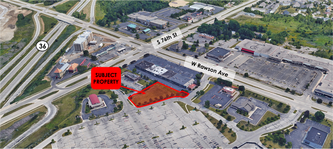
Property Record
S 76Th St S, Franklin, WI 53132

Property Detail
S 76Th St S
Milwaukee-Waukesha, WI
CSM 7170 NE 9 5 21 PARCEL 3
755-0192-005
MILWAUKEE
Commercialnec
Wisconsin
B and X Area of moderate flood hazard, usually the area between the limits of the 100-year and 500-year floods.
0.70 AC
2024
SW Outlying Milwaukee
2024
Milwaukee/Madison
150304
NEARBY LISTINGS FOR SALE OR LEASE
DEMOGRAPHICS near S 76Th St S
1 mile
3 mile
5 mile
2025 Total Population
4,637
53,934
157,039
2030 Population
4,658
53,802
156,859
Pop Growth 2025-2030
+ 0.45%
(0.24%)
(0.11%)
Average Age
44
43
42
2025 Total Households
1,780
22,503
66,024
HH Growth 2025-2030
+ 0.45%
(0.32%)
(0.20%)
Median Household Inc
$125,948
$100,674
$88,976
Avg Household Size
2.60
2.30
2.30
2025 Avg HH Vehicles
2.00
2.00
2.00
Median Home Value
$386,281
$340,365
$296,056
Median Year Built
1988
1978
1974
Nearby Places
Map Layers
Map Styles
 Street
 Aerial
Layers
 Traffic
 Biking
Places
Listings with unknown addresses are not visible on the map
- Restaurants
- Banks
- Shops
- Fitness
- Groceries
PUBLIC TRANSPORTATION
COMMUTER RAIL
General Mitchell Intl. Airport Amtrak Station (Hiawatha Service - Amtrak)
Drive
Walk
Distance
General Mitchell Intl. Airport Amtrak Station (Hiawatha Service - Amtrak)
15 min
6.8 mi
AIRPORT
General Mitchell International
Drive
Walk
Distance
General Mitchell International
15 min
7.7 mi
Freight Ports
Port Milwaukee
Drive
Walk
Distance
Port Milwaukee
17 min
10.2 mi
SALE & LEASE HISTORY
LISTING DATE
SALE/LEASE

Oct 13, 2022
For Sale
Apr 18, 2018
For Sale
Nearby Properties
Address
Land Use
TOTAL SIZE
Lot Size
Zoning
Address
Land Use
TOTAL SIZE
Lot Size
Zoning
19.92 AC
Address
Land Use
TOTAL SIZE
Lot Size
Zoning
27.11 AC
Address
Land Use
TOTAL SIZE
Lot Size
Zoning
Address
Land Use
TOTAL SIZE
Lot Size
Zoning
17.46 AC
Address
Land Use
TOTAL SIZE
Lot Size
Zoning
5.74 AC
Address
Land Use
TOTAL SIZE
Lot Size
Zoning
63,273 SF
5.42 AC
Address
Land Use
TOTAL SIZE
Lot Size
Zoning
Address
Land Use
TOTAL SIZE
Lot Size
Zoning
262,150 SF
14.62 AC
PUDR5
Address
Land Use
TOTAL SIZE
Lot Size
Zoning
228,912 SF
16.77 AC
Address
Land Use
TOTAL SIZE
Lot Size
Zoning
33.48 AC
Address
Land Use
TOTAL SIZE
Lot Size
Zoning
13.84 AC
Address
Land Use
TOTAL SIZE
Lot Size
Zoning
15.78 AC
Address
Land Use
TOTAL SIZE
Lot Size
Zoning
11.33 AC
Address
Land Use
TOTAL SIZE
Lot Size
Zoning
14.95 AC
Address
Land Use
TOTAL SIZE
Lot Size
Zoning
Address
Land Use
TOTAL SIZE
Lot Size
Zoning
Address
Land Use
TOTAL SIZE
Lot Size
Zoning
Address
Land Use
TOTAL SIZE
Lot Size
Zoning
65,227 SF
4.29 AC
Address
Land Use
TOTAL SIZE
Lot Size
Zoning
Address
Land Use
TOTAL SIZE
Lot Size
Zoning
Address
Land Use
TOTAL SIZE
Lot Size
Zoning
Address
Land Use
TOTAL SIZE
Lot Size
Zoning
4.16 AC
Address
Land Use
TOTAL SIZE
Lot Size
Zoning
10.98 AC
Address
Land Use
TOTAL SIZE
Lot Size
Zoning
9.68 AC
Address
Land Use
TOTAL SIZE
Lot Size
Zoning
Address
Land Use
TOTAL SIZE
Lot Size
Zoning
Address
Land Use
TOTAL SIZE
Lot Size
Zoning
Address
Land Use
TOTAL SIZE
Lot Size
Zoning
9.61 AC
Address
Land Use
TOTAL SIZE
Lot Size
Zoning
Address
Land Use
TOTAL SIZE
Lot Size
Zoning
9.13 AC
The World's #1 Commercial Real Estate Marketplace
Connect with us
© 2026 CoStar Group
The information above has been obtained from sources believed reliable. While we do not doubt its accuracy we have not verified it and make no guarantee, warranty or representation about it. It is your responsibility to independently confirm its accuracy and completeness. Any projections, opinions, assumptions, or estimates used are for example only and do not represent the current or future performance of the property. The value of this transaction to you depends on tax and other factors which should be evaluated by your tax, financial, and legal advisors. You and your advisors should conduct a careful, independent investigation of the property to determine to your satisfaction the suitability of the property for your needs.