Property Record
S Center Rd, Burton, MI 48519

NEARBY LISTINGS FOR SALE OR LEASE
Property Detail
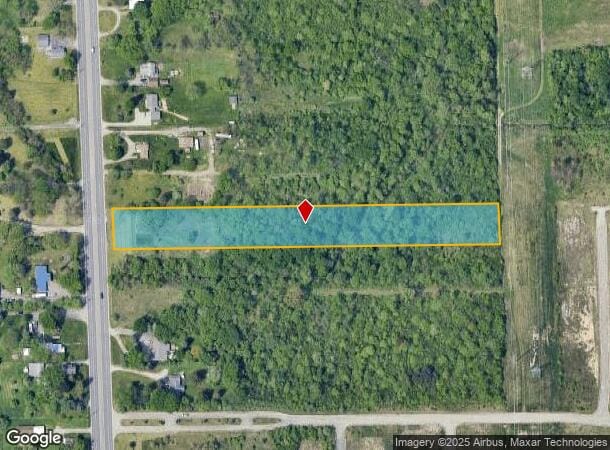
S Center Rd
Flint, MI
Walker Acres
59-27-502-010
LOT 10 WALKER ACRES
Commercialacreage
Genesee
AE
Michigan
26049C0307D
10
2024
2.88 AC
2025
Flint
011402
Detroit
DEMOGRAPHICS near S Center Rd
1 mile
3 mile
5 mile
2024 Total Population
4,645
45,533
127,396
2029 Population
4,583
44,764
125,932
Pop Growth 2024-2029
(1.33%)
(1.69%)
(1.15%)
Average Age
39
39
39
2024 Total Households
1,974
18,788
53,114
HH Growth 2024-2029
(1.52%)
(1.72%)
(1.18%)
Median Household Inc
$35,787
$44,906
$46,193
Avg Household Size
2.30
2.40
2.30
2024 Avg HH Vehicles
1.00
2.00
2.00
Median Home Value
$99,792
$109,546
$126,882
Median Year Built
1974
1960
1964
Nearby Places
Map Layers
Map Styles
 Street
 Aerial
Transit
 Traffic
 Biking
Places
Listings with unknown addresses are not visible on the map
- Restaurants
- Banks
- Shops
- Fitness
- Groceries
PUBLIC TRANSPORTATION
COMMUTER RAIL
Flint Amtrak Station (Blue Water - Amtrak)
Drive
Walk
Distance
Flint Amtrak Station (Blue Water - Amtrak)
8 min
3.3 mi
AIRPORT
Bishop International
Drive
Walk
Distance
Bishop International
26 min
10.7 mi
Freight Ports
Port of Toledo
Drive
Walk
Distance
Port of Toledo
139 min
115.4 mi
SALE & LEASE HISTORY
LISTING DATE
SALE/LEASE

Sep 25, 2016
For Lease
Sep 24, 2016
For Sale
Oct 07, 2016
For Sale
Jan 04, 2017
For Sale
Nearby Properties
Address
Land Use
TOTAL SIZE
Lot Size
Zoning
Address
Land Use
TOTAL SIZE
Lot Size
Zoning
290,267 SF
79 AC
PC
Address
Land Use
TOTAL SIZE
Lot Size
Zoning
157,756 SF
21.17 AC
MDM
Address
Land Use
TOTAL SIZE
Lot Size
Zoning
227,755 SF
32.27 AC
C-2
Address
Land Use
TOTAL SIZE
Lot Size
Zoning
354,079 SF
48.41 AC
C-4
Address
Land Use
TOTAL SIZE
Lot Size
Zoning
371,636 SF
12.50 AC
M-1
Address
Land Use
TOTAL SIZE
Lot Size
Zoning
60,613 SF
12.91 AC
RO
Address
Land Use
TOTAL SIZE
Lot Size
Zoning
246,759 SF
19.03 AC
CC
Address
Land Use
TOTAL SIZE
Lot Size
Zoning
24.38 AC
RM
Address
Land Use
TOTAL SIZE
Lot Size
Zoning
91,726 SF
7.28 AC
HDM
Address
Land Use
TOTAL SIZE
Lot Size
Zoning
111,882 SF
5.36 AC
C-4
Address
Land Use
TOTAL SIZE
Lot Size
Zoning
225,506 SF
31.13 AC
CE
Address
Land Use
TOTAL SIZE
Lot Size
Zoning
24,670 SF
9.62 AC
GC
Address
Land Use
TOTAL SIZE
Lot Size
Zoning
49,582 SF
25.15 AC
HRM
Address
Land Use
TOTAL SIZE
Lot Size
Zoning
364,289 SF
24.80 AC
GN-1
Address
Land Use
TOTAL SIZE
Lot Size
Zoning
136,506 SF
16.54 AC
C-4
Address
Land Use
TOTAL SIZE
Lot Size
Zoning
236,340 SF
25.17 AC
CE
Address
Land Use
TOTAL SIZE
Lot Size
Zoning
11.22 AC
RM
Address
Land Use
TOTAL SIZE
Lot Size
Zoning
2,321 SF
18.59 AC
M-1
Address
Land Use
TOTAL SIZE
Lot Size
Zoning
2,829 SF
75.78 AC
RMH
Address
Land Use
TOTAL SIZE
Lot Size
Zoning
320,622 SF
14.93 AC
M-2
Address
Land Use
TOTAL SIZE
Lot Size
Zoning
98,932 SF
6.09 AC
GI-2
Address
Land Use
TOTAL SIZE
Lot Size
Zoning
122,240 SF
3.42 AC
TN-2
Address
Land Use
TOTAL SIZE
Lot Size
Zoning
218,229 SF
37.64 AC
CE
Address
Land Use
TOTAL SIZE
Lot Size
Zoning
236,671 SF
31.13 AC
CE
Address
Land Use
TOTAL SIZE
Lot Size
Zoning
149,136 SF
9.35 AC
CE
Address
Land Use
TOTAL SIZE
Lot Size
Zoning
82,240 SF
15.03 AC
C-2
Address
Land Use
TOTAL SIZE
Lot Size
Zoning
80,872 SF
4.41 AC
M-2
Address
Land Use
TOTAL SIZE
Lot Size
Zoning
192,900 SF
6.50 AC
CE
Address
Land Use
TOTAL SIZE
Lot Size
Zoning
118,210 SF
6.60 AC
CE
Address
Land Use
TOTAL SIZE
Lot Size
Zoning
33,350 SF
M-2
The World's #1 Commercial Real Estate Marketplace
Connect with us
© 2026 CoStar Group
The information above has been obtained from sources believed reliable. While we do not doubt its accuracy we have not verified it and make no guarantee, warranty or representation about it. It is your responsibility to independently confirm its accuracy and completeness. Any projections, opinions, assumptions, or estimates used are for example only and do not represent the current or future performance of the property. The value of this transaction to you depends on tax and other factors which should be evaluated by your tax, financial, and legal advisors. You and your advisors should conduct a careful, independent investigation of the property to determine to your satisfaction the suitability of the property for your needs.