Property Record
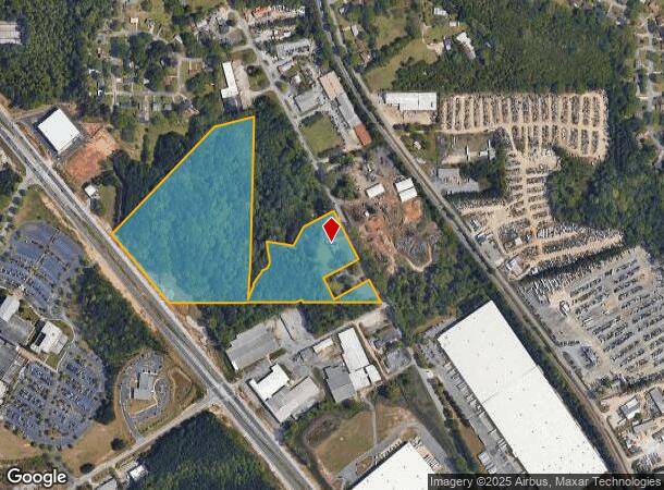
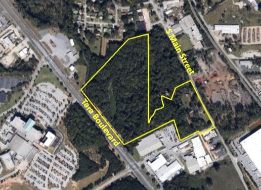
294 S Main St, Jonesboro, GA 30236
NEARBY LISTINGS FOR SALE OR LEASE
Property Detail
294 S Main St
Commercialofficeresidentialmixeduse
Clayton
X
Georgia
13063C0088F
16.21 AC
2025
South Clayton/Henry Cnty
2025
Atlanta
040635
Atlanta-Sandy Springs-Roswell, GA
3,142 SF
06-0032A-00B-002Z
DEMOGRAPHICS near 294 S Main St
1 Mile
3 Mile
5 Mile
2024 Total Population
4,338
57,009
146,107
2029 Population
4,326
56,797
146,374
Pop Growth 2024-2029
(0.28%)
(0.37%)
+ 0.18%
Average Age
38
37
37
2024 Total Households
1,390
19,673
51,415
HH Growth 2024-2029
(0.29%)
(0.41%)
+ 0.16%
Median Household Inc
$68,888
$60,508
$59,208
Avg Household Size
2.80
2.80
2.80
2024 Avg HH Vehicles
2.00
2.00
2.00
Median Home Value
$189,499
$195,787
$186,784
Median Year Built
1986
1987
1989
Nearby Places
Map Layers
Map Styles
 Street
 Aerial
- Restaurants
- Banks
- Shops
- Fitness
- Groceries
PUBLIC TRANSPORTATION
AIRPORT
Hartsfield - Jackson Atlanta International
DRIVE
WALK
Distance
Hartsfield - Jackson Atlanta International
22 min
12.3 mi
Freight Ports
Georgia Ports - Savannah
DRIVE
WALK
Distance
Georgia Ports - Savannah
264 min
233.1 mi
SALE & LEASE HISTORY
LISTING DATE
SALE/LEASE

May 08, 2017
For Sale
Nearby Properties
Address
Land Use
TOTAL SIZE
Lot Size
Zoning
Address
Land Use
TOTAL SIZE
Lot Size
Zoning
231,046 SF
97.58 AC
C
Address
Land Use
TOTAL SIZE
Lot Size
Zoning
7,851 SF
94.84 AC
RS180
Address
Land Use
TOTAL SIZE
Lot Size
Zoning
194,682 SF
27.80 AC
OI
Address
Land Use
TOTAL SIZE
Lot Size
Zoning
324 SF
49.49 AC
RM
Address
Land Use
TOTAL SIZE
Lot Size
Zoning
11.31 AC
RM
Address
Land Use
TOTAL SIZE
Lot Size
Zoning
123,000 SF
48 AC
RS110
Address
Land Use
TOTAL SIZE
Lot Size
Zoning
1,140 SF
187.84 AC
MX
Address
Land Use
TOTAL SIZE
Lot Size
Zoning
230 SF
27.09 AC
RM
Address
Land Use
TOTAL SIZE
Lot Size
Zoning
123,842 SF
31.53 AC
RS110
Address
Land Use
TOTAL SIZE
Lot Size
Zoning
500,415 SF
26.99 AC
HI
Address
Land Use
TOTAL SIZE
Lot Size
Zoning
14,230 AC
C
Address
Land Use
TOTAL SIZE
Lot Size
Zoning
220 SF
26.84 AC
RM
Address
Land Use
TOTAL SIZE
Lot Size
Zoning
30.90 AC
RS110
Address
Land Use
TOTAL SIZE
Lot Size
Zoning
65,798 SF
7.41 AC
C
Address
Land Use
TOTAL SIZE
Lot Size
Zoning
155,204 SF
21.37 AC
I
Address
Land Use
TOTAL SIZE
Lot Size
Zoning
200 SF
13.12 AC
RM
Address
Land Use
TOTAL SIZE
Lot Size
Zoning
96,315 SF
3.53 AC
RS110
Address
Land Use
TOTAL SIZE
Lot Size
Zoning
56,939 SF
10.04 AC
C
Address
Land Use
TOTAL SIZE
Lot Size
Zoning
265,041 SF
32.63 AC
HI
Address
Land Use
TOTAL SIZE
Lot Size
Zoning
144 SF
11.70 AC
MX
Address
Land Use
TOTAL SIZE
Lot Size
Zoning
96,022 SF
5.04 AC
C
Address
Land Use
TOTAL SIZE
Lot Size
Zoning
81,986 SF
15 AC
RS180
Address
Land Use
TOTAL SIZE
Lot Size
Zoning
69,505 SF
10.68 AC
GB
Address
Land Use
TOTAL SIZE
Lot Size
Zoning
55,650 SF
19.71 AC
AG
Address
Land Use
TOTAL SIZE
Lot Size
Zoning
116,822 SF
4.10 AC
RS180
Address
Land Use
TOTAL SIZE
Lot Size
Zoning
184 SF
16.89 AC
C
Address
Land Use
TOTAL SIZE
Lot Size
Zoning
50,930 SF
15.80 AC
I
Address
Land Use
TOTAL SIZE
Lot Size
Zoning
63,256 SF
27.07 AC
I
Address
Land Use
TOTAL SIZE
Lot Size
Zoning
201,312 SF
9 AC
HI
Address
Land Use
TOTAL SIZE
Lot Size
Zoning
132 SF
12.70 AC
C
The World's #1 Commercial Real Estate Marketplace
Connect with us
© 2025 CoStar Group
The information above has been obtained from sources believed reliable. While we do not doubt its accuracy we have not verified it and make no guarantee, warranty or representation about it. It is your responsibility to independently confirm its accuracy and completeness. Any projections, opinions, assumptions, or estimates used are for example only and do not represent the current or future performance of the property. The value of this transaction to you depends on tax and other factors which should be evaluated by your tax, financial, and legal advisors. You and your advisors should conduct a careful, independent investigation of the property to determine to your satisfaction the suitability of the property for your needs.