Property Record
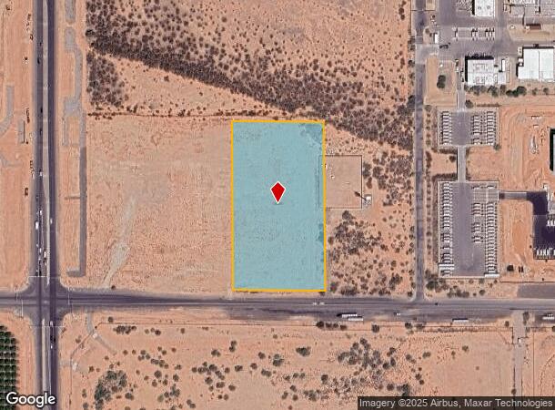
Signal Butte & Pecos Rd, Mesa, AZ 85212

NEARBY LISTINGS FOR SALE OR LEASE
Property Detail
Signal Butte & Pecos Rd
304-34-043
W2 SE4 SW4 SW4 SEC 36 EX S 55F RD
Industrialacreage
Maricopa
X
Arizona
04013C2790L
4.58 AC
2025
Gateway Airport/Loop 202
2025
Phoenix
817600
Phoenix-Mesa-Scottsdale, AZ
DEMOGRAPHICS near Signal Butte & Pecos Rd
1 Mile
3 Mile
5 Mile
2024 Total Population
565
38,952
118,215
2029 Population
654
44,428
134,513
Pop Growth 2024-2029
+ 15.75%
+ 14.06%
+ 13.79%
Average Age
28
36
35
2024 Total Households
179
12,202
35,806
HH Growth 2024-2029
+ 17.88%
+ 14.49%
+ 14.00%
Median Household Inc
$60,268
$131,587
$115,520
Avg Household Size
2.70
3.20
3.20
2024 Avg HH Vehicles
2.00
2.00
2.00
Median Home Value
$476,190
$470,998
$446,561
Median Year Built
2010
2011
2010
Nearby Places
Map Layers
Map Styles
 Street
 Aerial
- Restaurants
- Banks
- Shops
- Fitness
- Groceries
PUBLIC TRANSPORTATION
AIRPORT
Phoenix-Mesa Gateway
DRIVE
WALK
Distance
Phoenix-Mesa Gateway
13 min
7.2 mi
Phoenix Sky Harbor International
DRIVE
WALK
Distance
Phoenix Sky Harbor International
45 min
32.7 mi
Freight Ports
Port of San Diego
DRIVE
WALK
Distance
Port of San Diego
421 min
381.7 mi
Nearby Properties
Address
Land Use
TOTAL SIZE
Lot Size
Zoning
Address
Land Use
TOTAL SIZE
Lot Size
Zoning
284.14 AC
Address
Land Use
TOTAL SIZE
Lot Size
Zoning
3,864 SF
67.50 AC
MH
Address
Land Use
TOTAL SIZE
Lot Size
Zoning
64.72 AC
LI
Address
Land Use
TOTAL SIZE
Lot Size
Zoning
15.22 AC
Address
Land Use
TOTAL SIZE
Lot Size
Zoning
75,378 SF
10.36 AC
Address
Land Use
TOTAL SIZE
Lot Size
Zoning
1,200,340 SF
85.82 AC
Address
Land Use
TOTAL SIZE
Lot Size
Zoning
39.46 AC
Address
Land Use
TOTAL SIZE
Lot Size
Zoning
37.68 AC
Address
Land Use
TOTAL SIZE
Lot Size
Zoning
1,342,987 SF
225.90 AC
I-2
Address
Land Use
TOTAL SIZE
Lot Size
Zoning
20.68 AC
Address
Land Use
TOTAL SIZE
Lot Size
Zoning
21,010 SF
2.72 AC
I-1
Address
Land Use
TOTAL SIZE
Lot Size
Zoning
19.83 AC
Address
Land Use
TOTAL SIZE
Lot Size
Zoning
463,567 SF
135.55 AC
I-2
Address
Land Use
TOTAL SIZE
Lot Size
Zoning
152,549 SF
60 AC
PC
Address
Land Use
TOTAL SIZE
Lot Size
Zoning
278,147 SF
49.82 AC
I-2
Address
Land Use
TOTAL SIZE
Lot Size
Zoning
269,550 SF
63.63 AC
Address
Land Use
TOTAL SIZE
Lot Size
Zoning
218,680 SF
8.50 AC
PC
Address
Land Use
TOTAL SIZE
Lot Size
Zoning
178,266 SF
16.32 AC
Address
Land Use
TOTAL SIZE
Lot Size
Zoning
163,373 SF
16.44 AC
MDR
Address
Land Use
TOTAL SIZE
Lot Size
Zoning
127,184 SF
14.80 AC
R-43
Address
Land Use
TOTAL SIZE
Lot Size
Zoning
228,634 SF
154.38 AC
I-1
Address
Land Use
TOTAL SIZE
Lot Size
Zoning
269,500 SF
18.18 AC
Address
Land Use
TOTAL SIZE
Lot Size
Zoning
89,899 SF
12.72 AC
R-6
Address
Land Use
TOTAL SIZE
Lot Size
Zoning
10,406 SF
2.40 AC
Address
Land Use
TOTAL SIZE
Lot Size
Zoning
95,167 SF
15 AC
PC
Address
Land Use
TOTAL SIZE
Lot Size
Zoning
7.28 AC
Address
Land Use
TOTAL SIZE
Lot Size
Zoning
152,901 SF
19.45 AC
Address
Land Use
TOTAL SIZE
Lot Size
Zoning
269,500 SF
19.34 AC
Address
Land Use
TOTAL SIZE
Lot Size
Zoning
4.08 AC
Address
Land Use
TOTAL SIZE
Lot Size
Zoning
50,822 SF
12.15 AC
R-C
The World's #1 Commercial Real Estate Marketplace
Connect with us
© 2026 CoStar Group
The information above has been obtained from sources believed reliable. While we do not doubt its accuracy we have not verified it and make no guarantee, warranty or representation about it. It is your responsibility to independently confirm its accuracy and completeness. Any projections, opinions, assumptions, or estimates used are for example only and do not represent the current or future performance of the property. The value of this transaction to you depends on tax and other factors which should be evaluated by your tax, financial, and legal advisors. You and your advisors should conduct a careful, independent investigation of the property to determine to your satisfaction the suitability of the property for your needs.