Property Record
Situs Not Available, Aurora, CO

Property Detail
Situs Not Available
Denver-Aurora-Centennial, CO
SECT,TWN,RNG:13-3-65 DESC: ALL EXC DT AND RD ROWS (REC NO C0761533 & C0614412) 629A
1819-00-0-00-028
ADAMS
Farms
Colorado
AE The base floodplain where base flood elevations are provided. AE Zones are now used on new format FIRMs instead of A1-A30 Zones.
619.91 AC
2024
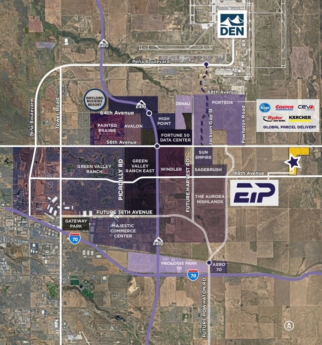
Northeast Denver
2025
Denver
008353
NEARBY LISTINGS FOR SALE OR LEASE
DEMOGRAPHICS near Situs Not Available
1 mile
3 mile
5 mile
2025 Total Population
2
205
4,865
2030 Population
2
217
5,613
Pop Growth 2025-2030
0.00%
+ 5.85%
+ 15.38%
Average Age
0
42
36
2025 Total Households
1
69
1,384
HH Growth 2025-2030
0.00%
+ 4.35%
+ 14.67%
Median Household Inc
$0
$122,221
$119,293
Avg Household Size
.00
2.90
3.10
2025 Avg HH Vehicles
.00
3.00
3.00
Median Home Value
$0
$696,428
$704,514
Median Year Built
0
1993
2010
Nearby Places
Map Layers
Map Styles
 Street
 Aerial
Transit
 Traffic
 Biking
Places
Listings with unknown addresses are not visible on the map
- Restaurants
- Banks
- Shops
- Fitness
- Groceries
PUBLIC TRANSPORTATION
COMMUTER RAIL
Denver Airport Station (Union Station to Denver Airport Station - Regional Transportation District)
Drive
Walk
Distance
Denver Airport Station (Union Station to Denver Airport Station - Regional Transportation District)
14 min
8.5 mi
61St & Pena Station Track 2 (Union Station to Denver Airport Station - Regional Transportation District)
Drive
Walk
Distance
61St & Pena Station Track 2 (Union Station to Denver Airport Station - Regional Transportation District)
16 min
9.5 mi
AIRPORT
Denver International
Drive
Walk
Distance
Denver International
15 min
8.9 mi
Freight Ports
Tulsa Port Of Catoosa
Drive
Walk
Distance
Tulsa Port Of Catoosa
709 min
691.4 mi
Nearby Properties
Address
Land Use
TOTAL SIZE
Lot Size
Zoning
Address
Land Use
TOTAL SIZE
Lot Size
Zoning
166.32 AC
Address
Land Use
TOTAL SIZE
Lot Size
Zoning
291.65 AC
Address
Land Use
TOTAL SIZE
Lot Size
Zoning
Address
Land Use
TOTAL SIZE
Lot Size
Zoning
Address
Land Use
TOTAL SIZE
Lot Size
Zoning
Address
Land Use
TOTAL SIZE
Lot Size
Zoning
Address
Land Use
TOTAL SIZE
Lot Size
Zoning
4,950 SF
320 AC
AV
Address
Land Use
TOTAL SIZE
Lot Size
Zoning
44.11 AC
Address
Land Use
TOTAL SIZE
Lot Size
Zoning
10,000 SF
28.18 AC
PUD
Address
Land Use
TOTAL SIZE
Lot Size
Zoning
8,832 SF
DIA
Address
Land Use
TOTAL SIZE
Lot Size
Zoning
4.70 AC
Address
Land Use
TOTAL SIZE
Lot Size
Zoning
12,200 SF
12.15 AC
Address
Land Use
TOTAL SIZE
Lot Size
Zoning
656.04 AC
A3
Address
Land Use
TOTAL SIZE
Lot Size
Zoning
955.14 AC
PUD
Address
Land Use
TOTAL SIZE
Lot Size
Zoning
14.21 AC
DIA
Address
Land Use
TOTAL SIZE
Lot Size
Zoning
Address
Land Use
TOTAL SIZE
Lot Size
Zoning
3,488 SF
7.33 AC
AV
Address
Land Use
TOTAL SIZE
Lot Size
Zoning
503.09 AC
Address
Land Use
TOTAL SIZE
Lot Size
Zoning
527.72 AC
Address
Land Use
TOTAL SIZE
Lot Size
Zoning
Address
Land Use
TOTAL SIZE
Lot Size
Zoning
478.01 AC
A3
Address
Land Use
TOTAL SIZE
Lot Size
Zoning
243,235 SF
475.58 AC
Address
Land Use
TOTAL SIZE
Lot Size
Zoning
437 AC
A3
Address
Land Use
TOTAL SIZE
Lot Size
Zoning
5,048 SF
39.93 AC
Address
Land Use
TOTAL SIZE
Lot Size
Zoning
7.75 AC
DIA
Address
Land Use
TOTAL SIZE
Lot Size
Zoning
630.63 AC
DIA
Address
Land Use
TOTAL SIZE
Lot Size
Zoning
5,918 SF
39.71 AC
A3
Address
Land Use
TOTAL SIZE
Lot Size
Zoning
4,000 SF
15 AC
Address
Land Use
TOTAL SIZE
Lot Size
Zoning
2,700 SF
35.11 AC
A3
The World's #1 Commercial Real Estate Marketplace
Connect with us
© 2026 CoStar Group
The information above has been obtained from sources believed reliable. While we do not doubt its accuracy we have not verified it and make no guarantee, warranty or representation about it. It is your responsibility to independently confirm its accuracy and completeness. Any projections, opinions, assumptions, or estimates used are for example only and do not represent the current or future performance of the property. The value of this transaction to you depends on tax and other factors which should be evaluated by your tax, financial, and legal advisors. You and your advisors should conduct a careful, independent investigation of the property to determine to your satisfaction the suitability of the property for your needs.