Property Record
Spring St, Cascade, CO 80809
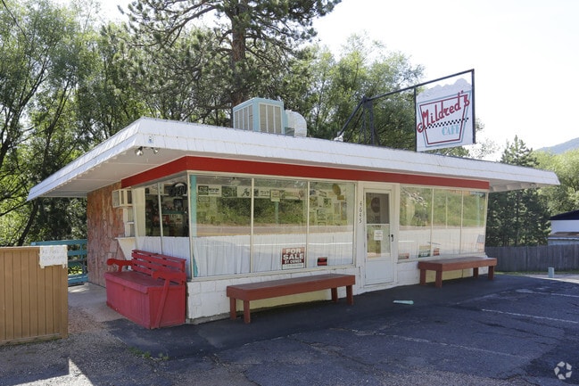
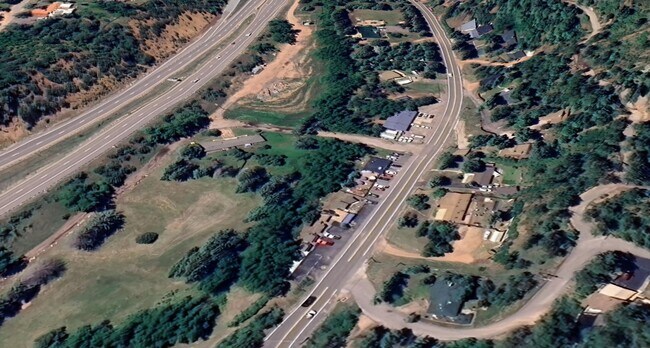

Property Detail
Spring St
83233-00-084
PART OF BLK 21 RESUB OF BLKS 10 TO 13 INC CASCADE AS FOLS, BEG AT SW COR OF SD BLK, TH NLY 5.0 FT TO SW COR OF BUCHHEISTER TR, ELY ALG SLY LN OF SD TR 107.0 FT, TH SELY 5.55 FT TO S LN OF SD BLK, TH WLY ON SD S LN TO POB
Recreationalacreage
EL PASO
C-2
Colorado
AE The base floodplain where base flood elevations are provided. AE Zones are now used on new format FIRMs instead of A1-A30 Zones.
0.01 AC
2024
Southwest
2025
Colorado Springs
003401
Colorado Springs, CO
NEARBY LISTINGS FOR SALE OR LEASE
-
-
View all Cascade listings for sale on LoopNet.com
DEMOGRAPHICS near Spring St
1 mile
3 mile
5 mile
2025 Total Population
705
1,565
6,039
2030 Population
713
1,584
6,127
Pop Growth 2025-2030
+ 1.13%
+ 1.21%
+ 1.46%
Average Age
49
48
46
2025 Total Households
316
724
2,980
HH Growth 2025-2030
+ 1.58%
+ 1.38%
+ 1.81%
Median Household Inc
$159,375
$112,946
$85,958
Avg Household Size
2.20
2.20
2.00
2025 Avg HH Vehicles
3.00
2.00
2.00
Median Home Value
$738,505
$666,666
$640,299
Median Year Built
1987
1971
1953
Nearby Places
Map Layers
Map Styles
 Street
 Aerial
Transit
 Traffic
 Biking
Places
Listings with unknown addresses are not visible on the map
- Restaurants
- Banks
- Shops
- Fitness
- Groceries
PUBLIC TRANSPORTATION
AIRPORT
City of Colorado Springs Municipal
Drive
Walk
Distance
City of Colorado Springs Municipal
36 min
20.7 mi
SALE & LEASE HISTORY
LISTING DATE
SALE/LEASE

Aug 15, 2024
For Sale
Nearby Properties
Address
Land Use
TOTAL SIZE
Lot Size
Zoning
Address
Land Use
TOTAL SIZE
Lot Size
Zoning
5,387.79 AC
R-T
Address
Land Use
TOTAL SIZE
Lot Size
Zoning
4.78 AC
R-T
Address
Land Use
TOTAL SIZE
Lot Size
Zoning
23,817 SF
320 AC
R-T
Address
Land Use
TOTAL SIZE
Lot Size
Zoning
17,645 SF
50 AC
R-T
Address
Land Use
TOTAL SIZE
Lot Size
Zoning
6,726 SF
34.29 AC
R-T
Address
Land Use
TOTAL SIZE
Lot Size
Zoning
400 AC
R-T
Address
Land Use
TOTAL SIZE
Lot Size
Zoning
640 AC
R-T
Address
Land Use
TOTAL SIZE
Lot Size
Zoning
103.14 AC
R-T
Address
Land Use
TOTAL SIZE
Lot Size
Zoning
3,873 SF
0.93 AC
R-T
Address
Land Use
TOTAL SIZE
Lot Size
Zoning
625 SF
9.82 AC
R-T
Address
Land Use
TOTAL SIZE
Lot Size
Zoning
80 AC
R-T
Address
Land Use
TOTAL SIZE
Lot Size
Zoning
277.50 AC
R-T
Address
Land Use
TOTAL SIZE
Lot Size
Zoning
18,081 SF
27.69 AC
CR
Address
Land Use
TOTAL SIZE
Lot Size
Zoning
160 AC
R-T
Address
Land Use
TOTAL SIZE
Lot Size
Zoning
400 AC
R-T
Address
Land Use
TOTAL SIZE
Lot Size
Zoning
160 AC
R-T
Address
Land Use
TOTAL SIZE
Lot Size
Zoning
900 SF
3.16 AC
R-T
Address
Land Use
TOTAL SIZE
Lot Size
Zoning
120 AC
R-T
Address
Land Use
TOTAL SIZE
Lot Size
Zoning
374.74 AC
R-T
Address
Land Use
TOTAL SIZE
Lot Size
Zoning
19.93 AC
R-T
Address
Land Use
TOTAL SIZE
Lot Size
Zoning
2,574 SF
2.54 AC
R-T
Address
Land Use
TOTAL SIZE
Lot Size
Zoning
225 AC
R-T
Address
Land Use
TOTAL SIZE
Lot Size
Zoning
62 SF
2.40 AC
R-T
Address
Land Use
TOTAL SIZE
Lot Size
Zoning
320 AC
R-T
Address
Land Use
TOTAL SIZE
Lot Size
Zoning
1,440 SF
240 AC
R-T
Address
Land Use
TOTAL SIZE
Lot Size
Zoning
88.80 AC
R-T
Address
Land Use
TOTAL SIZE
Lot Size
Zoning
7,997 SF
0.92 AC
C-2
Address
Land Use
TOTAL SIZE
Lot Size
Zoning
2,273 SF
0.37 AC
Address
Land Use
TOTAL SIZE
Lot Size
Zoning
2,100 SF
1.88 AC
Address
Land Use
TOTAL SIZE
Lot Size
Zoning
40 AC
R-T
The World's #1 Commercial Real Estate Marketplace
Connect with us
© 2026 CoStar Group
The information above has been obtained from sources believed reliable. While we do not doubt its accuracy we have not verified it and make no guarantee, warranty or representation about it. It is your responsibility to independently confirm its accuracy and completeness. Any projections, opinions, assumptions, or estimates used are for example only and do not represent the current or future performance of the property. The value of this transaction to you depends on tax and other factors which should be evaluated by your tax, financial, and legal advisors. You and your advisors should conduct a careful, independent investigation of the property to determine to your satisfaction the suitability of the property for your needs.