Property Record
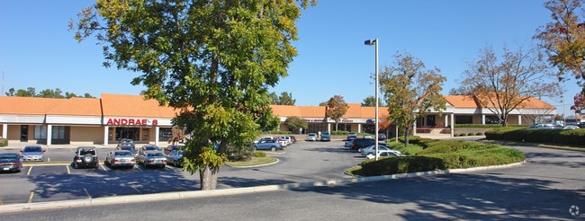
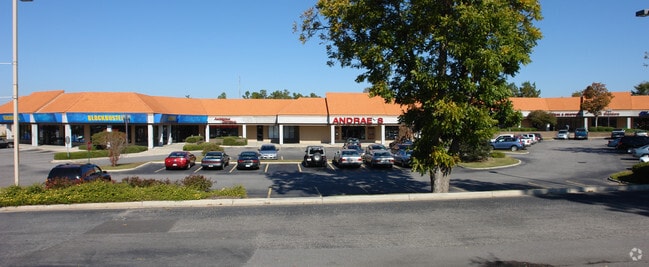
St Matthews Rd, Orangeburg, SC 29115

Property Detail
St Matthews Rd
0174-17-03-005.000
GROVE PARK/BI-LO 51 00241303
Stripcommercialcenter
ORANGEBURG
B and X Area of moderate flood hazard, usually the area between the limits of the 100-year and 500-year floods.
South Carolina
2024
9.57 AC
2024
Orangeburg/Sumter
011400
Other Market Areas
29,977 SF
Orangeburg, SC
NEARBY LISTINGS FOR SALE OR LEASE
DEMOGRAPHICS near St Matthews Rd
1 mile
3 mile
5 mile
2025 Total Population
5,418
25,858
35,419
2030 Population
5,341
25,988
35,485
Pop Growth 2025-2030
(1.42%)
+ 0.50%
+ 0.19%
Average Age
40
39
40
2025 Total Households
2,340
9,631
13,479
HH Growth 2025-2030
(1.92%)
+ 0.36%
+ 0.06%
Median Household Inc
$35,204
$42,105
$46,598
Avg Household Size
2.10
2.20
2.30
2025 Avg HH Vehicles
2.00
2.00
2.00
Median Home Value
$149,753
$156,192
$150,235
Median Year Built
1972
1976
1978
Nearby Places
Map Layers
Map Styles
 Street
 Aerial
Layers
 Traffic
 Biking
Places
Listings with unknown addresses are not visible on the map
- Restaurants
- Banks
- Shops
- Fitness
- Groceries
SALE & LEASE HISTORY
LISTING DATE
SALE/LEASE

Jan 20, 2017
For Lease
Dec 18, 2017
For Lease
Dec 15, 2016
For Lease
Nearby Properties
Address
Land Use
TOTAL SIZE
Lot Size
Zoning
Address
Land Use
TOTAL SIZE
Lot Size
Zoning
331,360 SF
58 AC
Address
Land Use
TOTAL SIZE
Lot Size
Zoning
24,351 SF
1.23 AC
Address
Land Use
TOTAL SIZE
Lot Size
Zoning
195,536 SF
22.90 AC
Address
Land Use
TOTAL SIZE
Lot Size
Zoning
20,838 SF
7.70 AC
Address
Land Use
TOTAL SIZE
Lot Size
Zoning
41,412 SF
7.40 AC
Address
Land Use
TOTAL SIZE
Lot Size
Zoning
7,634 SF
0.72 AC
Address
Land Use
TOTAL SIZE
Lot Size
Zoning
206,224 SF
42.20 AC
Address
Land Use
TOTAL SIZE
Lot Size
Zoning
320,700 SF
35.10 AC
Address
Land Use
TOTAL SIZE
Lot Size
Zoning
10,366 SF
98 AC
Address
Land Use
TOTAL SIZE
Lot Size
Zoning
130,175 SF
14.58 AC
Address
Land Use
TOTAL SIZE
Lot Size
Zoning
20,160 SF
3.35 AC
Address
Land Use
TOTAL SIZE
Lot Size
Zoning
5,059 SF
3.60 AC
Address
Land Use
TOTAL SIZE
Lot Size
Zoning
179,500 SF
83 AC
Address
Land Use
TOTAL SIZE
Lot Size
Zoning
24,186 SF
2.15 AC
Address
Land Use
TOTAL SIZE
Lot Size
Zoning
3,898 SF
2.04 AC
Address
Land Use
TOTAL SIZE
Lot Size
Zoning
102,557 SF
10.30 AC
Address
Land Use
TOTAL SIZE
Lot Size
Zoning
35,928 SF
1.80 AC
Address
Land Use
TOTAL SIZE
Lot Size
Zoning
2,500 SF
14.76 AC
Address
Land Use
TOTAL SIZE
Lot Size
Zoning
29,275 SF
8.50 AC
Address
Land Use
TOTAL SIZE
Lot Size
Zoning
14,606 SF
1.80 AC
Address
Land Use
TOTAL SIZE
Lot Size
Zoning
41,838 SF
2.40 AC
Address
Land Use
TOTAL SIZE
Lot Size
Zoning
159,852 SF
27 AC
Address
Land Use
TOTAL SIZE
Lot Size
Zoning
26,640 SF
5.40 AC
Address
Land Use
TOTAL SIZE
Lot Size
Zoning
24,824 SF
8.70 AC
Address
Land Use
TOTAL SIZE
Lot Size
Zoning
25,775 SF
15.80 AC
Address
Land Use
TOTAL SIZE
Lot Size
Zoning
9,358 SF
2.20 AC
Address
Land Use
TOTAL SIZE
Lot Size
Zoning
3,876 SF
5 AC
The World's #1 Commercial Real Estate Marketplace
Connect with us
© 2026 CoStar Group
The information above has been obtained from sources believed reliable. While we do not doubt its accuracy we have not verified it and make no guarantee, warranty or representation about it. It is your responsibility to independently confirm its accuracy and completeness. Any projections, opinions, assumptions, or estimates used are for example only and do not represent the current or future performance of the property. The value of this transaction to you depends on tax and other factors which should be evaluated by your tax, financial, and legal advisors. You and your advisors should conduct a careful, independent investigation of the property to determine to your satisfaction the suitability of the property for your needs.