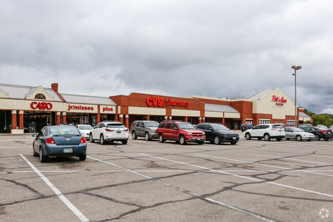
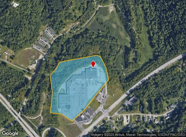
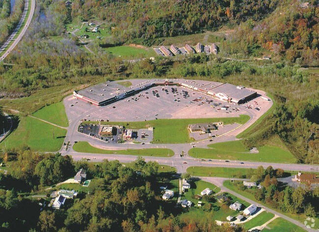
Property Record
State Route 93, Ironton, OH 45638
NEARBY LISTINGS FOR SALE OR LEASE
Property Detail
State Route 93
34-054-0510-003
Ironton
Regionalshoppingcenterormallwithanchorstore
18-01-16&20 IRONTON HILLS PLAZA PT TRACT 1 UPPER PARCEL 24.40 AC
AE
Lawrence
21089C0216D
Ohio
0
24.40 AC
2024
Lawrence County
050800
Huntington/Ashland
158,775 SF
Huntington-Ashland, WV-KY-OH
DEMOGRAPHICS near State Route 93
1 Mile
3 Mile
5 Mile
2024 Total Population
3,690
20,668
41,154
2029 Population
3,595
20,125
40,147
Pop Growth 2024-2029
(2.57%)
(2.63%)
(2.45%)
Average Age
41
43
42
2024 Total Households
1,631
8,598
16,995
HH Growth 2024-2029
(2.51%)
(2.55%)
(2.37%)
Median Household Inc
$29,499
$51,110
$52,072
Avg Household Size
2.10
2.30
2.30
2024 Avg HH Vehicles
1.00
2.00
2.00
Median Home Value
$110,781
$112,595
$113,220
Median Year Built
1953
1962
1967
Nearby Places
Map Layers
Map Styles
 Street
 Aerial
- Restaurants
- Banks
- Shops
- Fitness
- Groceries
PUBLIC TRANSPORTATION
COMMUTER RAIL
Ashland Amtrak Station (Cardinal - Amtrak)
DRIVE
WALK
Distance
Ashland Amtrak Station (Cardinal - Amtrak)
9 min
5.6 mi
AIRPORT
Tri-State/Milton J Ferguson Field
DRIVE
WALK
Distance
Tri-State/Milton J Ferguson Field
29 min
17.6 mi
Freight Ports
Port of Toledo
DRIVE
WALK
Distance
Port of Toledo
329 min
253.1 mi
Nearby Properties
Address
Land Use
TOTAL SIZE
Lot Size
Zoning
Address
Land Use
TOTAL SIZE
Lot Size
Zoning
Address
Land Use
TOTAL SIZE
Lot Size
Zoning
Address
Land Use
TOTAL SIZE
Lot Size
Zoning
11.95 AC
Address
Land Use
TOTAL SIZE
Lot Size
Zoning
12.54 AC
Address
Land Use
TOTAL SIZE
Lot Size
Zoning
40.94 AC
Address
Land Use
TOTAL SIZE
Lot Size
Zoning
Address
Land Use
TOTAL SIZE
Lot Size
Zoning
19.91 AC
Address
Land Use
TOTAL SIZE
Lot Size
Zoning
1,424 SF
6.46 AC
Address
Land Use
TOTAL SIZE
Lot Size
Zoning
139,148 SF
Address
Land Use
TOTAL SIZE
Lot Size
Zoning
35,014 SF
3.81 AC
Address
Land Use
TOTAL SIZE
Lot Size
Zoning
9.43 AC
Address
Land Use
TOTAL SIZE
Lot Size
Zoning
30,250 SF
8.29 AC
Address
Land Use
TOTAL SIZE
Lot Size
Zoning
75,820 SF
1.71 AC
Address
Land Use
TOTAL SIZE
Lot Size
Zoning
1,440 SF
1.38 AC
Address
Land Use
TOTAL SIZE
Lot Size
Zoning
9.49 AC
Address
Land Use
TOTAL SIZE
Lot Size
Zoning
47,557 SF
1.69 AC
Address
Land Use
TOTAL SIZE
Lot Size
Zoning
Address
Land Use
TOTAL SIZE
Lot Size
Zoning
5,472 SF
4.94 AC
Address
Land Use
TOTAL SIZE
Lot Size
Zoning
Address
Land Use
TOTAL SIZE
Lot Size
Zoning
135,431 SF
9.19 AC
Address
Land Use
TOTAL SIZE
Lot Size
Zoning
47,253 SF
5 AC
Address
Land Use
TOTAL SIZE
Lot Size
Zoning
Address
Land Use
TOTAL SIZE
Lot Size
Zoning
5,280 SF
0.72 AC
Address
Land Use
TOTAL SIZE
Lot Size
Zoning
31,419 SF
10.43 AC
Address
Land Use
TOTAL SIZE
Lot Size
Zoning
17.93 AC
Address
Land Use
TOTAL SIZE
Lot Size
Zoning
Address
Land Use
TOTAL SIZE
Lot Size
Zoning
Address
Land Use
TOTAL SIZE
Lot Size
Zoning
115,790 SF
20.22 AC
Address
Land Use
TOTAL SIZE
Lot Size
Zoning
3.32 AC
The World's #1 Commercial Real Estate Marketplace
Connect with us
© 2025 CoStar Group
The information above has been obtained from sources believed reliable. While we do not doubt its accuracy we have not verified it and make no guarantee, warranty or representation about it. It is your responsibility to independently confirm its accuracy and completeness. Any projections, opinions, assumptions, or estimates used are for example only and do not represent the current or future performance of the property. The value of this transaction to you depends on tax and other factors which should be evaluated by your tax, financial, and legal advisors. You and your advisors should conduct a careful, independent investigation of the property to determine to your satisfaction the suitability of the property for your needs.