Property Record
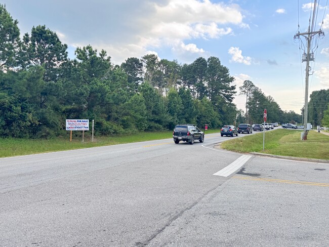
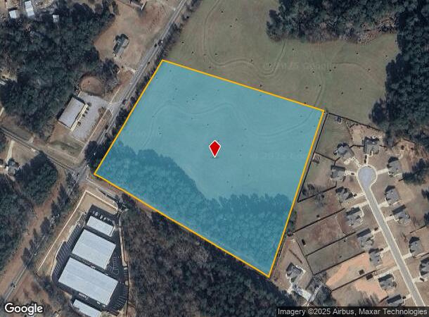
Tanners Bridge Rd, Bethlehem, GA 30620

NEARBY LISTINGS FOR SALE OR LEASE
Property Detail
Tanners Bridge Rd
XX054-037A
PB 6-380 TR 4A
Agriculturalland
Barrow
X
Georgia
13297C0020F
14.30 AC
2024
Barrow County
2024
Atlanta
180503
Atlanta-Sandy Springs-Roswell, GA
DEMOGRAPHICS near Tanners Bridge Rd
1 Mile
3 Mile
5 Mile
2024 Total Population
4,760
21,855
42,099
2029 Population
5,392
24,579
47,021
Pop Growth 2024-2029
+ 13.28%
+ 12.46%
+ 11.69%
Average Age
35
36
37
2024 Total Households
1,526
7,100
13,766
HH Growth 2024-2029
+ 13.30%
+ 12.51%
+ 11.82%
Median Household Inc
$72,034
$79,718
$87,152
Avg Household Size
3.10
3.00
3.00
2024 Avg HH Vehicles
2.00
2.00
2.00
Median Home Value
$317,468
$321,108
$335,536
Median Year Built
2005
2004
2003
Nearby Places
Map Layers
Map Styles
 Street
 Aerial
- Restaurants
- Banks
- Shops
- Fitness
- Groceries
Nearby Properties
Address
Land Use
TOTAL SIZE
Lot Size
Zoning
Address
Land Use
TOTAL SIZE
Lot Size
Zoning
10,128 SF
28.20 AC
R-3
Address
Land Use
TOTAL SIZE
Lot Size
Zoning
26,789 SF
35.60 AC
C-3
Address
Land Use
TOTAL SIZE
Lot Size
Zoning
22,320 SF
15.90 AC
R-3
Address
Land Use
TOTAL SIZE
Lot Size
Zoning
120,000 SF
142.70 AC
AG
Address
Land Use
TOTAL SIZE
Lot Size
Zoning
2,046 SF
13 AC
B-2,R-3
Address
Land Use
TOTAL SIZE
Lot Size
Zoning
132,156 SF
10.10 AC
C-2
Address
Land Use
TOTAL SIZE
Lot Size
Zoning
79,029 SF
9.70 AC
C-2
Address
Land Use
TOTAL SIZE
Lot Size
Zoning
37,162 SF
4.60 AC
R-3
Address
Land Use
TOTAL SIZE
Lot Size
Zoning
104,805 SF
12.50 AC
C-3
Address
Land Use
TOTAL SIZE
Lot Size
Zoning
1,188 SF
7.60 AC
R-3
Address
Land Use
TOTAL SIZE
Lot Size
Zoning
38,550 SF
3 AC
C-2
Address
Land Use
TOTAL SIZE
Lot Size
Zoning
55,420 SF
5 AC
C-3
Address
Land Use
TOTAL SIZE
Lot Size
Zoning
46,339 SF
2 AC
B-2
Address
Land Use
TOTAL SIZE
Lot Size
Zoning
76,768 SF
19 AC
AG
Address
Land Use
TOTAL SIZE
Lot Size
Zoning
45,296 SF
8.20 AC
B-2
Address
Land Use
TOTAL SIZE
Lot Size
Zoning
19,483 SF
2.80 AC
B-2
Address
Land Use
TOTAL SIZE
Lot Size
Zoning
153 AC
R100
Address
Land Use
TOTAL SIZE
Lot Size
Zoning
2,398 SF
8.10 AC
R-3
Address
Land Use
TOTAL SIZE
Lot Size
Zoning
18,240 SF
0.93 AC
B-2
Address
Land Use
TOTAL SIZE
Lot Size
Zoning
5,500 SF
12.90 AC
C-3
Address
Land Use
TOTAL SIZE
Lot Size
Zoning
14,300 SF
5.80 AC
M-1
Address
Land Use
TOTAL SIZE
Lot Size
Zoning
4,026 SF
1.60 AC
B-2
Address
Land Use
TOTAL SIZE
Lot Size
Zoning
14,356 SF
2.30 AC
B-2
Address
Land Use
TOTAL SIZE
Lot Size
Zoning
1,395 SF
0.16 AC
HPM2*
Address
Land Use
TOTAL SIZE
Lot Size
Zoning
13,439 SF
1.30 AC
B-2
Address
Land Use
TOTAL SIZE
Lot Size
Zoning
14.70 AC
C-2
Address
Land Use
TOTAL SIZE
Lot Size
Zoning
10,455 SF
2 AC
B-2
Address
Land Use
TOTAL SIZE
Lot Size
Zoning
23,378 SF
9.60 AC
M-1
Address
Land Use
TOTAL SIZE
Lot Size
Zoning
3,600 SF
3 AC
C-3
Address
Land Use
TOTAL SIZE
Lot Size
Zoning
106 AC
C-3
The World's #1 Commercial Real Estate Marketplace
Connect with us
© 2025 CoStar Group
The information above has been obtained from sources believed reliable. While we do not doubt its accuracy we have not verified it and make no guarantee, warranty or representation about it. It is your responsibility to independently confirm its accuracy and completeness. Any projections, opinions, assumptions, or estimates used are for example only and do not represent the current or future performance of the property. The value of this transaction to you depends on tax and other factors which should be evaluated by your tax, financial, and legal advisors. You and your advisors should conduct a careful, independent investigation of the property to determine to your satisfaction the suitability of the property for your needs.