Property Record
9359 W Ustick Rd, Nampa, ID 83687
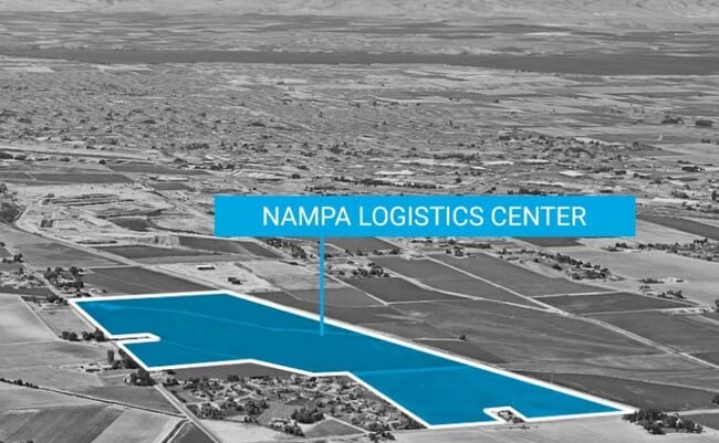


Property Detail
9359 W Ustick Rd
Boise City, ID
04-3N-2W NE TX 24376 IN GOVT LTS 2
R308350100
Canyon
Industrialacreage
Idaho
B and X Area of moderate flood hazard, usually the area between the limits of the 100-year and 500-year floods.
2
0
12.02 AC
2025
Nampa
021008
Boise City/Nampa
NEARBY LISTINGS FOR SALE OR LEASE
DEMOGRAPHICS near 9359 W Ustick Rd
1 mile
3 mile
5 mile
2025 Total Population
2,232
39,862
128,857
2030 Population
2,604
44,993
143,988
Pop Growth 2025-2030
+ 16.67%
+ 12.87%
+ 11.74%
Average Age
38
36
36
2025 Total Households
720
13,603
43,410
HH Growth 2025-2030
+ 17.08%
+ 13.04%
+ 11.99%
Median Household Inc
$94,078
$70,822
$68,401
Avg Household Size
3.00
2.90
2.90
2025 Avg HH Vehicles
3.00
2.00
2.00
Median Home Value
$487,735
$366,462
$362,340
Median Year Built
2010
2005
2002
Nearby Places
Map Layers
Map Styles
 Street
 Aerial
Layers
 Traffic
 Biking
Places
Listings with unknown addresses are not visible on the map
- Restaurants
- Banks
- Shops
- Fitness
- Groceries
PUBLIC TRANSPORTATION
AIRPORT
Boise Air Trml/Gowen Field
Drive
Walk
Distance
Boise Air Trml/Gowen Field
44 min
25.4 mi
Freight Ports
Port of Portland
Drive
Walk
Distance
Port of Portland
459 min
415.2 mi
SALE & LEASE HISTORY
LISTING DATE
SALE/LEASE

Dec 26, 2023
For Sale
Nearby Properties
Address
Land Use
TOTAL SIZE
Lot Size
Zoning
Address
Land Use
TOTAL SIZE
Lot Size
Zoning
13.53 AC
Address
Land Use
TOTAL SIZE
Lot Size
Zoning
345,974 SF
40.28 AC
Address
Land Use
TOTAL SIZE
Lot Size
Zoning
64.50 AC
Address
Land Use
TOTAL SIZE
Lot Size
Zoning
13.10 AC
Address
Land Use
TOTAL SIZE
Lot Size
Zoning
11.26 AC
Address
Land Use
TOTAL SIZE
Lot Size
Zoning
37.83 AC
Address
Land Use
TOTAL SIZE
Lot Size
Zoning
18.74 AC
Address
Land Use
TOTAL SIZE
Lot Size
Zoning
158.05 AC
M1
Address
Land Use
TOTAL SIZE
Lot Size
Zoning
11.15 AC
Address
Land Use
TOTAL SIZE
Lot Size
Zoning
1,048 SF
13.09 AC
Address
Land Use
TOTAL SIZE
Lot Size
Zoning
243,353 SF
20.57 AC
Address
Land Use
TOTAL SIZE
Lot Size
Zoning
18.68 AC
Address
Land Use
TOTAL SIZE
Lot Size
Zoning
219,520 SF
26.72 AC
Address
Land Use
TOTAL SIZE
Lot Size
Zoning
119.97 AC
Address
Land Use
TOTAL SIZE
Lot Size
Zoning
1.03 AC
Address
Land Use
TOTAL SIZE
Lot Size
Zoning
244,100 SF
13.64 AC
Address
Land Use
TOTAL SIZE
Lot Size
Zoning
8.34 AC
R1
Address
Land Use
TOTAL SIZE
Lot Size
Zoning
11.48 AC
Address
Land Use
TOTAL SIZE
Lot Size
Zoning
1,212 SF
14.91 AC
Address
Land Use
TOTAL SIZE
Lot Size
Zoning
11.75 AC
Address
Land Use
TOTAL SIZE
Lot Size
Zoning
1,696 SF
5.28 AC
R1
Address
Land Use
TOTAL SIZE
Lot Size
Zoning
Address
Land Use
TOTAL SIZE
Lot Size
Zoning
189,415 SF
10 AC
Address
Land Use
TOTAL SIZE
Lot Size
Zoning
42.30 AC
M2
Address
Land Use
TOTAL SIZE
Lot Size
Zoning
7.06 AC
Address
Land Use
TOTAL SIZE
Lot Size
Zoning
7.48 AC
Address
Land Use
TOTAL SIZE
Lot Size
Zoning
9.81 AC
R1
Address
Land Use
TOTAL SIZE
Lot Size
Zoning
52,336 SF
11.13 AC
Address
Land Use
TOTAL SIZE
Lot Size
Zoning
7.22 AC
Address
Land Use
TOTAL SIZE
Lot Size
Zoning
6.29 AC
The World's #1 Commercial Real Estate Marketplace
Connect with us
© 2026 CoStar Group
The information above has been obtained from sources believed reliable. While we do not doubt its accuracy we have not verified it and make no guarantee, warranty or representation about it. It is your responsibility to independently confirm its accuracy and completeness. Any projections, opinions, assumptions, or estimates used are for example only and do not represent the current or future performance of the property. The value of this transaction to you depends on tax and other factors which should be evaluated by your tax, financial, and legal advisors. You and your advisors should conduct a careful, independent investigation of the property to determine to your satisfaction the suitability of the property for your needs.