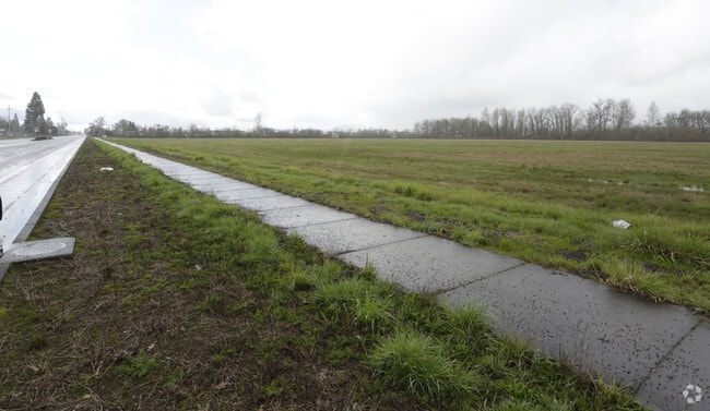
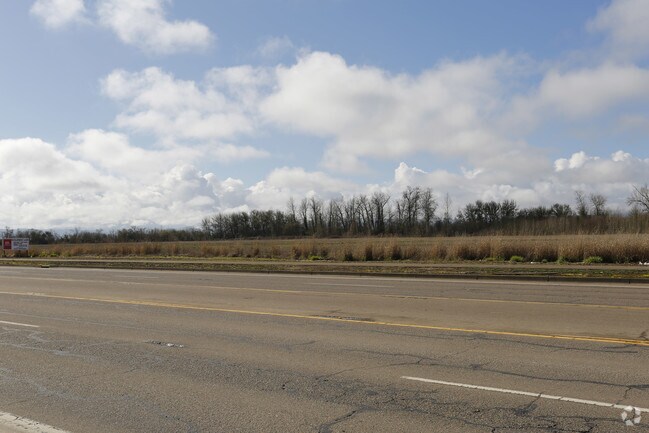
Property Record
Unassigned, Corvallis, OR 97333

Property Detail
Unassigned
156475
BENTON
Industrialacreage
Oregon
RS-20
44.75 AC
B and X Area of moderate flood hazard, usually the area between the limits of the 100-year and 500-year floods.
Oregon West Area
2024
Other Market Areas
2025
Corvallis, OR
000100
NEARBY LISTINGS FOR SALE OR LEASE
DEMOGRAPHICS near Unassigned
1 mile
3 mile
5 mile
2025 Total Population
6,506
41,618
74,553
2030 Population
6,720
44,068
77,471
Pop Growth 2025-2030
+ 3.29%
+ 5.89%
+ 3.91%
Average Age
38
33
37
2025 Total Households
2,562
15,960
29,884
HH Growth 2025-2030
+ 3.36%
+ 6.64%
+ 4.19%
Median Household Inc
$80,103
$50,222
$65,732
Avg Household Size
2.40
2.20
2.20
2025 Avg HH Vehicles
2.00
2.00
2.00
Median Home Value
$442,225
$487,409
$503,439
Median Year Built
1989
1989
1980
Nearby Places
Map Layers
Map Styles
 Street
 Aerial
Layers
 Traffic
 Biking
Places
Listings with unknown addresses are not visible on the map
- Restaurants
- Banks
- Shops
- Fitness
- Groceries
PUBLIC TRANSPORTATION
AIRPORT
Mahlon Sweet Field
Drive
Walk
Distance
Mahlon Sweet Field
51 min
33.5 mi
Freight Ports
Port of Portland
Drive
Walk
Distance
Port of Portland
113 min
88.3 mi
SALE & LEASE HISTORY
LISTING DATE
SALE/LEASE

Apr 27, 2017
For Sale
Apr 10, 2017
For Sale
Nearby Properties
Address
Land Use
TOTAL SIZE
Lot Size
Zoning
Address
Land Use
TOTAL SIZE
Lot Size
Zoning
552,129 SF
25.99 AC
RS-12
Address
Land Use
TOTAL SIZE
Lot Size
Zoning
Address
Land Use
TOTAL SIZE
Lot Size
Zoning
339,006 SF
0.69 AC
RF
Address
Land Use
TOTAL SIZE
Lot Size
Zoning
330,693 SF
1.25 AC
MUE
Address
Land Use
TOTAL SIZE
Lot Size
Zoning
106,538 SF
4.38 AC
RS-12
Address
Land Use
TOTAL SIZE
Lot Size
Zoning
166,415 SF
3.04 AC
OSU
Address
Land Use
TOTAL SIZE
Lot Size
Zoning
81,113 SF
1.81 AC
PD(RS-20)
Address
Land Use
TOTAL SIZE
Lot Size
Zoning
Address
Land Use
TOTAL SIZE
Lot Size
Zoning
107,412 SF
9.16 AC
RTC
Address
Land Use
TOTAL SIZE
Lot Size
Zoning
235,104 SF
9.96 AC
PD(RS-20)
Address
Land Use
TOTAL SIZE
Lot Size
Zoning
67,925 SF
4.84 AC
RTC
Address
Land Use
TOTAL SIZE
Lot Size
Zoning
139,766 SF
6.41 AC
PD(RS-9)
Address
Land Use
TOTAL SIZE
Lot Size
Zoning
122,984 SF
2.56 AC
RS-20
Address
Land Use
TOTAL SIZE
Lot Size
Zoning
94,542 SF
10.96 AC
PD(NC-MAJO
Address
Land Use
TOTAL SIZE
Lot Size
Zoning
117,960 SF
5.41 AC
RS-20
Address
Land Use
TOTAL SIZE
Lot Size
Zoning
224,384 SF
2.41 AC
MUCS
Address
Land Use
TOTAL SIZE
Lot Size
Zoning
136,117 SF
6.40 AC
PD(RS-9)
Address
Land Use
TOTAL SIZE
Lot Size
Zoning
63,978 SF
3.06 AC
PD(MUGC)
Address
Land Use
TOTAL SIZE
Lot Size
Zoning
123,766 SF
6.12 AC
PD(RS-20)
Address
Land Use
TOTAL SIZE
Lot Size
Zoning
53,602 SF
4.83 AC
RTC
Address
Land Use
TOTAL SIZE
Lot Size
Zoning
174,512 SF
3.62 AC
OSU
Address
Land Use
TOTAL SIZE
Lot Size
Zoning
84,170 SF
1.34 AC
RS-20
Address
Land Use
TOTAL SIZE
Lot Size
Zoning
112,048 SF
4.72 AC
RS-20
Address
Land Use
TOTAL SIZE
Lot Size
Zoning
1.20 AC
CBF
Address
Land Use
TOTAL SIZE
Lot Size
Zoning
50,576 SF
Address
Land Use
TOTAL SIZE
Lot Size
Zoning
106,912 SF
4.05 AC
PD(RS-12)
Address
Land Use
TOTAL SIZE
Lot Size
Zoning
76,625 SF
3.40 AC
PD(RS-12)
Address
Land Use
TOTAL SIZE
Lot Size
Zoning
Address
Land Use
TOTAL SIZE
Lot Size
Zoning
98,282 SF
1.38 AC
RS-20
Address
Land Use
TOTAL SIZE
Lot Size
Zoning
103,024 SF
4.53 AC
PD(RS-20)
The World's #1 Commercial Real Estate Marketplace
Connect with us
© 2026 CoStar Group
The information above has been obtained from sources believed reliable. While we do not doubt its accuracy we have not verified it and make no guarantee, warranty or representation about it. It is your responsibility to independently confirm its accuracy and completeness. Any projections, opinions, assumptions, or estimates used are for example only and do not represent the current or future performance of the property. The value of this transaction to you depends on tax and other factors which should be evaluated by your tax, financial, and legal advisors. You and your advisors should conduct a careful, independent investigation of the property to determine to your satisfaction the suitability of the property for your needs.