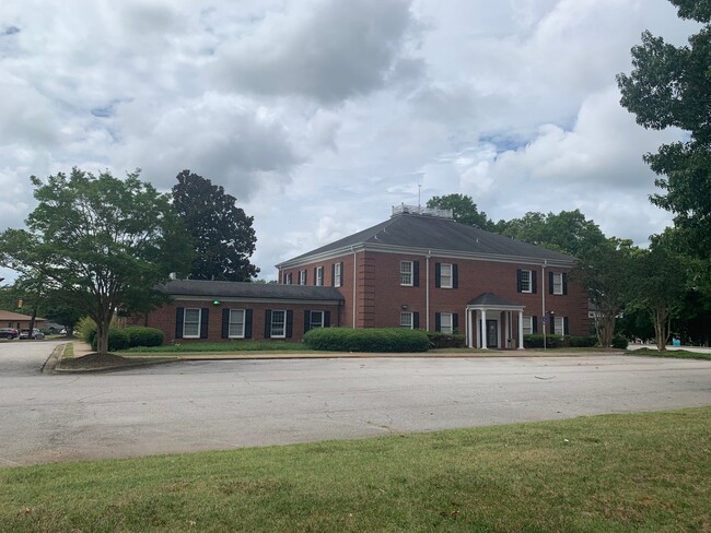
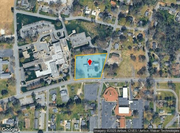
Property Record
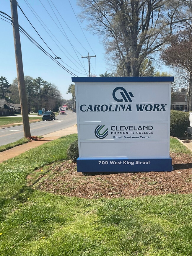
W King St, Kings Mountain, NC 28086
NEARBY LISTINGS FOR SALE OR LEASE
Property Detail
W King St
Shelby, NC
W Boyce Weir Land
13377
1.9078AC W KING ST
Financialbuilding
Cleveland
X
North Carolina
45021C0125D
2
2025
1.91 AC
2025
Cleveland County
950400
Charlotte
10,480 SF
DEMOGRAPHICS near W King St
1 Mile
3 Mile
5 Mile
2024 Total Population
4,642
16,009
26,814
2029 Population
4,864
16,847
28,225
Pop Growth 2024-2029
+ 4.78%
+ 5.23%
+ 5.26%
Average Age
40
40
41
2024 Total Households
1,897
6,445
10,671
HH Growth 2024-2029
+ 4.80%
+ 5.29%
+ 5.33%
Median Household Inc
$47,949
$50,978
$51,951
Avg Household Size
2.40
2.40
2.50
2024 Avg HH Vehicles
2.00
2.00
2.00
Median Home Value
$162,949
$146,235
$152,763
Median Year Built
1974
1975
1978
Nearby Places
Map Layers
Map Styles
 Street
 Aerial
- Restaurants
- Banks
- Shops
- Fitness
- Groceries
PUBLIC TRANSPORTATION
AIRPORT
Charlotte/Douglas International
DRIVE
WALK
Distance
Charlotte/Douglas International
44 min
27.8 mi
SALE & LEASE HISTORY
LISTING DATE
SALE/LEASE

Oct 18, 2023
For Lease
Jul 26, 2023
For Sale
Aug 09, 2022
For Sale
Apr 05, 2024
For Lease
Nearby Properties
Address
Land Use
TOTAL SIZE
Lot Size
Zoning
Address
Land Use
TOTAL SIZE
Lot Size
Zoning
163 AC
Address
Land Use
TOTAL SIZE
Lot Size
Zoning
98,784 SF
26.28 AC
LI
Address
Land Use
TOTAL SIZE
Lot Size
Zoning
214,400 SF
30.06 AC
LI
Address
Land Use
TOTAL SIZE
Lot Size
Zoning
148,770 SF
15.72 AC
LI
Address
Land Use
TOTAL SIZE
Lot Size
Zoning
536,116 SF
45.22 AC
HI
Address
Land Use
TOTAL SIZE
Lot Size
Zoning
130,000 SF
27.41 AC
LI
Address
Land Use
TOTAL SIZE
Lot Size
Zoning
469,498 SF
35.38 AC
STOR2
Address
Land Use
TOTAL SIZE
Lot Size
Zoning
12,183 SF
78.45 AC
INDS3
Address
Land Use
TOTAL SIZE
Lot Size
Zoning
Address
Land Use
TOTAL SIZE
Lot Size
Zoning
828 SF
85.98 AC
R10
Address
Land Use
TOTAL SIZE
Lot Size
Zoning
12.52 AC
RO
Address
Land Use
TOTAL SIZE
Lot Size
Zoning
300,993 SF
19.39 AC
HI
Address
Land Use
TOTAL SIZE
Lot Size
Zoning
32.87 AC
Address
Land Use
TOTAL SIZE
Lot Size
Zoning
135,000 SF
20.43 AC
HI
Address
Land Use
TOTAL SIZE
Lot Size
Zoning
125.73 AC
LI
Address
Land Use
TOTAL SIZE
Lot Size
Zoning
175,610 SF
25.84 AC
LI
Address
Land Use
TOTAL SIZE
Lot Size
Zoning
32,880 SF
2.88 AC
R08
Address
Land Use
TOTAL SIZE
Lot Size
Zoning
16,414 SF
5 AC
R10
Address
Land Use
TOTAL SIZE
Lot Size
Zoning
44,094 SF
2.67 AC
HI
Address
Land Use
TOTAL SIZE
Lot Size
Zoning
81,828 SF
19.01 AC
R10
Address
Land Use
TOTAL SIZE
Lot Size
Zoning
4,935 SF
13.07 AC
LI
Address
Land Use
TOTAL SIZE
Lot Size
Zoning
7,000 SF
536.04 AC
HI
Address
Land Use
TOTAL SIZE
Lot Size
Zoning
149,927 SF
5 AC
LI
Address
Land Use
TOTAL SIZE
Lot Size
Zoning
111,034 SF
39.75 AC
OFF01
Address
Land Use
TOTAL SIZE
Lot Size
Zoning
32,926 SF
4.40 AC
RO
Address
Land Use
TOTAL SIZE
Lot Size
Zoning
1,500 SF
10.02 AC
INDS1
Address
Land Use
TOTAL SIZE
Lot Size
Zoning
12,320 SF
11.48 AC
R06
Address
Land Use
TOTAL SIZE
Lot Size
Zoning
109,000 SF
50.10 AC
R20
Address
Land Use
TOTAL SIZE
Lot Size
Zoning
100,225 SF
10.48 AC
HI
Address
Land Use
TOTAL SIZE
Lot Size
Zoning
11,920 SF
3.10 AC
GB
The World's #1 Commercial Real Estate Marketplace
Connect with us
© 2026 CoStar Group
The information above has been obtained from sources believed reliable. While we do not doubt its accuracy we have not verified it and make no guarantee, warranty or representation about it. It is your responsibility to independently confirm its accuracy and completeness. Any projections, opinions, assumptions, or estimates used are for example only and do not represent the current or future performance of the property. The value of this transaction to you depends on tax and other factors which should be evaluated by your tax, financial, and legal advisors. You and your advisors should conduct a careful, independent investigation of the property to determine to your satisfaction the suitability of the property for your needs.