Property Record
W Sr 38, Pendleton, IN 46064

NEARBY LISTINGS FOR SALE OR LEASE
Property Detail
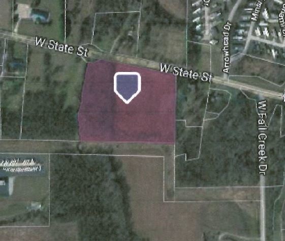
W Sr 38
48-14-20-200-004.000-013
N2 NW 8.2530ACRES STR: 20187 SECTION: PLAT: 00 IN: OUT:
Agriculturalland
Madison
X
Indiana
18057C0200G
8.25 AC
2024
Anderson/Madison Cnty
2025
Indianapolis
011501
Indianapolis-Carmel-Greenwood, IN
DEMOGRAPHICS near W Sr 38
1 Mile
3 Mile
5 Mile
2024 Total Population
1,803
11,403
22,286
2029 Population
1,870
11,710
22,899
Pop Growth 2024-2029
+ 3.72%
+ 2.69%
+ 2.75%
Average Age
41
42
40
2024 Total Households
679
3,355
7,306
HH Growth 2024-2029
+ 3.98%
+ 3.55%
+ 3.18%
Median Household Inc
$77,533
$81,625
$79,438
Avg Household Size
2.30
2.40
2.60
2024 Avg HH Vehicles
2.00
2.00
2.00
Median Home Value
$188,332
$221,399
$201,049
Median Year Built
1974
1981
1986
Nearby Places
Map Layers
Map Styles
 Street
 Aerial
- Restaurants
- Banks
- Shops
- Fitness
- Groceries
SALE & LEASE HISTORY
LISTING DATE
SALE/LEASE

Apr 19, 2021
For Sale
Apr 12, 2019
For Sale
Nearby Properties
Address
Land Use
TOTAL SIZE
Lot Size
Zoning
Address
Land Use
TOTAL SIZE
Lot Size
Zoning
256,290 SF
77.35 AC
Address
Land Use
TOTAL SIZE
Lot Size
Zoning
727,832 SF
46.15 AC
Address
Land Use
TOTAL SIZE
Lot Size
Zoning
399,763 SF
40 AC
Address
Land Use
TOTAL SIZE
Lot Size
Zoning
324,931 SF
25.40 AC
Address
Land Use
TOTAL SIZE
Lot Size
Zoning
117,536 SF
14.44 AC
Address
Land Use
TOTAL SIZE
Lot Size
Zoning
325,122 SF
40 AC
Address
Land Use
TOTAL SIZE
Lot Size
Zoning
160,230 SF
15 AC
Address
Land Use
TOTAL SIZE
Lot Size
Zoning
77,500 SF
8.42 AC
Address
Land Use
TOTAL SIZE
Lot Size
Zoning
17,729 SF
6.62 AC
Address
Land Use
TOTAL SIZE
Lot Size
Zoning
47,370 SF
11.23 AC
Address
Land Use
TOTAL SIZE
Lot Size
Zoning
17,729 SF
3.38 AC
Address
Land Use
TOTAL SIZE
Lot Size
Zoning
70,000 SF
10.07 AC
Address
Land Use
TOTAL SIZE
Lot Size
Zoning
115,522 SF
20 AC
Address
Land Use
TOTAL SIZE
Lot Size
Zoning
60,000 SF
6.71 AC
Address
Land Use
TOTAL SIZE
Lot Size
Zoning
32,586 SF
3.65 AC
Address
Land Use
TOTAL SIZE
Lot Size
Zoning
21,020 SF
1.15 AC
Address
Land Use
TOTAL SIZE
Lot Size
Zoning
6,660 SF
1.39 AC
Address
Land Use
TOTAL SIZE
Lot Size
Zoning
30,560 SF
11.27 AC
Address
Land Use
TOTAL SIZE
Lot Size
Zoning
8,245 SF
8.66 AC
Address
Land Use
TOTAL SIZE
Lot Size
Zoning
6,400 SF
15.72 AC
Address
Land Use
TOTAL SIZE
Lot Size
Zoning
5,469 SF
2.67 AC
Address
Land Use
TOTAL SIZE
Lot Size
Zoning
10,771 SF
1.78 AC
Address
Land Use
TOTAL SIZE
Lot Size
Zoning
27,400 SF
0.32 AC
Address
Land Use
TOTAL SIZE
Lot Size
Zoning
4,676 SF
4.74 AC
Address
Land Use
TOTAL SIZE
Lot Size
Zoning
3,210 SF
32.65 AC
Address
Land Use
TOTAL SIZE
Lot Size
Zoning
20.70 AC
Address
Land Use
TOTAL SIZE
Lot Size
Zoning
17,580 SF
5 AC
Address
Land Use
TOTAL SIZE
Lot Size
Zoning
2,860 SF
2.23 AC
Address
Land Use
TOTAL SIZE
Lot Size
Zoning
3,456 SF
5.14 AC
Address
Land Use
TOTAL SIZE
Lot Size
Zoning
11,500 SF
7.63 AC
The World's #1 Commercial Real Estate Marketplace
Connect with us
© 2026 CoStar Group
The information above has been obtained from sources believed reliable. While we do not doubt its accuracy we have not verified it and make no guarantee, warranty or representation about it. It is your responsibility to independently confirm its accuracy and completeness. Any projections, opinions, assumptions, or estimates used are for example only and do not represent the current or future performance of the property. The value of this transaction to you depends on tax and other factors which should be evaluated by your tax, financial, and legal advisors. You and your advisors should conduct a careful, independent investigation of the property to determine to your satisfaction the suitability of the property for your needs.