Property Record
W2654 County Road Kk, Appleton, WI 54915


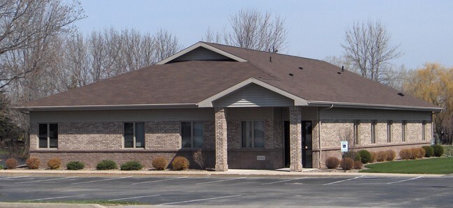
Property Detail
W2654 County Road Kk
Appleton, WI
E120FT OF S204.37FT OF W1/2 SW SE SEC33 T21N R18E .56AC M/L
03-0-0594-01
Outagamie
Commercialnec
Wisconsin
B and X Area of moderate flood hazard, usually the area between the limits of the 100-year and 500-year floods.
0.56 AC
2023
Outagamie County
2023
Green Bay
012000
NEARBY LISTINGS FOR SALE OR LEASE
DEMOGRAPHICS near W2654 County Road Kk
1 mile
3 mile
5 mile
2025 Total Population
10,020
53,900
124,545
2030 Population
10,471
55,353
127,598
Pop Growth 2025-2030
+ 4.50%
+ 2.70%
+ 2.45%
Average Age
39
40
40
2025 Total Households
3,542
21,163
50,047
HH Growth 2025-2030
+ 4.57%
+ 2.70%
+ 2.57%
Median Household Inc
$110,356
$86,361
$81,567
Avg Household Size
2.80
2.50
2.40
2025 Avg HH Vehicles
2.00
2.00
2.00
Median Home Value
$322,525
$268,008
$255,650
Median Year Built
1999
1989
1979
Nearby Places
Map Layers
Map Styles
 Street
 Aerial
Layers
 Traffic
 Biking
Places
Listings with unknown addresses are not visible on the map
- Restaurants
- Banks
- Shops
- Fitness
- Groceries
PUBLIC TRANSPORTATION
AIRPORT
Appleton International
Drive
Walk
Distance
Appleton International
22 min
13.1 mi
Green Bay/Austin Straubel International
Drive
Walk
Distance
Green Bay/Austin Straubel International
35 min
24.4 mi
Nearby Properties
Address
Land Use
TOTAL SIZE
Lot Size
Zoning
Address
Land Use
TOTAL SIZE
Lot Size
Zoning
232,800 SF
16.62 AC
Address
Land Use
TOTAL SIZE
Lot Size
Zoning
309,785 SF
20.13 AC
R3
Address
Land Use
TOTAL SIZE
Lot Size
Zoning
17.51 AC
Address
Land Use
TOTAL SIZE
Lot Size
Zoning
101,466 SF
13.87 AC
Address
Land Use
TOTAL SIZE
Lot Size
Zoning
20.37 AC
PDC2
Address
Land Use
TOTAL SIZE
Lot Size
Zoning
31.46 AC
Address
Land Use
TOTAL SIZE
Lot Size
Zoning
249,600 SF
11.88 AC
M1
Address
Land Use
TOTAL SIZE
Lot Size
Zoning
13.23 AC
Address
Land Use
TOTAL SIZE
Lot Size
Zoning
2,992 SF
12.49 AC
Address
Land Use
TOTAL SIZE
Lot Size
Zoning
100,105 SF
12.62 AC
C2
Address
Land Use
TOTAL SIZE
Lot Size
Zoning
66,760 SF
52.60 AC
Address
Land Use
TOTAL SIZE
Lot Size
Zoning
222,848 SF
12.39 AC
M1
Address
Land Use
TOTAL SIZE
Lot Size
Zoning
6.02 AC
Address
Land Use
TOTAL SIZE
Lot Size
Zoning
247,520 SF
13.68 AC
M1
Address
Land Use
TOTAL SIZE
Lot Size
Zoning
273,484 SF
23.01 AC
PDR3
Address
Land Use
TOTAL SIZE
Lot Size
Zoning
Address
Land Use
TOTAL SIZE
Lot Size
Zoning
37,430 SF
7.32 AC
M1
Address
Land Use
TOTAL SIZE
Lot Size
Zoning
Address
Land Use
TOTAL SIZE
Lot Size
Zoning
200,880 SF
14.60 AC
M1
Address
Land Use
TOTAL SIZE
Lot Size
Zoning
Address
Land Use
TOTAL SIZE
Lot Size
Zoning
83,664 SF
10.06 AC
Address
Land Use
TOTAL SIZE
Lot Size
Zoning
59,010 SF
13.09 AC
Address
Land Use
TOTAL SIZE
Lot Size
Zoning
5.10 AC
Address
Land Use
TOTAL SIZE
Lot Size
Zoning
32.61 AC
Address
Land Use
TOTAL SIZE
Lot Size
Zoning
8.08 AC
Address
Land Use
TOTAL SIZE
Lot Size
Zoning
45.88 AC
Address
Land Use
TOTAL SIZE
Lot Size
Zoning
105,360 SF
16.21 AC
M1
Address
Land Use
TOTAL SIZE
Lot Size
Zoning
146,812 SF
8.93 AC
R3
Address
Land Use
TOTAL SIZE
Lot Size
Zoning
20.22 AC
M1
Address
Land Use
TOTAL SIZE
Lot Size
Zoning
205,111 SF
18.40 AC
PDC2
The World's #1 Commercial Real Estate Marketplace
Connect with us
© 2026 CoStar Group
The information above has been obtained from sources believed reliable. While we do not doubt its accuracy we have not verified it and make no guarantee, warranty or representation about it. It is your responsibility to independently confirm its accuracy and completeness. Any projections, opinions, assumptions, or estimates used are for example only and do not represent the current or future performance of the property. The value of this transaction to you depends on tax and other factors which should be evaluated by your tax, financial, and legal advisors. You and your advisors should conduct a careful, independent investigation of the property to determine to your satisfaction the suitability of the property for your needs.