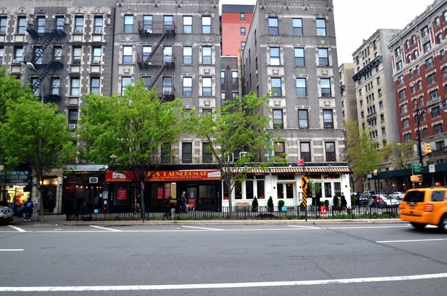
Property Record
1012 Amsterdam Ave, New York, NY 10025


Property Detail
1012 Amsterdam Ave
1881-0035
New York
Apartment
New York
R8
35
B and X Area of moderate flood hazard, usually the area between the limits of the 100-year and 500-year floods.
0.16 AC
2024
Upper West Side
2025
New York City
019500
New York-Jersey City-White Plains, NY-NJ
31,644 SF
NEARBY LISTINGS FOR SALE OR LEASE
DEMOGRAPHICS near 1012 Amsterdam Ave
1 mile
3 mile
5 mile
2025 Total Population
182,554
1,205,795
2,615,620
2030 Population
190,708
1,252,688
2,693,605
Pop Growth 2025-2030
+ 4.47%
+ 3.89%
+ 2.98%
Average Age
41
42
40
2025 Total Households
77,391
534,402
1,122,817
HH Growth 2025-2030
+ 4.65%
+ 4.33%
+ 3.43%
Median Household Inc
$90,090
$86,569
$82,747
Avg Household Size
2.10
2.10
2.20
2025 Avg HH Vehicles
.00
.00
.00
Median Home Value
$1,008,137
$917,641
$847,606
Median Year Built
1948
1956
1957
Nearby Places
Map Layers
Map Styles
 Street
 Aerial
Transit
 Traffic
 Biking
Places
Listings with unknown addresses are not visible on the map
- Restaurants
- Banks
- Shops
- Fitness
- Groceries
PUBLIC TRANSPORTATION
TRANSIT/SUBWAY
Cathedral Parkway (110 Street) (1 Line) (1 - New York MTA Subway (The Subway))
Drive
Walk
Distance
Cathedral Parkway (110 Street) (1 Line) (1 - New York MTA Subway (The Subway))
1 min
2 min
0.1 mi
Cathedral Parkway (110 Street) (A,B,C Line) (A - New York MTA Subway (The Subway), B - New York MTA Subway (The Subway), C - New York MTA Subway (The Subway))
Drive
Walk
Distance
Cathedral Parkway (110 Street) (A,B,C Line) (A - New York MTA Subway (The Subway), B - New York MTA Subway (The Subway), C - New York MTA Subway (The Subway))
1 min
7 min
0.4 mi
116 Street-Columbia University (1 - New York MTA Subway (The Subway))
Drive
Walk
Distance
116 Street-Columbia University (1 - New York MTA Subway (The Subway))
2 min
8 min
0.5 mi
103 Street (1 Line) (1 - New York MTA Subway (The Subway))
Drive
Walk
Distance
103 Street (1 Line) (1 - New York MTA Subway (The Subway))
3 min
9 min
0.5 mi
116 Street (A,B,C Line) (A - New York MTA Subway (The Subway), B - New York MTA Subway (The Subway), C - New York MTA Subway (The Subway))
Drive
Walk
Distance
116 Street (A,B,C Line) (A - New York MTA Subway (The Subway), B - New York MTA Subway (The Subway), C - New York MTA Subway (The Subway))
3 min
12 min
0.6 mi
COMMUTER RAIL
Harlem-125th Street Station (Harlem Line - Metro-North Commuter Railroad Company (Metro-North), Hudson Line - Metro-North Commuter Railroad Company (Metro-North), New Haven Line - Metro-North Commuter Railroad Company (Metro-North))
Drive
Walk
Distance
Harlem-125th Street Station (Harlem Line - Metro-North Commuter Railroad Company (Metro-North), Hudson Line - Metro-North Commuter Railroad Company (Metro-North), New Haven Line - Metro-North Commuter Railroad Company (Metro-North))
9 min
2.0 mi
Yankees-E 153rd Street Station (Hudson Line - Metro-North Commuter Railroad Company (Metro-North))
Drive
Walk
Distance
Yankees-E 153rd Street Station (Hudson Line - Metro-North Commuter Railroad Company (Metro-North))
14 min
3.7 mi
AIRPORT
LaGuardia
Drive
Walk
Distance
LaGuardia
20 min
8.0 mi
Newark Liberty International
Drive
Walk
Distance
Newark Liberty International
32 min
18.1 mi
John F Kennedy International
Drive
Walk
Distance
John F Kennedy International
34 min
19.2 mi
Freight Ports
NY - Red Hook Container Terminal
Drive
Walk
Distance
NY - Red Hook Container Terminal
1 min
8.4 mi
SALE & LEASE HISTORY
LISTING DATE
SALE/LEASE

Sep 25, 2016
For Lease
Nov 14, 2016
For Sale
May 18, 2017
For Lease
Nearby Properties
Address
Land Use
TOTAL SIZE
Lot Size
Zoning
Address
Land Use
TOTAL SIZE
Lot Size
Zoning
1,783,434 SF
1.94 AC
C5-3
Address
Land Use
TOTAL SIZE
Lot Size
Zoning
1,233,684 SF
16.94 AC
PARK
Address
Land Use
TOTAL SIZE
Lot Size
Zoning
1,638,259 SF
1.43 AC
C52.5
Address
Land Use
TOTAL SIZE
Lot Size
Zoning
3,693,539 SF
8.37 AC
R8
Address
Land Use
TOTAL SIZE
Lot Size
Zoning
1,842,991 SF
2.08 AC
C66.5
Address
Land Use
TOTAL SIZE
Lot Size
Zoning
400,160 SF
10.96 AC
R7-2
Address
Land Use
TOTAL SIZE
Lot Size
Zoning
2,215,000 SF
6.43 AC
R9
Address
Land Use
TOTAL SIZE
Lot Size
Zoning
264,420 SF
7.26 AC
C4-7
Address
Land Use
TOTAL SIZE
Lot Size
Zoning
1,606,528 SF
1.84 AC
C6-6
Address
Land Use
TOTAL SIZE
Lot Size
Zoning
1,482,208 SF
1.71 AC
C5-3
Address
Land Use
TOTAL SIZE
Lot Size
Zoning
2,230,742 SF
6.33 AC
R9
Address
Land Use
TOTAL SIZE
Lot Size
Zoning
637,863 SF
C6-6
Address
Land Use
TOTAL SIZE
Lot Size
Zoning
174 AC
P2
Address
Land Use
TOTAL SIZE
Lot Size
Zoning
539,643 SF
C5-2
Address
Land Use
TOTAL SIZE
Lot Size
Zoning
685,125 SF
0.85 AC
C5-3
Address
Land Use
TOTAL SIZE
Lot Size
Zoning
26.93 AC
R8
Address
Land Use
TOTAL SIZE
Lot Size
Zoning
843,564 SF
1.07 AC
C6-4
Address
Land Use
TOTAL SIZE
Lot Size
Zoning
986,246 SF
0.90 AC
C5-3
Address
Land Use
TOTAL SIZE
Lot Size
Zoning
1,368,870 SF
16.86 AC
R8
Address
Land Use
TOTAL SIZE
Lot Size
Zoning
2,278,432 SF
5.99 AC
R7-2
Address
Land Use
TOTAL SIZE
Lot Size
Zoning
1,338,131 SF
2.10 AC
C66.5
Address
Land Use
TOTAL SIZE
Lot Size
Zoning
449,876 SF
0.81 AC
C5-3
Address
Land Use
TOTAL SIZE
Lot Size
Zoning
449,876 SF
0.81 AC
C5-3
Address
Land Use
TOTAL SIZE
Lot Size
Zoning
1,112,096 SF
1.97 AC
C4-7
Address
Land Use
TOTAL SIZE
Lot Size
Zoning
1,025,320 SF
4.47 AC
C4-7
Address
Land Use
TOTAL SIZE
Lot Size
Zoning
1,200,000 SF
10.24 AC
R9
Address
Land Use
TOTAL SIZE
Lot Size
Zoning
755,000 SF
1.85 AC
R7-2
Address
Land Use
TOTAL SIZE
Lot Size
Zoning
796,156 SF
0.74 AC
C6-6
Address
Land Use
TOTAL SIZE
Lot Size
Zoning
35.58 AC
I
Address
Land Use
TOTAL SIZE
Lot Size
Zoning
310,000 SF
0.42 AC
C5-3
The World's #1 Commercial Real Estate Marketplace
Connect with us
© 2026 CoStar Group
The information above has been obtained from sources believed reliable. While we do not doubt its accuracy we have not verified it and make no guarantee, warranty or representation about it. It is your responsibility to independently confirm its accuracy and completeness. Any projections, opinions, assumptions, or estimates used are for example only and do not represent the current or future performance of the property. The value of this transaction to you depends on tax and other factors which should be evaluated by your tax, financial, and legal advisors. You and your advisors should conduct a careful, independent investigation of the property to determine to your satisfaction the suitability of the property for your needs.