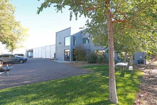
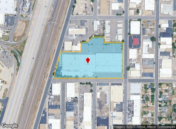
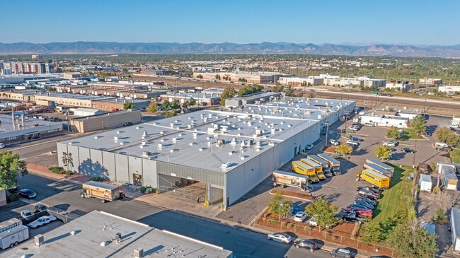
Property Record
3890 S Windermere St, Englewood, CO 80110

Property Detail
3890 S Windermere St
2077-04-1-35-002
SUBDIVISIONCD 043401 SUBDIVISIONNAME MANSFIELD SUB BLOCK 000 LOT 002 LOT 2 MANSFIELD SUB
Warehouse
ARAPAHOE
EI1
Colorado
B and X Area of moderate flood hazard, usually the area between the limits of the 100-year and 500-year floods.
002,2
2024
5.54 AC
2025
Southwest C-470
006000
Denver
195,179 SF
Denver-Aurora-Centennial, CO
NEARBY LISTINGS FOR SALE OR LEASE
DEMOGRAPHICS near 3890 S Windermere St
1 mile
3 mile
5 mile
2025 Total Population
10,718
122,055
345,440
2030 Population
10,925
124,245
350,231
Pop Growth 2025-2030
+ 1.93%
+ 1.79%
+ 1.39%
Average Age
39
40
40
2025 Total Households
5,206
51,401
144,039
HH Growth 2025-2030
+ 2.04%
+ 1.94%
+ 1.54%
Median Household Inc
$84,773
$90,109
$96,508
Avg Household Size
2.00
2.30
2.30
2025 Avg HH Vehicles
2.00
2.00
2.00
Median Home Value
$530,351
$634,494
$694,277
Median Year Built
1971
1967
1970
Nearby Places
Map Layers
Map Styles
 Street
 Aerial
Layers
 Traffic
 Biking
Places
Listings with unknown addresses are not visible on the map
- Restaurants
- Banks
- Shops
- Fitness
- Groceries
PUBLIC TRANSPORTATION
COMMUTER RAIL
Union Station: LoDo-Coors Field-16th Street Mall (C Line - Denver Regional Transportation District Light Rail (TheRide), E Line - Denver Regional Transportation District Light Rail (TheRide), W Line - Denver Regional Transportation District Light Rail (TheRide))
Drive
Walk
Distance
Union Station: LoDo-Coors Field-16th Street Mall (C Line - Denver Regional Transportation District Light Rail (TheRide), E Line - Denver Regional Transportation District Light Rail (TheRide), W Line - Denver Regional Transportation District Light Rail (TheRide))
15 min
9.2 mi
Drive
Walk
Distance
15 min
9.2 mi
AIRPORT
Denver International
Drive
Walk
Distance
Denver International
44 min
31.7 mi
SALE & LEASE HISTORY
LISTING DATE
SALE/LEASE

Sep 23, 2016
For Sale
Nov 08, 2019
For Lease
Nov 08, 2019
For Lease
Jul 24, 2024
For Lease
Nearby Properties
Address
Land Use
TOTAL SIZE
Lot Size
Zoning
Address
Land Use
TOTAL SIZE
Lot Size
Zoning
377,735 SF
1.72 AC
G-RX
Address
Land Use
TOTAL SIZE
Lot Size
Zoning
1,360,162 SF
6.27 AC
Address
Land Use
TOTAL SIZE
Lot Size
Zoning
1,137,044 SF
35.49 AC
CMP-EI
Address
Land Use
TOTAL SIZE
Lot Size
Zoning
124,658 SF
2.13 AC
CMP-EI
Address
Land Use
TOTAL SIZE
Lot Size
Zoning
117,535 SF
4.76 AC
Address
Land Use
TOTAL SIZE
Lot Size
Zoning
169,731 SF
0.69 AC
C-RX
Address
Land Use
TOTAL SIZE
Lot Size
Zoning
441,643 SF
9.79 AC
H-1-B
Address
Land Use
TOTAL SIZE
Lot Size
Zoning
533,298 SF
3.23 AC
C-MX
Address
Land Use
TOTAL SIZE
Lot Size
Zoning
330,776 SF
48.11 AC
CMP-H2
Address
Land Use
TOTAL SIZE
Lot Size
Zoning
248,291 SF
128.77 AC
CMP-H2
Address
Land Use
TOTAL SIZE
Lot Size
Zoning
147,078 SF
6.17 AC
CMP-EI
Address
Land Use
TOTAL SIZE
Lot Size
Zoning
251,583 SF
38.03 AC
Address
Land Use
TOTAL SIZE
Lot Size
Zoning
98,523 SF
4.17 AC
Address
Land Use
TOTAL SIZE
Lot Size
Zoning
68,500 SF
2.14 AC
Address
Land Use
TOTAL SIZE
Lot Size
Zoning
381 SF
66.05 AC
I-B
Address
Land Use
TOTAL SIZE
Lot Size
Zoning
214,192 SF
0.03 AC
Address
Land Use
TOTAL SIZE
Lot Size
Zoning
47,765 SF
3.34 AC
E-SU
Address
Land Use
TOTAL SIZE
Lot Size
Zoning
250,402 SF
21 AC
Address
Land Use
TOTAL SIZE
Lot Size
Zoning
158,805 SF
3.71 AC
CMP-EI
Address
Land Use
TOTAL SIZE
Lot Size
Zoning
208,529 SF
34.81 AC
R-5
Address
Land Use
TOTAL SIZE
Lot Size
Zoning
38,992 SF
1 AC
Address
Land Use
TOTAL SIZE
Lot Size
Zoning
42,444 SF
1.41 AC
Address
Land Use
TOTAL SIZE
Lot Size
Zoning
33,500 SF
53.33 AC
Address
Land Use
TOTAL SIZE
Lot Size
Zoning
58,006 SF
1.80 AC
Address
Land Use
TOTAL SIZE
Lot Size
Zoning
368,527 SF
18.71 AC
S-SU-D
Address
Land Use
TOTAL SIZE
Lot Size
Zoning
110,016 SF
1.29 AC
Address
Land Use
TOTAL SIZE
Lot Size
Zoning
117,641 SF
7.44 AC
S-SU-D
Address
Land Use
TOTAL SIZE
Lot Size
Zoning
221,025 SF
8.45 AC
PUD
Address
Land Use
TOTAL SIZE
Lot Size
Zoning
139,858 SF
2.36 AC
Address
Land Use
TOTAL SIZE
Lot Size
Zoning
47.24 AC
The World's #1 Commercial Real Estate Marketplace
Connect with us
© 2026 CoStar Group
The information above has been obtained from sources believed reliable. While we do not doubt its accuracy we have not verified it and make no guarantee, warranty or representation about it. It is your responsibility to independently confirm its accuracy and completeness. Any projections, opinions, assumptions, or estimates used are for example only and do not represent the current or future performance of the property. The value of this transaction to you depends on tax and other factors which should be evaluated by your tax, financial, and legal advisors. You and your advisors should conduct a careful, independent investigation of the property to determine to your satisfaction the suitability of the property for your needs.