Property Record
1 Front St, Hempstead, NY 11550


Save to a Folder
{{folder.Name}}
{{folder.ListingIds.length}} Properties
{{folder.ListingIds.length}} Property
Create a New Folder
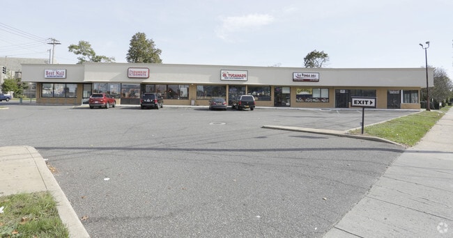
Property Detail
1 Front St
Nassau County-Suffolk County, NY
41 & 57
2013-34-295-00-0041-0
NASSAU
Commercialnec
New York
B and X Area of moderate flood hazard, usually the area between the limits of the 100-year and 500-year floods.
41
2025
0.69 AC
2026
Central Nassau
406701
Long Island (New York)
7,951 SF
NEARBY LISTINGS FOR SALE OR LEASE
DEMOGRAPHICS near 1 Front St
1 mile
3 mile
5 mile
2025 Total Population
32,347
235,440
644,119
2030 Population
32,418
234,605
640,758
Pop Growth 2025-2030
+ 0.22%
(0.35%)
(0.52%)
Average Age
39
40
42
2025 Total Households
9,984
70,324
201,451
HH Growth 2025-2030
+ 0.13%
(0.35%)
(0.57%)
Median Household Inc
$80,809
$130,382
$133,670
Avg Household Size
3.10
3.10
3.00
2025 Avg HH Vehicles
1.00
2.00
2.00
Median Home Value
$644,281
$706,523
$711,185
Median Year Built
1957
1952
1952
Nearby Places
Map Layers
Map Styles
 Street
 Aerial
Layers
 Traffic
 Biking
Places
Listings with unknown addresses are not visible on the map
- Restaurants
- Banks
- Shops
- Fitness
- Groceries
PUBLIC TRANSPORTATION
COMMUTER RAIL
West Hempstead Station (West Hempstead Branch - Long Island Rail Road)
Drive
Walk
Distance
West Hempstead Station (West Hempstead Branch - Long Island Rail Road)
2 min
6 min
0.3 mi
Hempstead Gardens Station (West Hempstead Branch - Long Island Rail Road)
Drive
Walk
Distance
Hempstead Gardens Station (West Hempstead Branch - Long Island Rail Road)
4 min
19 min
0.9 mi
AIRPORT
John F Kennedy International
Drive
Walk
Distance
John F Kennedy International
21 min
13.4 mi
LaGuardia
Drive
Walk
Distance
LaGuardia
31 min
20.8 mi
Westchester County
Drive
Walk
Distance
Westchester County
54 min
41.0 mi
SALE & LEASE HISTORY
LISTING DATE
SALE/LEASE

Nov 07, 2017
For Lease
Jul 07, 2017
For Lease
Nearby Properties
Address
Land Use
TOTAL SIZE
Lot Size
Zoning
Address
Land Use
TOTAL SIZE
Lot Size
Zoning
5,322,666 SF
86.10 AC
Address
Land Use
TOTAL SIZE
Lot Size
Zoning
419,282 SF
57.46 AC
Address
Land Use
TOTAL SIZE
Lot Size
Zoning
202.54 AC
Address
Land Use
TOTAL SIZE
Lot Size
Zoning
1,188,742 SF
11.93 AC
Address
Land Use
TOTAL SIZE
Lot Size
Zoning
181,472 SF
168.80 AC
Address
Land Use
TOTAL SIZE
Lot Size
Zoning
1,197,283 SF
64.50 AC
Address
Land Use
TOTAL SIZE
Lot Size
Zoning
574,353 SF
65 AC
Address
Land Use
TOTAL SIZE
Lot Size
Zoning
186 AC
Address
Land Use
TOTAL SIZE
Lot Size
Zoning
556,575 SF
11.46 AC
Address
Land Use
TOTAL SIZE
Lot Size
Zoning
51,432 SF
32.03 AC
Address
Land Use
TOTAL SIZE
Lot Size
Zoning
822,113 SF
26 AC
Address
Land Use
TOTAL SIZE
Lot Size
Zoning
962,971 SF
18.90 AC
Address
Land Use
TOTAL SIZE
Lot Size
Zoning
29,224 SF
1.33 AC
Address
Land Use
TOTAL SIZE
Lot Size
Zoning
277,200 SF
21.03 AC
Address
Land Use
TOTAL SIZE
Lot Size
Zoning
130,720 SF
48.60 AC
Address
Land Use
TOTAL SIZE
Lot Size
Zoning
111,756 SF
21.24 AC
Address
Land Use
TOTAL SIZE
Lot Size
Zoning
254,845 SF
22.28 AC
Address
Land Use
TOTAL SIZE
Lot Size
Zoning
63,600 SF
2 AC
Address
Land Use
TOTAL SIZE
Lot Size
Zoning
182,129 SF
1.51 AC
Address
Land Use
TOTAL SIZE
Lot Size
Zoning
92,466 SF
8 AC
Address
Land Use
TOTAL SIZE
Lot Size
Zoning
46,404 SF
38.43 AC
Address
Land Use
TOTAL SIZE
Lot Size
Zoning
116,998 SF
26.35 AC
Address
Land Use
TOTAL SIZE
Lot Size
Zoning
399,955 SF
13.63 AC
Address
Land Use
TOTAL SIZE
Lot Size
Zoning
126,558 SF
12.76 AC
Address
Land Use
TOTAL SIZE
Lot Size
Zoning
115.42 AC
Address
Land Use
TOTAL SIZE
Lot Size
Zoning
441,888 SF
22.09 AC
Address
Land Use
TOTAL SIZE
Lot Size
Zoning
315,667 SF
22.49 AC
Address
Land Use
TOTAL SIZE
Lot Size
Zoning
23,148 SF
18.67 AC
Address
Land Use
TOTAL SIZE
Lot Size
Zoning
76.10 AC
Address
Land Use
TOTAL SIZE
Lot Size
Zoning
83.42 AC
The World's #1 Commercial Real Estate Marketplace
Connect with us
© 2026 CoStar Group
The information above has been obtained from sources believed reliable. While we do not doubt its accuracy we have not verified it and make no guarantee, warranty or representation about it. It is your responsibility to independently confirm its accuracy and completeness. Any projections, opinions, assumptions, or estimates used are for example only and do not represent the current or future performance of the property. The value of this transaction to you depends on tax and other factors which should be evaluated by your tax, financial, and legal advisors. You and your advisors should conduct a careful, independent investigation of the property to determine to your satisfaction the suitability of the property for your needs.