Property Record
1 S Sutton Rd, Streamwood, IL 60107


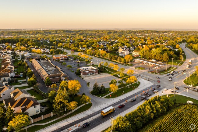
Property Detail
1 S Sutton Rd
Chicago-Naperville-Elgin, IL-IN
THE EMERALD HILLS COMMONS LOT 1
06-22-107-040-0000
Cook
Commercialbuilding
Illinois
B and X Area of moderate flood hazard, usually the area between the limits of the 100-year and 500-year floods.
1
2023
0.96 AC
2025
Far Northwest
804314
Chicago
3,000 SF
NEARBY LISTINGS FOR SALE OR LEASE
DEMOGRAPHICS near 1 S Sutton Rd
1 mile
3 mile
5 mile
2025 Total Population
7,758
77,360
218,778
2030 Population
7,794
77,520
219,610
Pop Growth 2025-2030
+ 0.46%
+ 0.21%
+ 0.38%
Average Age
43
41
40
2025 Total Households
2,698
26,453
74,220
HH Growth 2025-2030
+ 0.33%
+ 0.01%
+ 0.22%
Median Household Inc
$109,986
$100,178
$94,249
Avg Household Size
2.80
2.80
2.80
2025 Avg HH Vehicles
2.00
2.00
2.00
Median Home Value
$330,525
$280,653
$283,327
Median Year Built
1990
1986
1977
Nearby Places
Map Layers
Map Styles
 Street
 Aerial
Layers
 Traffic
 Biking
Places
Listings with unknown addresses are not visible on the map
- Restaurants
- Banks
- Shops
- Fitness
- Groceries
PUBLIC TRANSPORTATION
COMMUTER RAIL
Bartlett Station (Milwaukee District West Line - Northeast Illinois Regional Commuter Railroad (Metra))
Drive
Walk
Distance
Bartlett Station (Milwaukee District West Line - Northeast Illinois Regional Commuter Railroad (Metra))
8 min
3.9 mi
Elgin Station (Milwaukee District West Line - Northeast Illinois Regional Commuter Railroad (Metra))
Drive
Walk
Distance
Elgin Station (Milwaukee District West Line - Northeast Illinois Regional Commuter Railroad (Metra))
12 min
5.0 mi
AIRPORT
Chicago O'Hare International
Drive
Walk
Distance
Chicago O'Hare International
30 min
23.2 mi
Chicago Midway International
Drive
Walk
Distance
Chicago Midway International
51 min
34.4 mi
SALE & LEASE HISTORY
LISTING DATE
SALE/LEASE

Sep 15, 2023
For Sale
Mar 22, 2023
For Sale
Mar 21, 2019
For Sale
Feb 25, 2020
For Sale
Nearby Properties
Address
Land Use
TOTAL SIZE
Lot Size
Zoning
Address
Land Use
TOTAL SIZE
Lot Size
Zoning
51,091 SF
3.52 AC
Address
Land Use
TOTAL SIZE
Lot Size
Zoning
258,989 SF
27.84 AC
Address
Land Use
TOTAL SIZE
Lot Size
Zoning
130,923 SF
13.15 AC
Address
Land Use
TOTAL SIZE
Lot Size
Zoning
30,000 SF
1.04 AC
Address
Land Use
TOTAL SIZE
Lot Size
Zoning
179,497 SF
12.33 AC
Address
Land Use
TOTAL SIZE
Lot Size
Zoning
64,182 SF
2.62 AC
Address
Land Use
TOTAL SIZE
Lot Size
Zoning
201,539 SF
15.66 AC
Address
Land Use
TOTAL SIZE
Lot Size
Zoning
11,132 SF
2 AC
Address
Land Use
TOTAL SIZE
Lot Size
Zoning
Address
Land Use
TOTAL SIZE
Lot Size
Zoning
3,205 SF
2.35 AC
Address
Land Use
TOTAL SIZE
Lot Size
Zoning
227,125 SF
2.79 AC
Address
Land Use
TOTAL SIZE
Lot Size
Zoning
167,166 SF
12.85 AC
Address
Land Use
TOTAL SIZE
Lot Size
Zoning
293,632 SF
Address
Land Use
TOTAL SIZE
Lot Size
Zoning
38.13 AC
Address
Land Use
TOTAL SIZE
Lot Size
Zoning
Address
Land Use
TOTAL SIZE
Lot Size
Zoning
133,320 SF
14.51 AC
Address
Land Use
TOTAL SIZE
Lot Size
Zoning
Address
Land Use
TOTAL SIZE
Lot Size
Zoning
102,643 SF
10.54 AC
Address
Land Use
TOTAL SIZE
Lot Size
Zoning
109,316 SF
4.73 AC
Address
Land Use
TOTAL SIZE
Lot Size
Zoning
113,870 SF
6.51 AC
Address
Land Use
TOTAL SIZE
Lot Size
Zoning
90,640 SF
18.99 AC
Address
Land Use
TOTAL SIZE
Lot Size
Zoning
1,352 SF
1.27 AC
Address
Land Use
TOTAL SIZE
Lot Size
Zoning
69,221 SF
3.22 AC
Address
Land Use
TOTAL SIZE
Lot Size
Zoning
49,476 SF
4.70 AC
Address
Land Use
TOTAL SIZE
Lot Size
Zoning
343,853 SF
20.79 AC
Address
Land Use
TOTAL SIZE
Lot Size
Zoning
92,515 SF
4.19 AC
Address
Land Use
TOTAL SIZE
Lot Size
Zoning
187,856 SF
10.95 AC
Address
Land Use
TOTAL SIZE
Lot Size
Zoning
Address
Land Use
TOTAL SIZE
Lot Size
Zoning
Address
Land Use
TOTAL SIZE
Lot Size
Zoning
121,751 SF
9.02 AC
The World's #1 Commercial Real Estate Marketplace
Connect with us
© 2026 CoStar Group
The information above has been obtained from sources believed reliable. While we do not doubt its accuracy we have not verified it and make no guarantee, warranty or representation about it. It is your responsibility to independently confirm its accuracy and completeness. Any projections, opinions, assumptions, or estimates used are for example only and do not represent the current or future performance of the property. The value of this transaction to you depends on tax and other factors which should be evaluated by your tax, financial, and legal advisors. You and your advisors should conduct a careful, independent investigation of the property to determine to your satisfaction the suitability of the property for your needs.