Property Record
1000 S Mccaslin Blvd, Superior, CO 80027


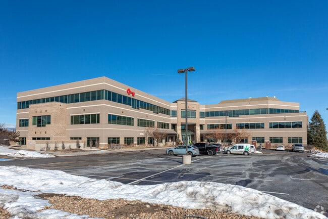
Property Detail
1000 S Mccaslin Blvd
1575193-06-003
LOT 1 & 2 SUPERIOR HILL OFFICE PARK R0130322 & R0031070 COMBINED 2024
Storesoffices
Boulder
A
Colorado
B and X Area of moderate flood hazard, usually the area between the limits of the 100-year and 500-year floods.
1,2
2022
13.96 AC
2025
Boulder County
060602
Denver
154,528 SF
Boulder, CO
NEARBY LISTINGS FOR SALE OR LEASE
DEMOGRAPHICS near 1000 S Mccaslin Blvd
1 mile
3 mile
5 mile
2025 Total Population
5,742
36,515
91,151
2030 Population
5,822
36,962
91,707
Pop Growth 2025-2030
+ 1.39%
+ 1.22%
+ 0.61%
Average Age
39
40
41
2025 Total Households
2,117
15,427
38,833
HH Growth 2025-2030
+ 1.70%
+ 2.07%
+ 1.02%
Median Household Inc
$144,821
$124,648
$114,005
Avg Household Size
2.70
2.30
2.30
2025 Avg HH Vehicles
2.00
2.00
2.00
Median Home Value
$823,300
$840,508
$788,987
Median Year Built
1995
1997
1992
Nearby Places
Map Layers
Map Styles
 Street
 Aerial
Layers
 Traffic
 Biking
Places
Listings with unknown addresses are not visible on the map
- Restaurants
- Banks
- Shops
- Fitness
- Groceries
PUBLIC TRANSPORTATION
AIRPORT
Denver International
Drive
Walk
Distance
Denver International
44 min
37.0 mi
SALE & LEASE HISTORY
LISTING DATE
SALE/LEASE

Sep 26, 2016
For Lease
Sep 25, 2016
For Lease
Sep 25, 2016
For Lease
Sep 20, 2022
For Lease
Mar 05, 2020
For Lease
Jul 07, 2020
For Lease
Dec 11, 2019
For Lease
Nearby Properties
Address
Land Use
TOTAL SIZE
Lot Size
Zoning
Address
Land Use
TOTAL SIZE
Lot Size
Zoning
776,625 SF
41.29 AC
PUD
Address
Land Use
TOTAL SIZE
Lot Size
Zoning
206.60 AC
A
Address
Land Use
TOTAL SIZE
Lot Size
Zoning
305,331 SF
14.41 AC
PUD
Address
Land Use
TOTAL SIZE
Lot Size
Zoning
411,485 SF
24.79 AC
Address
Land Use
TOTAL SIZE
Lot Size
Zoning
57.62 AC
Address
Land Use
TOTAL SIZE
Lot Size
Zoning
246.37 AC
Address
Land Use
TOTAL SIZE
Lot Size
Zoning
49.69 AC
Address
Land Use
TOTAL SIZE
Lot Size
Zoning
34.84 AC
Address
Land Use
TOTAL SIZE
Lot Size
Zoning
41.05 AC
Address
Land Use
TOTAL SIZE
Lot Size
Zoning
98.12 AC
A
Address
Land Use
TOTAL SIZE
Lot Size
Zoning
279,770 SF
34.13 AC
Address
Land Use
TOTAL SIZE
Lot Size
Zoning
233.17 AC
A
Address
Land Use
TOTAL SIZE
Lot Size
Zoning
167,000 SF
20.32 AC
Address
Land Use
TOTAL SIZE
Lot Size
Zoning
42.46 AC
A
Address
Land Use
TOTAL SIZE
Lot Size
Zoning
86.39 AC
Address
Land Use
TOTAL SIZE
Lot Size
Zoning
320,771 SF
18.60 AC
PUD
Address
Land Use
TOTAL SIZE
Lot Size
Zoning
78.47 AC
A
Address
Land Use
TOTAL SIZE
Lot Size
Zoning
130,769 SF
18.61 AC
PUD
Address
Land Use
TOTAL SIZE
Lot Size
Zoning
104.21 AC
A
Address
Land Use
TOTAL SIZE
Lot Size
Zoning
643,992 SF
13.24 AC
PUD
Address
Land Use
TOTAL SIZE
Lot Size
Zoning
75.36 AC
A
Address
Land Use
TOTAL SIZE
Lot Size
Zoning
76.13 AC
A
Address
Land Use
TOTAL SIZE
Lot Size
Zoning
111.14 AC
ER
Address
Land Use
TOTAL SIZE
Lot Size
Zoning
153,430 SF
12.16 AC
Address
Land Use
TOTAL SIZE
Lot Size
Zoning
19.16 AC
Address
Land Use
TOTAL SIZE
Lot Size
Zoning
108.62 AC
A
Address
Land Use
TOTAL SIZE
Lot Size
Zoning
25.01 AC
Address
Land Use
TOTAL SIZE
Lot Size
Zoning
81.89 AC
A
Address
Land Use
TOTAL SIZE
Lot Size
Zoning
64.30 AC
Address
Land Use
TOTAL SIZE
Lot Size
Zoning
137,435 SF
9.49 AC
The World's #1 Commercial Real Estate Marketplace
Connect with us
© 2026 CoStar Group
The information above has been obtained from sources believed reliable. While we do not doubt its accuracy we have not verified it and make no guarantee, warranty or representation about it. It is your responsibility to independently confirm its accuracy and completeness. Any projections, opinions, assumptions, or estimates used are for example only and do not represent the current or future performance of the property. The value of this transaction to you depends on tax and other factors which should be evaluated by your tax, financial, and legal advisors. You and your advisors should conduct a careful, independent investigation of the property to determine to your satisfaction the suitability of the property for your needs.