Property Record
1005 S Public Rd, Lafayette, CO 80026


Property Detail
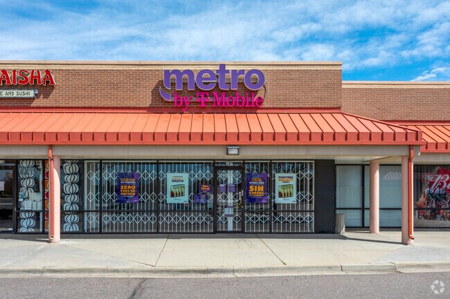
1005 S Public Rd
Boulder, CO
LOTS 1 & 2 REPLAT OF LOT 3 COUNTRYSIDE VILLAGE SHOPPING CENTER AMEND 2 R0127855 & R0104018 COMBINED 2023
1575034-76-003
BOULDER
Commercialnec
Colorado
B and X Area of moderate flood hazard, usually the area between the limits of the 100-year and 500-year floods.
1,2,3
0
1.62 AC
2026
Boulder
012905
Denver
18,123 SF
NEARBY LISTINGS FOR SALE OR LEASE
DEMOGRAPHICS near 1005 S Public Rd
1 mile
3 mile
5 mile
2025 Total Population
15,159
53,170
141,453
2030 Population
15,173
53,694
145,324
Pop Growth 2025-2030
+ 0.09%
+ 0.99%
+ 2.74%
Average Age
39
42
41
2025 Total Households
6,066
21,187
54,688
HH Growth 2025-2030
0.00%
+ 0.93%
+ 2.79%
Median Household Inc
$81,145
$116,847
$128,192
Avg Household Size
2.40
2.50
2.50
2025 Avg HH Vehicles
2.00
2.00
2.00
Median Home Value
$617,707
$776,778
$771,860
Median Year Built
1987
1996
1998
Nearby Places
Map Layers
Map Styles
 Street
 Aerial
Layers
 Traffic
 Biking
Places
Listings with unknown addresses are not visible on the map
- Restaurants
- Banks
- Shops
- Fitness
- Groceries
PUBLIC TRANSPORTATION
AIRPORT
Denver International
Drive
Walk
Distance
Denver International
39 min
32.8 mi
Freight Ports
Tulsa Port Of Catoosa
Drive
Walk
Distance
Tulsa Port Of Catoosa
746 min
726.9 mi
SALE & LEASE HISTORY
LISTING DATE
SALE/LEASE

Sep 24, 2016
For Lease
Nearby Properties
Address
Land Use
TOTAL SIZE
Lot Size
Zoning
Address
Land Use
TOTAL SIZE
Lot Size
Zoning
420,330 SF
41.96 AC
A
Address
Land Use
TOTAL SIZE
Lot Size
Zoning
62.60 AC
Address
Land Use
TOTAL SIZE
Lot Size
Zoning
279.72 AC
A
Address
Land Use
TOTAL SIZE
Lot Size
Zoning
188,092 SF
2.01 AC
Address
Land Use
TOTAL SIZE
Lot Size
Zoning
57.98 AC
A
Address
Land Use
TOTAL SIZE
Lot Size
Zoning
103,416 SF
45.52 AC
PUD
Address
Land Use
TOTAL SIZE
Lot Size
Zoning
273,678 SF
10.79 AC
Address
Land Use
TOTAL SIZE
Lot Size
Zoning
120,510 SF
11.02 AC
Address
Land Use
TOTAL SIZE
Lot Size
Zoning
186,744 SF
10.46 AC
Address
Land Use
TOTAL SIZE
Lot Size
Zoning
117.98 AC
Address
Land Use
TOTAL SIZE
Lot Size
Zoning
165,172 SF
11.12 AC
Address
Land Use
TOTAL SIZE
Lot Size
Zoning
153,430 SF
12.16 AC
Address
Land Use
TOTAL SIZE
Lot Size
Zoning
116.21 AC
A
Address
Land Use
TOTAL SIZE
Lot Size
Zoning
137,435 SF
9.49 AC
Address
Land Use
TOTAL SIZE
Lot Size
Zoning
164,842 SF
10.97 AC
Address
Land Use
TOTAL SIZE
Lot Size
Zoning
130,348 SF
8.88 AC
Address
Land Use
TOTAL SIZE
Lot Size
Zoning
67,551 SF
4.27 AC
Address
Land Use
TOTAL SIZE
Lot Size
Zoning
136,448 SF
10.86 AC
Address
Land Use
TOTAL SIZE
Lot Size
Zoning
132.98 AC
Address
Land Use
TOTAL SIZE
Lot Size
Zoning
109,547 SF
7.91 AC
Address
Land Use
TOTAL SIZE
Lot Size
Zoning
113,473 SF
8.59 AC
Address
Land Use
TOTAL SIZE
Lot Size
Zoning
76.96 AC
A
Address
Land Use
TOTAL SIZE
Lot Size
Zoning
83,615 SF
6.81 AC
Address
Land Use
TOTAL SIZE
Lot Size
Zoning
217,874 SF
10.49 AC
Address
Land Use
TOTAL SIZE
Lot Size
Zoning
97,831 SF
8.37 AC
Address
Land Use
TOTAL SIZE
Lot Size
Zoning
91,570 SF
6.09 AC
Address
Land Use
TOTAL SIZE
Lot Size
Zoning
109,068 SF
7.76 AC
Address
Land Use
TOTAL SIZE
Lot Size
Zoning
171,317 SF
4.68 AC
Address
Land Use
TOTAL SIZE
Lot Size
Zoning
65,000 SF
5.91 AC
Address
Land Use
TOTAL SIZE
Lot Size
Zoning
92,365 SF
5.40 AC
The World's #1 Commercial Real Estate Marketplace
Connect with us
© 2026 CoStar Group
The information above has been obtained from sources believed reliable. While we do not doubt its accuracy we have not verified it and make no guarantee, warranty or representation about it. It is your responsibility to independently confirm its accuracy and completeness. Any projections, opinions, assumptions, or estimates used are for example only and do not represent the current or future performance of the property. The value of this transaction to you depends on tax and other factors which should be evaluated by your tax, financial, and legal advisors. You and your advisors should conduct a careful, independent investigation of the property to determine to your satisfaction the suitability of the property for your needs.