Property Record
1015 Beecave Woods Dr, Austin, TX 78746


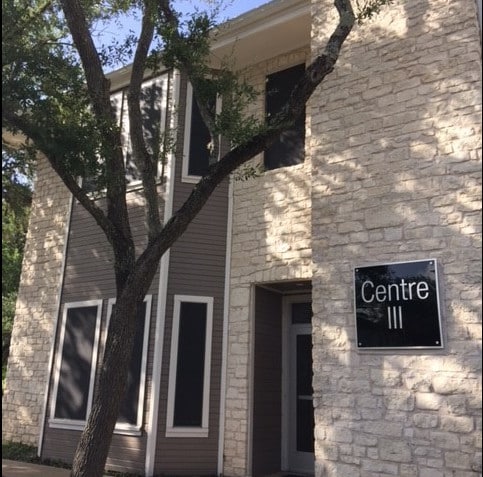
Property Detail
1015 Beecave Woods Dr
Austin-Round Rock-San Marcos, TX
LOT 1 BLK 2 CORNERS THE
105786
TRAVIS
Officebuilding
Texas
B and X Area of moderate flood hazard, usually the area between the limits of the 100-year and 500-year floods.
1
2025
0.99 AC
2025
Southwest
001910
Austin
14,838 SF
NEARBY LISTINGS FOR SALE OR LEASE
DEMOGRAPHICS near 1015 Beecave Woods Dr
1 mile
3 mile
5 mile
2025 Total Population
9,445
82,440
284,016
2030 Population
9,823
86,283
298,112
Pop Growth 2025-2030
+ 4.00%
+ 4.66%
+ 4.96%
Average Age
41
40
37
2025 Total Households
3,985
41,112
133,875
HH Growth 2025-2030
+ 4.72%
+ 5.41%
+ 5.82%
Median Household Inc
$145,381
$127,172
$101,766
Avg Household Size
2.30
1.90
1.90
2025 Avg HH Vehicles
2.00
2.00
2.00
Median Home Value
$1,113,958
$1,056,085
$898,947
Median Year Built
1986
1993
1994
Nearby Places
Map Layers
Map Styles
 Street
 Aerial
Layers
 Traffic
 Biking
Places
Listings with unknown addresses are not visible on the map
- Restaurants
- Banks
- Shops
- Fitness
- Groceries
PUBLIC TRANSPORTATION
COMMUTER RAIL
Austin (Texas Eagle - Amtrak)
Drive
Walk
Distance
Austin (Texas Eagle - Amtrak)
7 min
3.7 mi
AIRPORT
Austin-Bergstrom International
Drive
Walk
Distance
Austin-Bergstrom International
28 min
15.2 mi
Freight Ports
Calhoun Port
Drive
Walk
Distance
Calhoun Port
193 min
158.7 mi
SALE & LEASE HISTORY
LISTING DATE
SALE/LEASE

Nov 11, 2022
For Lease
Jun 27, 2017
For Lease
Aug 27, 2018
For Lease
Apr 06, 2017
For Lease
Nearby Properties
Address
Land Use
TOTAL SIZE
Lot Size
Zoning
Address
Land Use
TOTAL SIZE
Lot Size
Zoning
262 SF
65.06 AC
Address
Land Use
TOTAL SIZE
Lot Size
Zoning
29,594 SF
155.62 AC
Address
Land Use
TOTAL SIZE
Lot Size
Zoning
786,600 SF
1.27 AC
Address
Land Use
TOTAL SIZE
Lot Size
Zoning
47.20 AC
Address
Land Use
TOTAL SIZE
Lot Size
Zoning
35,041 SF
28.65 AC
Address
Land Use
TOTAL SIZE
Lot Size
Zoning
513,567 SF
1.78 AC
Address
Land Use
TOTAL SIZE
Lot Size
Zoning
500,511 SF
0.82 AC
Address
Land Use
TOTAL SIZE
Lot Size
Zoning
632.50 AC
Address
Land Use
TOTAL SIZE
Lot Size
Zoning
24.06 AC
Address
Land Use
TOTAL SIZE
Lot Size
Zoning
826,478 SF
1.75 AC
Address
Land Use
TOTAL SIZE
Lot Size
Zoning
337,855 SF
43.51 AC
Address
Land Use
TOTAL SIZE
Lot Size
Zoning
Address
Land Use
TOTAL SIZE
Lot Size
Zoning
48.75 AC
Address
Land Use
TOTAL SIZE
Lot Size
Zoning
27.45 AC
Address
Land Use
TOTAL SIZE
Lot Size
Zoning
627,984 SF
0.81 AC
Address
Land Use
TOTAL SIZE
Lot Size
Zoning
219,543 SF
0.22 AC
Address
Land Use
TOTAL SIZE
Lot Size
Zoning
46.98 AC
Address
Land Use
TOTAL SIZE
Lot Size
Zoning
101.08 AC
Address
Land Use
TOTAL SIZE
Lot Size
Zoning
442,023 SF
8.97 AC
Address
Land Use
TOTAL SIZE
Lot Size
Zoning
372,000 SF
1.35 AC
Address
Land Use
TOTAL SIZE
Lot Size
Zoning
34.03 AC
Address
Land Use
TOTAL SIZE
Lot Size
Zoning
13.46 AC
Address
Land Use
TOTAL SIZE
Lot Size
Zoning
35.28 AC
Address
Land Use
TOTAL SIZE
Lot Size
Zoning
551,881 SF
34.85 AC
Address
Land Use
TOTAL SIZE
Lot Size
Zoning
42.26 AC
Address
Land Use
TOTAL SIZE
Lot Size
Zoning
230,000 SF
1.77 AC
Address
Land Use
TOTAL SIZE
Lot Size
Zoning
23,324 SF
19.55 AC
Address
Land Use
TOTAL SIZE
Lot Size
Zoning
115,000 SF
1.73 AC
Address
Land Use
TOTAL SIZE
Lot Size
Zoning
300,530 SF
3.62 AC
Address
Land Use
TOTAL SIZE
Lot Size
Zoning
413,880 SF
30.21 AC
The World's #1 Commercial Real Estate Marketplace
Connect with us
© 2026 CoStar Group
The information above has been obtained from sources believed reliable. While we do not doubt its accuracy we have not verified it and make no guarantee, warranty or representation about it. It is your responsibility to independently confirm its accuracy and completeness. Any projections, opinions, assumptions, or estimates used are for example only and do not represent the current or future performance of the property. The value of this transaction to you depends on tax and other factors which should be evaluated by your tax, financial, and legal advisors. You and your advisors should conduct a careful, independent investigation of the property to determine to your satisfaction the suitability of the property for your needs.