Property Record
1018 Woodruff Rd, Greenville, SC 29607
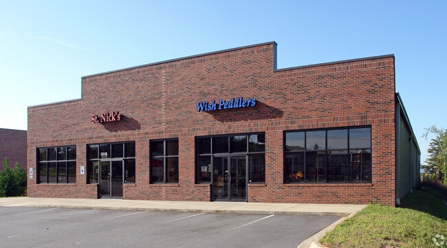

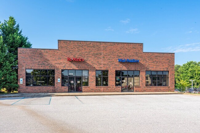
Property Detail
1018 Woodruff Rd
Greenville-Anderson-Greer, SC
MAP 0545.01; 3
0545.01-01-025.07
Greenville
Storebuilding
South Carolina
C2
025.07
B and X Area of moderate flood hazard, usually the area between the limits of the 100-year and 500-year floods.
1.10 AC
2025
Congaree Rd Corridor
2025
Greenville/Spartanburg
001900
NEARBY LISTINGS FOR SALE OR LEASE
DEMOGRAPHICS near 1018 Woodruff Rd
1 mile
3 mile
5 mile
2025 Total Population
4,460
58,759
177,050
2030 Population
4,932
63,391
190,364
Pop Growth 2025-2030
+ 10.58%
+ 7.88%
+ 7.52%
Average Age
39
39
40
2025 Total Households
2,148
27,195
76,221
HH Growth 2025-2030
+ 11.22%
+ 8.18%
+ 7.87%
Median Household Inc
$86,172
$81,228
$83,399
Avg Household Size
2.00
2.10
2.20
2025 Avg HH Vehicles
1.00
2.00
2.00
Median Home Value
$696,113
$423,319
$388,323
Median Year Built
2003
1991
1988
Nearby Places
Map Layers
Map Styles
 Street
 Aerial
Layers
 Traffic
 Biking
Places
Listings with unknown addresses are not visible on the map
- Restaurants
- Banks
- Shops
- Fitness
- Groceries
PUBLIC TRANSPORTATION
COMMUTER RAIL
Drive
Walk
Distance
12 min
7.1 mi
AIRPORT
Greenville Spartanburg International
Drive
Walk
Distance
Greenville Spartanburg International
15 min
9.0 mi
SALE & LEASE HISTORY
LISTING DATE
SALE/LEASE

Mar 08, 2019
For Sale
Feb 24, 2021
For Sale
Feb 24, 2021
For Lease
Aug 10, 2020
For Lease
Nearby Properties
Address
Land Use
TOTAL SIZE
Lot Size
Zoning
Address
Land Use
TOTAL SIZE
Lot Size
Zoning
330.98 AC
S1
Address
Land Use
TOTAL SIZE
Lot Size
Zoning
17.56 AC
C3
Address
Land Use
TOTAL SIZE
Lot Size
Zoning
0.73 AC
C3
Address
Land Use
TOTAL SIZE
Lot Size
Zoning
1.43 AC
OD
Address
Land Use
TOTAL SIZE
Lot Size
Zoning
39.84 AC
OD
Address
Land Use
TOTAL SIZE
Lot Size
Zoning
17.07 AC
S1
Address
Land Use
TOTAL SIZE
Lot Size
Zoning
223.09 AC
I1
Address
Land Use
TOTAL SIZE
Lot Size
Zoning
14.41 AC
RM2
Address
Land Use
TOTAL SIZE
Lot Size
Zoning
1 AC
OD
Address
Land Use
TOTAL SIZE
Lot Size
Zoning
181.61 AC
C-2,I1
Address
Land Use
TOTAL SIZE
Lot Size
Zoning
18.55 AC
RS
Address
Land Use
TOTAL SIZE
Lot Size
Zoning
12.11 AC
C2
Address
Land Use
TOTAL SIZE
Lot Size
Zoning
20.63 AC
S1
Address
Land Use
TOTAL SIZE
Lot Size
Zoning
22.50 AC
S1
Address
Land Use
TOTAL SIZE
Lot Size
Zoning
11.82 AC
RM2
Address
Land Use
TOTAL SIZE
Lot Size
Zoning
15.32 AC
RM2
Address
Land Use
TOTAL SIZE
Lot Size
Zoning
0.47 AC
OD
Address
Land Use
TOTAL SIZE
Lot Size
Zoning
6.86 AC
S1
Address
Land Use
TOTAL SIZE
Lot Size
Zoning
9.13 AC
RM2
Address
Land Use
TOTAL SIZE
Lot Size
Zoning
2,355 SF
10.21 AC
RS
Address
Land Use
TOTAL SIZE
Lot Size
Zoning
10 AC
RM
Address
Land Use
TOTAL SIZE
Lot Size
Zoning
10.07 AC
S1
Address
Land Use
TOTAL SIZE
Lot Size
Zoning
Address
Land Use
TOTAL SIZE
Lot Size
Zoning
10.29 AC
S1
Address
Land Use
TOTAL SIZE
Lot Size
Zoning
10.59 AC
RM2
Address
Land Use
TOTAL SIZE
Lot Size
Zoning
3.38 AC
S1
Address
Land Use
TOTAL SIZE
Lot Size
Zoning
5.83 AC
S1
Address
Land Use
TOTAL SIZE
Lot Size
Zoning
6.11 AC
RM2
Address
Land Use
TOTAL SIZE
Lot Size
Zoning
31.81 AC
R6
Address
Land Use
TOTAL SIZE
Lot Size
Zoning
11.05 AC
S1
The World's #1 Commercial Real Estate Marketplace
Connect with us
© 2026 CoStar Group
The information above has been obtained from sources believed reliable. While we do not doubt its accuracy we have not verified it and make no guarantee, warranty or representation about it. It is your responsibility to independently confirm its accuracy and completeness. Any projections, opinions, assumptions, or estimates used are for example only and do not represent the current or future performance of the property. The value of this transaction to you depends on tax and other factors which should be evaluated by your tax, financial, and legal advisors. You and your advisors should conduct a careful, independent investigation of the property to determine to your satisfaction the suitability of the property for your needs.