Property Record
10650 E Bethany Dr, Aurora, CO 80014
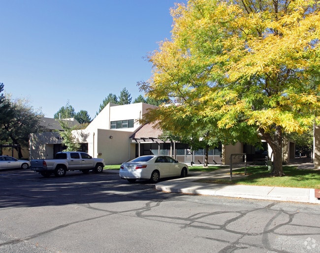

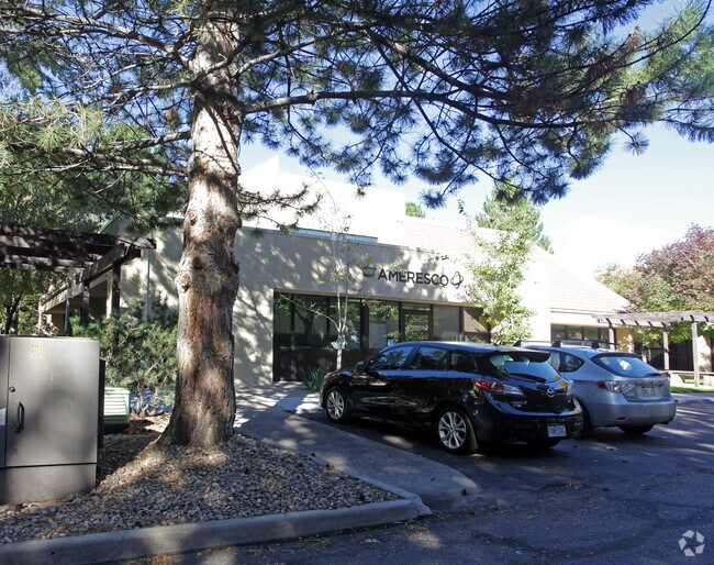

Property Detail
10650 E Bethany Dr
Denver-Aurora-Centennial, CO
SUBDIVISIONCD 023743 SUBDIVISIONNAME FOUNTAINHEAD SUB 4TH FLG BLOCK 001 LOT 007 LOTS 7-9 BLK 1 FOUNTAINHEAD SUB 4TH FLG
1973-35-2-19-030
Arapahoe
Officebuilding
Colorado
B and X Area of moderate flood hazard, usually the area between the limits of the 100-year and 500-year floods.
7
2024
0.15 AC
2025
East Hampden
080400
Denver
8,056 SF
NEARBY LISTINGS FOR SALE OR LEASE
DEMOGRAPHICS near 10650 E Bethany Dr
1 mile
3 mile
5 mile
2025 Total Population
17,775
156,157
416,485
2030 Population
18,176
159,239
424,281
Pop Growth 2025-2030
+ 2.26%
+ 1.97%
+ 1.87%
Average Age
37
40
39
2025 Total Households
7,921
70,312
176,279
HH Growth 2025-2030
+ 2.27%
+ 2.06%
+ 2.02%
Median Household Inc
$65,368
$75,274
$83,554
Avg Household Size
2.20
2.10
2.30
2025 Avg HH Vehicles
2.00
2.00
2.00
Median Home Value
$490,243
$470,875
$508,523
Median Year Built
1976
1980
1981
Nearby Places
Map Layers
Map Styles
 Street
 Aerial
Transit
 Traffic
 Biking
Places
Listings with unknown addresses are not visible on the map
- Restaurants
- Banks
- Shops
- Fitness
- Groceries
PUBLIC TRANSPORTATION
COMMUTER RAIL
Drive
Walk
Distance
19 min
8.9 mi
AIRPORT
Denver International
Drive
Walk
Distance
Denver International
30 min
23.0 mi
SALE & LEASE HISTORY
LISTING DATE
SALE/LEASE

Jun 27, 2018
For Sale
Nearby Properties
Address
Land Use
TOTAL SIZE
Lot Size
Zoning
Address
Land Use
TOTAL SIZE
Lot Size
Zoning
508,135 SF
6.99 AC
C-RX
Address
Land Use
TOTAL SIZE
Lot Size
Zoning
163,033 SF
5.94 AC
PUD
Address
Land Use
TOTAL SIZE
Lot Size
Zoning
496,493 SF
33.45 AC
Address
Land Use
TOTAL SIZE
Lot Size
Zoning
898,130 SF
89.50 AC
Address
Land Use
TOTAL SIZE
Lot Size
Zoning
87,207 SF
Address
Land Use
TOTAL SIZE
Lot Size
Zoning
355,464 SF
6.20 AC
B-8
Address
Land Use
TOTAL SIZE
Lot Size
Zoning
476,186 SF
42.62 AC
Address
Land Use
TOTAL SIZE
Lot Size
Zoning
70,296 SF
4.96 AC
Address
Land Use
TOTAL SIZE
Lot Size
Zoning
74,888 SF
4.35 AC
AMU
Address
Land Use
TOTAL SIZE
Lot Size
Zoning
83,951 SF
0.30 AC
R2
Address
Land Use
TOTAL SIZE
Lot Size
Zoning
313,836 SF
5.90 AC
B-8
Address
Land Use
TOTAL SIZE
Lot Size
Zoning
50,106 SF
1.67 AC
RB1
Address
Land Use
TOTAL SIZE
Lot Size
Zoning
372,593 SF
5.61 AC
S-MX-12
Address
Land Use
TOTAL SIZE
Lot Size
Zoning
231,867 SF
19.33 AC
S-MX-3A
Address
Land Use
TOTAL SIZE
Lot Size
Zoning
613,600 SF
29.40 AC
R-3
Address
Land Use
TOTAL SIZE
Lot Size
Zoning
396,041 SF
6.77 AC
B-8
Address
Land Use
TOTAL SIZE
Lot Size
Zoning
359,561 SF
2.28 AC
B-8
Address
Land Use
TOTAL SIZE
Lot Size
Zoning
295,877 SF
6 AC
S-MX-12
Address
Land Use
TOTAL SIZE
Lot Size
Zoning
61,018 SF
2.72 AC
C-MX
Address
Land Use
TOTAL SIZE
Lot Size
Zoning
74,729 SF
2.63 AC
S-MX
Address
Land Use
TOTAL SIZE
Lot Size
Zoning
130,531 SF
3.41 AC
Address
Land Use
TOTAL SIZE
Lot Size
Zoning
258,612 SF
4.91 AC
B-8
Address
Land Use
TOTAL SIZE
Lot Size
Zoning
478,994 SF
26.07 AC
Address
Land Use
TOTAL SIZE
Lot Size
Zoning
193,299 SF
2.90 AC
S-MX-12
Address
Land Use
TOTAL SIZE
Lot Size
Zoning
48,961 SF
4.15 AC
Address
Land Use
TOTAL SIZE
Lot Size
Zoning
205,250 SF
10 AC
I-A
Address
Land Use
TOTAL SIZE
Lot Size
Zoning
154,808 SF
16.71 AC
S-SU-D
Address
Land Use
TOTAL SIZE
Lot Size
Zoning
341,616 SF
4.88 AC
S-MX-5
Address
Land Use
TOTAL SIZE
Lot Size
Zoning
138,750 SF
12.17 AC
OS-A
Address
Land Use
TOTAL SIZE
Lot Size
Zoning
196,374 SF
5.69 AC
B-8
The World's #1 Commercial Real Estate Marketplace
Connect with us
© 2026 CoStar Group
The information above has been obtained from sources believed reliable. While we do not doubt its accuracy we have not verified it and make no guarantee, warranty or representation about it. It is your responsibility to independently confirm its accuracy and completeness. Any projections, opinions, assumptions, or estimates used are for example only and do not represent the current or future performance of the property. The value of this transaction to you depends on tax and other factors which should be evaluated by your tax, financial, and legal advisors. You and your advisors should conduct a careful, independent investigation of the property to determine to your satisfaction the suitability of the property for your needs.