Property Record
1121 Suemac Rd, Jacksonville, FL 32254


Save to a Folder
{{folder.Name}}
{{folder.ListingIds.length}} Properties
{{folder.ListingIds.length}} Property
Create a New Folder
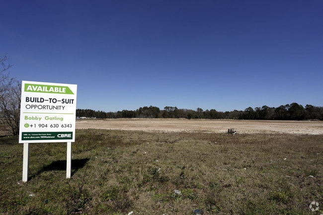
Property Detail
1121 Suemac Rd
005119-7600
65-169 12-2S-25E 12.231 WADE TRACT V TRACT B
Autorepair
DUVAL
PUD
Florida
B and X Area of moderate flood hazard, usually the area between the limits of the 100-year and 500-year floods.
12.23 AC
2025
Northwest Jacksonville
2026
Jacksonville (Florida)
011800
Jacksonville, FL
72,282 SF
NEARBY LISTINGS FOR SALE OR LEASE
DEMOGRAPHICS near 1121 Suemac Rd
1 mile
3 mile
5 mile
2025 Total Population
552
40,615
156,380
2030 Population
598
43,479
167,007
Pop Growth 2025-2030
+ 8.33%
+ 7.05%
+ 6.80%
Average Age
41
38
39
2025 Total Households
210
16,096
63,492
HH Growth 2025-2030
+ 8.57%
+ 7.28%
+ 7.09%
Median Household Inc
$49,999
$48,280
$53,357
Avg Household Size
2.40
2.40
2.40
2025 Avg HH Vehicles
2.00
2.00
2.00
Median Home Value
$135,869
$200,759
$227,476
Median Year Built
1958
1966
1966
Nearby Places
Map Layers
Map Styles
 Street
 Aerial
Layers
 Traffic
 Biking
Places
Listings with unknown addresses are not visible on the map
- Restaurants
- Banks
- Shops
- Fitness
- Groceries
PUBLIC TRANSPORTATION
COMMUTER RAIL
Jacksonville (Silver Meteor - Amtrak, Silver Star - Amtrak)
Drive
Walk
Distance
Jacksonville (Silver Meteor - Amtrak, Silver Star - Amtrak)
10 min
4.9 mi
AIRPORT
Jacksonville International
Drive
Walk
Distance
Jacksonville International
24 min
15.6 mi
Freight Ports
Jacksonville Port
Drive
Walk
Distance
Jacksonville Port
20 min
11.9 mi
SALE & LEASE HISTORY
LISTING DATE
SALE/LEASE

Sep 24, 2016
For Sale
Apr 14, 2017
For Lease
Nearby Properties
Address
Land Use
TOTAL SIZE
Lot Size
Zoning
Address
Land Use
TOTAL SIZE
Lot Size
Zoning
600,857 SF
38.14 AC
IL
Address
Land Use
TOTAL SIZE
Lot Size
Zoning
506,816 SF
39.32 AC
IBP
Address
Land Use
TOTAL SIZE
Lot Size
Zoning
874,178 SF
46.91 AC
PBF-2
Address
Land Use
TOTAL SIZE
Lot Size
Zoning
465,664 SF
21.27 AC
IL
Address
Land Use
TOTAL SIZE
Lot Size
Zoning
888,083 SF
46.65 AC
IL
Address
Land Use
TOTAL SIZE
Lot Size
Zoning
222,138 SF
13.18 AC
IL
Address
Land Use
TOTAL SIZE
Lot Size
Zoning
397,865 SF
42 AC
IL
Address
Land Use
TOTAL SIZE
Lot Size
Zoning
392,050 SF
50.22 AC
PUD
Address
Land Use
TOTAL SIZE
Lot Size
Zoning
594,573 SF
27.69 AC
IL
Address
Land Use
TOTAL SIZE
Lot Size
Zoning
307,732 SF
41.23 AC
IL
Address
Land Use
TOTAL SIZE
Lot Size
Zoning
299,288 SF
75.26 AC
IBP
Address
Land Use
TOTAL SIZE
Lot Size
Zoning
290,599 SF
27.84 AC
RMD-D
Address
Land Use
TOTAL SIZE
Lot Size
Zoning
310,972 SF
19.91 AC
RMD-D
Address
Land Use
TOTAL SIZE
Lot Size
Zoning
233,363 SF
20.36 AC
PUD
Address
Land Use
TOTAL SIZE
Lot Size
Zoning
255,048 SF
20.15 AC
IL
Address
Land Use
TOTAL SIZE
Lot Size
Zoning
262,792 SF
15.23 AC
PUD
Address
Land Use
TOTAL SIZE
Lot Size
Zoning
240,350 SF
28.53 AC
IBP
Address
Land Use
TOTAL SIZE
Lot Size
Zoning
196,790 SF
12.62 AC
RMD-D
Address
Land Use
TOTAL SIZE
Lot Size
Zoning
240,410 SF
16.76 AC
IL
Address
Land Use
TOTAL SIZE
Lot Size
Zoning
189,832 SF
13.08 AC
PUD
Address
Land Use
TOTAL SIZE
Lot Size
Zoning
171,572 SF
10.47 AC
PUD
Address
Land Use
TOTAL SIZE
Lot Size
Zoning
169,370 SF
10.87 AC
RMD-D
Address
Land Use
TOTAL SIZE
Lot Size
Zoning
267,290 SF
11.81 AC
IL
Address
Land Use
TOTAL SIZE
Lot Size
Zoning
323,261 SF
56.62 AC
IL
Address
Land Use
TOTAL SIZE
Lot Size
Zoning
162,283 SF
14.29 AC
IL
Address
Land Use
TOTAL SIZE
Lot Size
Zoning
161,001 SF
10.32 AC
IL
Address
Land Use
TOTAL SIZE
Lot Size
Zoning
196,548 SF
13.05 AC
PUD
Address
Land Use
TOTAL SIZE
Lot Size
Zoning
209,849 SF
22.42 AC
CCG-1
Address
Land Use
TOTAL SIZE
Lot Size
Zoning
157,948 SF
9.22 AC
PUD
Address
Land Use
TOTAL SIZE
Lot Size
Zoning
114,316 SF
20.57 AC
IL
The World's #1 Commercial Real Estate Marketplace
Connect with us
© 2026 CoStar Group
The information above has been obtained from sources believed reliable. While we do not doubt its accuracy we have not verified it and make no guarantee, warranty or representation about it. It is your responsibility to independently confirm its accuracy and completeness. Any projections, opinions, assumptions, or estimates used are for example only and do not represent the current or future performance of the property. The value of this transaction to you depends on tax and other factors which should be evaluated by your tax, financial, and legal advisors. You and your advisors should conduct a careful, independent investigation of the property to determine to your satisfaction the suitability of the property for your needs.