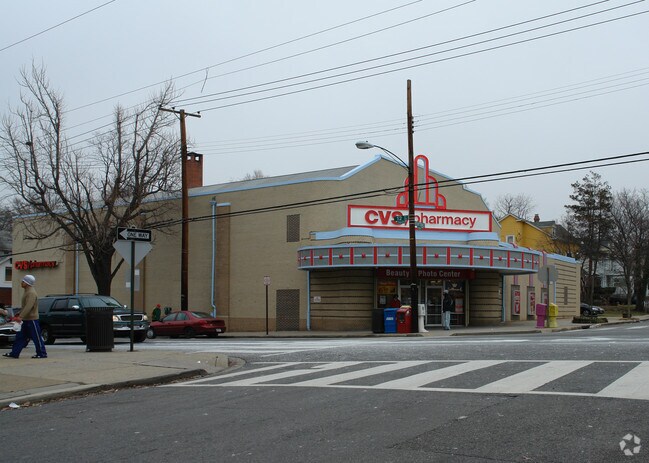
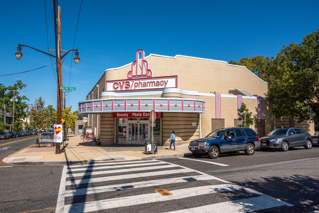
Property Record
1200 Newton St Ne, Washington, DC 20017

NEARBY LISTINGS FOR SALE OR LEASE
Property Detail
1200 Newton St Ne
Washington-Arlington-Alexandria, DC-VA-MD-WV
Brookland
3927-0812
SQUARE 3927 LOT 0010 NBHD: BROOKLAND
Storemultistory
District of Columbia
X
District of Columbia
1100010036C
10
2025
0.34 AC
2025
Northeast
009301
Washington, DC
11,816 SF
DEMOGRAPHICS near 1200 Newton St Ne
1 Mile
3 Mile
5 Mile
2024 Total Population
26,445
350,873
777,884
2029 Population
24,299
323,541
726,640
Pop Growth 2024-2029
(8.11%)
(7.79%)
(6.59%)
Average Age
39
37
37
2024 Total Households
10,951
156,726
340,045
HH Growth 2024-2029
(8.90%)
(8.64%)
(7.58%)
Median Household Inc
$88,963
$95,568
$92,899
Avg Household Size
2.20
2.10
2.10
2024 Avg HH Vehicles
1.00
1.00
1.00
Median Home Value
$687,214
$674,025
$633,902
Median Year Built
1950
1953
1959
Nearby Places
Map Layers
Map Styles
 Street
 Aerial
- Restaurants
- Banks
- Shops
- Fitness
- Groceries
PUBLIC TRANSPORTATION
TRANSIT/SUBWAY
Brookland-CUA (Red Line - Washington Metropolitan Area Transit Authority Metrorail (Metrorail))
DRIVE
WALK
Distance
Brookland-CUA (Red Line - Washington Metropolitan Area Transit Authority Metrorail (Metrorail))
1 min
4 min
0.2 mi
COMMUTER RAIL
Union Station (Red Line - Washington Metropolitan Area Transit Authority Metrorail (Metrorail))
DRIVE
WALK
Distance
Union Station (Red Line - Washington Metropolitan Area Transit Authority Metrorail (Metrorail))
7 min
3.4 mi
DRIVE
WALK
Distance
7 min
3.4 mi
AIRPORT
Ronald Reagan Washington Ntl
DRIVE
WALK
Distance
Ronald Reagan Washington Ntl
16 min
8.7 mi
Baltimore/Washington International Thurgood Marshall
DRIVE
WALK
Distance
Baltimore/Washington International Thurgood Marshall
45 min
28.8 mi
Washington Dulles International
DRIVE
WALK
Distance
Washington Dulles International
51 min
31.5 mi
Freight Ports
Port of Baltimore
DRIVE
WALK
Distance
Port of Baltimore
51 min
35.6 mi
SALE & LEASE HISTORY
LISTING DATE
SALE/LEASE

Oct 30, 2019
For Sale
Nearby Properties
Address
Land Use
TOTAL SIZE
Lot Size
Zoning
Address
Land Use
TOTAL SIZE
Lot Size
Zoning
2,300,000 SF
1.60 AC
D-5-R
Address
Land Use
TOTAL SIZE
Lot Size
Zoning
58,289 SF
418.97 AC
MU-4;PDR-1
Address
Land Use
TOTAL SIZE
Lot Size
Zoning
1,583,364 SF
276.66 AC
UNZONED
Address
Land Use
TOTAL SIZE
Lot Size
Zoning
1,043,058 SF
4.03 AC
UNZONED
Address
Land Use
TOTAL SIZE
Lot Size
Zoning
2,247,684 SF
6.39 AC
D-4-R
Address
Land Use
TOTAL SIZE
Lot Size
Zoning
607,735 SF
8.94 AC
PDR-3;UNZO
Address
Land Use
TOTAL SIZE
Lot Size
Zoning
758,000 SF
2.22 AC
D-4-R;MU-7
Address
Land Use
TOTAL SIZE
Lot Size
Zoning
1,562,988 SF
15.33 AC
MU-10 (IZ+
Address
Land Use
TOTAL SIZE
Lot Size
Zoning
479,505 SF
5 AC
D-6-R
Address
Land Use
TOTAL SIZE
Lot Size
Zoning
1,642,951 SF
95.12 AC
RF-1
Address
Land Use
TOTAL SIZE
Lot Size
Zoning
95.32 AC
RA-1
Address
Land Use
TOTAL SIZE
Lot Size
Zoning
730,233 SF
4.78 AC
UNZONED
Address
Land Use
TOTAL SIZE
Lot Size
Zoning
314,995 SF
5.83 AC
D-5
Address
Land Use
TOTAL SIZE
Lot Size
Zoning
7.41 AC
UNZONED
Address
Land Use
TOTAL SIZE
Lot Size
Zoning
526,768 SF
1.03 AC
D-5-R
Address
Land Use
TOTAL SIZE
Lot Size
Zoning
1,323,000 SF
3.36 AC
RA-2
Address
Land Use
TOTAL SIZE
Lot Size
Zoning
379,921 SF
1.03 AC
D-5-R
Address
Land Use
TOTAL SIZE
Lot Size
Zoning
1,835,827 SF
34.66 AC
UNZONED
Address
Land Use
TOTAL SIZE
Lot Size
Zoning
489,139 SF
1.75 AC
D-3
Address
Land Use
TOTAL SIZE
Lot Size
Zoning
1,262,010 SF
1.39 AC
D-4-R;D-5-
Address
Land Use
TOTAL SIZE
Lot Size
Zoning
647,591 SF
0.72 AC
D-5-R
Address
Land Use
TOTAL SIZE
Lot Size
Zoning
589,000 SF
1.39 AC
D-5
Address
Land Use
TOTAL SIZE
Lot Size
Zoning
558,645 SF
1.22 AC
D-5-R
Address
Land Use
TOTAL SIZE
Lot Size
Zoning
1,239,708 SF
2.21 AC
D-3
Address
Land Use
TOTAL SIZE
Lot Size
Zoning
5.53 AC
UNZONED
Address
Land Use
TOTAL SIZE
Lot Size
Zoning
791,730 SF
37.44 AC
RA-1
Address
Land Use
TOTAL SIZE
Lot Size
Zoning
1,095,275 SF
30.70 AC
MU-4;RA-2
Address
Land Use
TOTAL SIZE
Lot Size
Zoning
6.54 AC
MU-4;RF-1
Address
Land Use
TOTAL SIZE
Lot Size
Zoning
823,802 SF
7.30 AC
MU-2
Address
Land Use
TOTAL SIZE
Lot Size
Zoning
580,642 SF
1.74 AC
D-4
The World's #1 Commercial Real Estate Marketplace
Connect with us
© 2025 CoStar Group
The information above has been obtained from sources believed reliable. While we do not doubt its accuracy we have not verified it and make no guarantee, warranty or representation about it. It is your responsibility to independently confirm its accuracy and completeness. Any projections, opinions, assumptions, or estimates used are for example only and do not represent the current or future performance of the property. The value of this transaction to you depends on tax and other factors which should be evaluated by your tax, financial, and legal advisors. You and your advisors should conduct a careful, independent investigation of the property to determine to your satisfaction the suitability of the property for your needs.