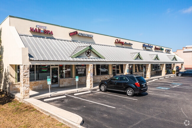
Property Record
12411 Bandera Rd, Helotes, TX 78023

Property Detail
12411 Bandera Rd
San Antonio-New Braunfels, TX
CB 4478D BLK 19 LOT 12 SONIC - HELOTES
04478-419-0120
BEXAR
Regionalshoppingcenterormallwithanchorstore
Texas
B and X Area of moderate flood hazard, usually the area between the limits of the 100-year and 500-year floods.
12
2025
1.49 AC
2025
Far Northwest
181724
San Antonio
9,100 SF
NEARBY LISTINGS FOR SALE OR LEASE
DEMOGRAPHICS near 12411 Bandera Rd
1 mile
3 mile
5 mile
2025 Total Population
5,232
82,342
224,002
2030 Population
5,380
85,552
234,547
Pop Growth 2025-2030
+ 2.83%
+ 3.90%
+ 4.71%
Average Age
40
38
37
2025 Total Households
1,935
28,544
79,482
HH Growth 2025-2030
+ 2.84%
+ 3.93%
+ 4.86%
Median Household Inc
$106,881
$107,802
$91,155
Avg Household Size
2.70
2.80
2.70
2025 Avg HH Vehicles
2.00
2.00
2.00
Median Home Value
$344,341
$319,574
$297,926
Median Year Built
2001
1998
1998
Nearby Places
Map Layers
Map Styles
 Street
 Aerial
Layers
 Traffic
 Biking
Places
Listings with unknown addresses are not visible on the map
- Restaurants
- Banks
- Shops
- Fitness
- Groceries
PUBLIC TRANSPORTATION
AIRPORT
San Antonio International
Drive
Walk
Distance
San Antonio International
24 min
15.9 mi
Freight Ports
Calhoun Port
Drive
Walk
Distance
Calhoun Port
202 min
169.5 mi
SALE & LEASE HISTORY
LISTING DATE
SALE/LEASE

Jun 04, 2025
For Lease
Nearby Properties
Address
Land Use
TOTAL SIZE
Lot Size
Zoning
Address
Land Use
TOTAL SIZE
Lot Size
Zoning
413,362 SF
33.77 AC
Address
Land Use
TOTAL SIZE
Lot Size
Zoning
149,500 SF
9.36 AC
Address
Land Use
TOTAL SIZE
Lot Size
Zoning
305,600 SF
30.64 AC
Address
Land Use
TOTAL SIZE
Lot Size
Zoning
307,272 SF
24.14 AC
Address
Land Use
TOTAL SIZE
Lot Size
Zoning
237,499 SF
37.26 AC
Address
Land Use
TOTAL SIZE
Lot Size
Zoning
220,719 SF
25.86 AC
Address
Land Use
TOTAL SIZE
Lot Size
Zoning
289,158 SF
31.78 AC
Address
Land Use
TOTAL SIZE
Lot Size
Zoning
217,267 SF
17.63 AC
Address
Land Use
TOTAL SIZE
Lot Size
Zoning
229,430 SF
11.92 AC
Address
Land Use
TOTAL SIZE
Lot Size
Zoning
255,890 SF
14.23 AC
Address
Land Use
TOTAL SIZE
Lot Size
Zoning
232,610 SF
13.16 AC
Address
Land Use
TOTAL SIZE
Lot Size
Zoning
185,896 SF
26.12 AC
Address
Land Use
TOTAL SIZE
Lot Size
Zoning
1,080 SF
92.05 AC
Address
Land Use
TOTAL SIZE
Lot Size
Zoning
193,004 SF
16.43 AC
Address
Land Use
TOTAL SIZE
Lot Size
Zoning
228,364 SF
16.14 AC
Address
Land Use
TOTAL SIZE
Lot Size
Zoning
191,361 SF
15.02 AC
Address
Land Use
TOTAL SIZE
Lot Size
Zoning
246,381 SF
10.56 AC
Address
Land Use
TOTAL SIZE
Lot Size
Zoning
194,289 SF
13.32 AC
Address
Land Use
TOTAL SIZE
Lot Size
Zoning
248,352 SF
14.72 AC
Address
Land Use
TOTAL SIZE
Lot Size
Zoning
74,514 SF
15.57 AC
Address
Land Use
TOTAL SIZE
Lot Size
Zoning
169,822 SF
7 AC
Address
Land Use
TOTAL SIZE
Lot Size
Zoning
157,714 SF
16.22 AC
Address
Land Use
TOTAL SIZE
Lot Size
Zoning
52,631 SF
5.54 AC
Address
Land Use
TOTAL SIZE
Lot Size
Zoning
62,157 SF
7.64 AC
Address
Land Use
TOTAL SIZE
Lot Size
Zoning
122,275 SF
3.51 AC
Address
Land Use
TOTAL SIZE
Lot Size
Zoning
67.52 AC
Address
Land Use
TOTAL SIZE
Lot Size
Zoning
27,712 SF
11.48 AC
Address
Land Use
TOTAL SIZE
Lot Size
Zoning
103,616 SF
5.94 AC
Address
Land Use
TOTAL SIZE
Lot Size
Zoning
114,677 SF
2.43 AC
Address
Land Use
TOTAL SIZE
Lot Size
Zoning
36,384 SF
2.79 AC
The World's #1 Commercial Real Estate Marketplace
Connect with us
© 2026 CoStar Group
The information above has been obtained from sources believed reliable. While we do not doubt its accuracy we have not verified it and make no guarantee, warranty or representation about it. It is your responsibility to independently confirm its accuracy and completeness. Any projections, opinions, assumptions, or estimates used are for example only and do not represent the current or future performance of the property. The value of this transaction to you depends on tax and other factors which should be evaluated by your tax, financial, and legal advisors. You and your advisors should conduct a careful, independent investigation of the property to determine to your satisfaction the suitability of the property for your needs.