Property Record
1250 Wattley Way, Mckinney, TX 75069
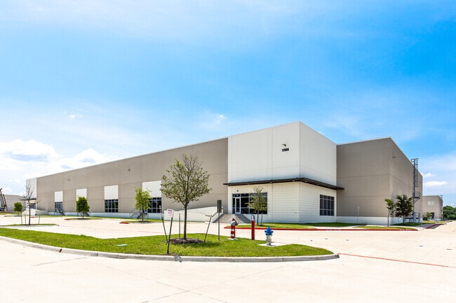

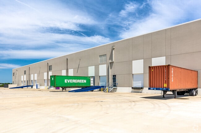
Property Detail
1250 Wattley Way
Dallas-Fort Worth-Arlington, TX
MCKINNEY INDUSTRIAL PARK NO 2, BLK D, LOT 3; (REPLAT)
R-1104-00D-0030-1
COLLIN
Commercialnec
Texas
B and X Area of moderate flood hazard, usually the area between the limits of the 100-year and 500-year floods.
3
2025
9.67 AC
2025
Allen/McKinney
030903
Dallas/Ft Worth
150,500 SF
NEARBY LISTINGS FOR SALE OR LEASE
DEMOGRAPHICS near 1250 Wattley Way
1 mile
3 mile
5 mile
2025 Total Population
2,174
43,071
147,433
2030 Population
2,478
49,165
169,093
Pop Growth 2025-2030
+ 13.98%
+ 14.15%
+ 14.69%
Average Age
38
40
39
2025 Total Households
694
16,926
51,665
HH Growth 2025-2030
+ 14.41%
+ 14.36%
+ 14.84%
Median Household Inc
$59,999
$79,517
$108,373
Avg Household Size
3.00
2.50
2.80
2025 Avg HH Vehicles
2.00
2.00
2.00
Median Home Value
$329,687
$498,781
$477,753
Median Year Built
1989
1999
2004
Nearby Places
Map Layers
Map Styles
 Street
 Aerial
Layers
 Traffic
 Biking
Places
Listings with unknown addresses are not visible on the map
- Restaurants
- Banks
- Shops
- Fitness
- Groceries
PUBLIC TRANSPORTATION
AIRPORT
Dallas Love Field
Drive
Walk
Distance
Dallas Love Field
46 min
34.2 mi
Freight Ports
Port of Shreveport
Drive
Walk
Distance
Port of Shreveport
242 min
220.4 mi
SALE & LEASE HISTORY
LISTING DATE
SALE/LEASE

Mar 16, 2021
For Lease
Mar 16, 2021
For Lease
Jun 22, 2018
For Lease
Feb 11, 2025
For Lease
Nearby Properties
Address
Land Use
TOTAL SIZE
Lot Size
Zoning
Address
Land Use
TOTAL SIZE
Lot Size
Zoning
638,539 SF
42.76 AC
Address
Land Use
TOTAL SIZE
Lot Size
Zoning
475,847 SF
16.34 AC
RG-18
Address
Land Use
TOTAL SIZE
Lot Size
Zoning
260,340 SF
18.64 AC
RG-18
Address
Land Use
TOTAL SIZE
Lot Size
Zoning
879,029 SF
50.26 AC
ML
Address
Land Use
TOTAL SIZE
Lot Size
Zoning
349,991 SF
13.53 AC
MF-M
Address
Land Use
TOTAL SIZE
Lot Size
Zoning
727,459 SF
48.83 AC
Address
Land Use
TOTAL SIZE
Lot Size
Zoning
725,223 SF
46.60 AC
Address
Land Use
TOTAL SIZE
Lot Size
Zoning
356,096 SF
19.50 AC
MF-M
Address
Land Use
TOTAL SIZE
Lot Size
Zoning
337,121 SF
9.39 AC
Address
Land Use
TOTAL SIZE
Lot Size
Zoning
321,982 SF
22.83 AC
SFR
Address
Land Use
TOTAL SIZE
Lot Size
Zoning
272,853 SF
17.32 AC
PD/ML
Address
Land Use
TOTAL SIZE
Lot Size
Zoning
1,708,448 SF
85.24 AC
Address
Land Use
TOTAL SIZE
Lot Size
Zoning
281,420 SF
9.43 AC
PD/ML
Address
Land Use
TOTAL SIZE
Lot Size
Zoning
201,484 SF
48.39 AC
PD/ML
Address
Land Use
TOTAL SIZE
Lot Size
Zoning
319,712 SF
69.85 AC
Address
Land Use
TOTAL SIZE
Lot Size
Zoning
244,074 SF
13.97 AC
Address
Land Use
TOTAL SIZE
Lot Size
Zoning
304,565 SF
19.09 AC
COMM
Address
Land Use
TOTAL SIZE
Lot Size
Zoning
174,624 SF
10.05 AC
Address
Land Use
TOTAL SIZE
Lot Size
Zoning
207,328 SF
15.10 AC
SFR
Address
Land Use
TOTAL SIZE
Lot Size
Zoning
119,230 SF
5.44 AC
Address
Land Use
TOTAL SIZE
Lot Size
Zoning
201,899 SF
9.77 AC
MF-M
Address
Land Use
TOTAL SIZE
Lot Size
Zoning
186,291 SF
11.13 AC
Address
Land Use
TOTAL SIZE
Lot Size
Zoning
195,589 SF
12.54 AC
RG-18
Address
Land Use
TOTAL SIZE
Lot Size
Zoning
212,093 SF
9.71 AC
RG-18
Address
Land Use
TOTAL SIZE
Lot Size
Zoning
231,192 SF
14.68 AC
Address
Land Use
TOTAL SIZE
Lot Size
Zoning
169,215 SF
10 AC
BN
Address
Land Use
TOTAL SIZE
Lot Size
Zoning
91,962 SF
8.29 AC
C
Address
Land Use
TOTAL SIZE
Lot Size
Zoning
419,205 SF
26.53 AC
Address
Land Use
TOTAL SIZE
Lot Size
Zoning
243,189 SF
11.78 AC
PD
The World's #1 Commercial Real Estate Marketplace
Connect with us
© 2026 CoStar Group
The information above has been obtained from sources believed reliable. While we do not doubt its accuracy we have not verified it and make no guarantee, warranty or representation about it. It is your responsibility to independently confirm its accuracy and completeness. Any projections, opinions, assumptions, or estimates used are for example only and do not represent the current or future performance of the property. The value of this transaction to you depends on tax and other factors which should be evaluated by your tax, financial, and legal advisors. You and your advisors should conduct a careful, independent investigation of the property to determine to your satisfaction the suitability of the property for your needs.