Property Record
12801 Access Undetermined Dr, Fort Myers, FL 33913

NEARBY LISTINGS FOR SALE OR LEASE
Property Detail
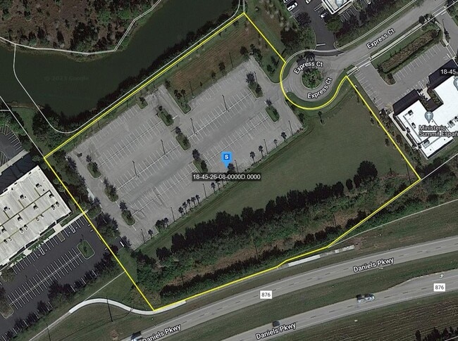
12801 Access Undetermined Dr
Cape Coral-Fort Myers, FL
E. Daniels Rd / Airport
18-45-26-08-0000D.0000
WORTHINGTON COMMERCE PARK PB 76 PGS 74-79 TRACT D
Commercialacreage
Lee
X
Florida
12071C0475F
5.68 AC
2024
S Ft Myers/San Carlos
2025
Southwest Florida
980000
DEMOGRAPHICS near 12801 Access Undetermined Dr
1 Mile
3 Mile
5 Mile
2024 Total Population
2,849
25,802
76,196
2029 Population
3,412
30,744
90,691
Pop Growth 2024-2029
+ 19.76%
+ 19.15%
+ 19.02%
Average Age
45
46
43
2024 Total Households
1,259
10,499
28,887
HH Growth 2024-2029
+ 19.62%
+ 19.14%
+ 19.10%
Median Household Inc
$73,858
$79,693
$73,761
Avg Household Size
2.30
2.40
2.50
2024 Avg HH Vehicles
2.00
2.00
2.00
Median Home Value
$374,482
$359,767
$301,403
Median Year Built
2007
2008
2005
Nearby Places
Map Layers
Map Styles
 Street
 Aerial
- Restaurants
- Banks
- Shops
- Fitness
- Groceries
PUBLIC TRANSPORTATION
AIRPORT
Southwest Florida International
DRIVE
WALK
Distance
Southwest Florida International
7 min
2.5 mi
Punta Gorda
DRIVE
WALK
Distance
Punta Gorda
43 min
35.0 mi
Freight Ports
Port Manatee
DRIVE
WALK
Distance
Port Manatee
123 min
106.7 mi
Nearby Properties
Address
Land Use
TOTAL SIZE
Lot Size
Zoning
Address
Land Use
TOTAL SIZE
Lot Size
Zoning
2,830,434 SF
6,201.32 AC
AOPD
Address
Land Use
TOTAL SIZE
Lot Size
Zoning
545,043 SF
16.29 AC
C-1
Address
Land Use
TOTAL SIZE
Lot Size
Zoning
21.08 AC
MDP-3
Address
Land Use
TOTAL SIZE
Lot Size
Zoning
246,785 SF
18.54 AC
AOPD
Address
Land Use
TOTAL SIZE
Lot Size
Zoning
315,233 SF
75.18 AC
CPD
Address
Land Use
TOTAL SIZE
Lot Size
Zoning
134,369 SF
8.31 AC
PUD
Address
Land Use
TOTAL SIZE
Lot Size
Zoning
130,970 SF
8.68 AC
PUD
Address
Land Use
TOTAL SIZE
Lot Size
Zoning
204,456 SF
5.21 AC
C-1
Address
Land Use
TOTAL SIZE
Lot Size
Zoning
213,556 SF
18.17 AC
CPD
Address
Land Use
TOTAL SIZE
Lot Size
Zoning
10.16 AC
MDP-3
Address
Land Use
TOTAL SIZE
Lot Size
Zoning
105,332 SF
11.08 AC
PUD
Address
Land Use
TOTAL SIZE
Lot Size
Zoning
Address
Land Use
TOTAL SIZE
Lot Size
Zoning
96,408 SF
5.75 AC
PUD
Address
Land Use
TOTAL SIZE
Lot Size
Zoning
119,952 SF
5 AC
PUD
Address
Land Use
TOTAL SIZE
Lot Size
Zoning
53,472 SF
75 AC
AG-2
Address
Land Use
TOTAL SIZE
Lot Size
Zoning
63,900 SF
4.18 AC
CT
Address
Land Use
TOTAL SIZE
Lot Size
Zoning
185,360 SF
9.90 AC
PUD
Address
Land Use
TOTAL SIZE
Lot Size
Zoning
50,290 SF
2.37 AC
MPD
Address
Land Use
TOTAL SIZE
Lot Size
Zoning
55.05 AC
MPD
Address
Land Use
TOTAL SIZE
Lot Size
Zoning
106,286 SF
16.57 AC
PUD
Address
Land Use
TOTAL SIZE
Lot Size
Zoning
74,274 SF
10.40 AC
Address
Land Use
TOTAL SIZE
Lot Size
Zoning
63,275 SF
10.12 AC
PUD
Address
Land Use
TOTAL SIZE
Lot Size
Zoning
63,365 SF
13.82 AC
AOPD
Address
Land Use
TOTAL SIZE
Lot Size
Zoning
59,686 SF
3.88 AC
IPD
Address
Land Use
TOTAL SIZE
Lot Size
Zoning
52,864 SF
1.32 AC
PUD
Address
Land Use
TOTAL SIZE
Lot Size
Zoning
69,480 SF
7.65 AC
PUD
Address
Land Use
TOTAL SIZE
Lot Size
Zoning
52,864 SF
1.32 AC
PUD
Address
Land Use
TOTAL SIZE
Lot Size
Zoning
52,864 SF
1.32 AC
Address
Land Use
TOTAL SIZE
Lot Size
Zoning
74,046 SF
7.90 AC
IL
Address
Land Use
TOTAL SIZE
Lot Size
Zoning
38,503 SF
4 AC
PUD
The World's #1 Commercial Real Estate Marketplace
Connect with us
© 2026 CoStar Group
The information above has been obtained from sources believed reliable. While we do not doubt its accuracy we have not verified it and make no guarantee, warranty or representation about it. It is your responsibility to independently confirm its accuracy and completeness. Any projections, opinions, assumptions, or estimates used are for example only and do not represent the current or future performance of the property. The value of this transaction to you depends on tax and other factors which should be evaluated by your tax, financial, and legal advisors. You and your advisors should conduct a careful, independent investigation of the property to determine to your satisfaction the suitability of the property for your needs.