Property Record
13017 N 20Th St, Phoenix, AZ 85022


NEARBY LISTINGS FOR SALE OR LEASE
Property Detail
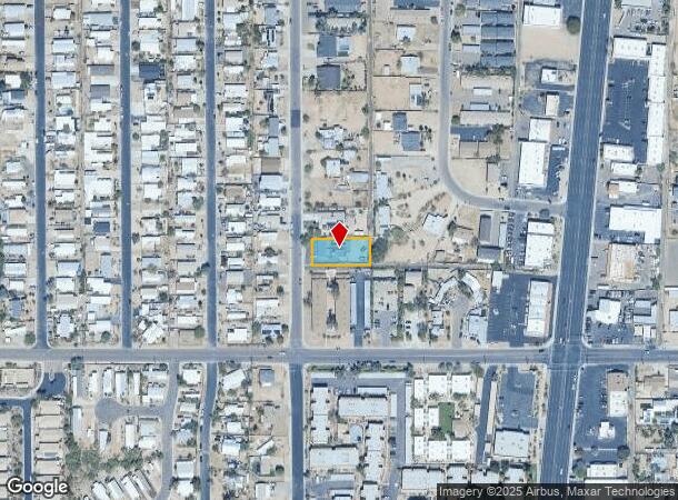
13017 N 20Th St
Phoenix-Mesa-Chandler, AZ
Sun & Sand Blk 1-3
166-11-040B
Maricopa
Triplex
Arizona
X
0.34 AC
04013C1735L
North Mountain
2,215 SF
Phoenix
DEMOGRAPHICS near 13017 N 20Th St
1 Mile
3 Mile
5 Mile
2024 Total Population
10,546
119,926
341,320
2029 Population
11,559
131,796
376,267
Pop Growth 2024-2029
+ 9.61%
+ 9.90%
+ 10.24%
Average Age
43
41
40
2024 Total Households
4,460
50,451
141,610
HH Growth 2024-2029
+ 9.73%
+ 10.21%
+ 10.54%
Median Household Inc
$67,315
$71,329
$70,845
Avg Household Size
2.30
2.30
2.30
2024 Avg HH Vehicles
2.00
2.00
2.00
Median Home Value
$408,879
$417,813
$407,412
Median Year Built
1983
1981
1983
Nearby Places
Map Layers
Map Styles
 Street
 Aerial
- Restaurants
- Banks
- Shops
- Fitness
- Groceries
PUBLIC TRANSPORTATION
AIRPORT
Phoenix Sky Harbor International
DRIVE
WALK
Distance
Phoenix Sky Harbor International
26 min
16.7 mi
Phoenix-Mesa Gateway
DRIVE
WALK
Distance
Phoenix-Mesa Gateway
58 min
43.5 mi
Freight Ports
Port of San Diego
DRIVE
WALK
Distance
Port of San Diego
414 min
369.2 mi
SALE & LEASE HISTORY
LISTING DATE
SALE/LEASE

May 16, 2025
For Sale
Nearby Properties
Address
Land Use
TOTAL SIZE
Lot Size
Zoning
Address
Land Use
TOTAL SIZE
Lot Size
Zoning
281,880 SF
14.13 AC
Address
Land Use
TOTAL SIZE
Lot Size
Zoning
128,046 SF
9.97 AC
C2
Address
Land Use
TOTAL SIZE
Lot Size
Zoning
1,089,213 SF
53.03 AC
R-3
Address
Land Use
TOTAL SIZE
Lot Size
Zoning
512,499 SF
23.03 AC
R3A
Address
Land Use
TOTAL SIZE
Lot Size
Zoning
323,288 SF
40.56 AC
R1-10
Address
Land Use
TOTAL SIZE
Lot Size
Zoning
452,506 SF
55.11 AC
RH
Address
Land Use
TOTAL SIZE
Lot Size
Zoning
3.27 AC
C-C
Address
Land Use
TOTAL SIZE
Lot Size
Zoning
336,529 SF
11.23 AC
R4A
Address
Land Use
TOTAL SIZE
Lot Size
Zoning
211,239 SF
12.33 AC
M-M
Address
Land Use
TOTAL SIZE
Lot Size
Zoning
28,805 SF
2.67 AC
C-C
Address
Land Use
TOTAL SIZE
Lot Size
Zoning
316,766 SF
13.32 AC
M-H
Address
Land Use
TOTAL SIZE
Lot Size
Zoning
358,670 SF
18.14 AC
M-H
Address
Land Use
TOTAL SIZE
Lot Size
Zoning
281,018 SF
9.26 AC
M-H
Address
Land Use
TOTAL SIZE
Lot Size
Zoning
120,494 SF
11.17 AC
C-C
Address
Land Use
TOTAL SIZE
Lot Size
Zoning
115,983 SF
4.85 AC
R-14
Address
Land Use
TOTAL SIZE
Lot Size
Zoning
84,738 SF
8.83 AC
R-6
Address
Land Use
TOTAL SIZE
Lot Size
Zoning
362,106 SF
15.60 AC
M-H
Address
Land Use
TOTAL SIZE
Lot Size
Zoning
81,692 SF
8.65 AC
R-10
Address
Land Use
TOTAL SIZE
Lot Size
Zoning
180,205 SF
11.53 AC
C-C
Address
Land Use
TOTAL SIZE
Lot Size
Zoning
110,623 SF
4.39 AC
R-10
Address
Land Use
TOTAL SIZE
Lot Size
Zoning
435,890 SF
16.51 AC
R5
Address
Land Use
TOTAL SIZE
Lot Size
Zoning
341,747 SF
17.61 AC
R-2
Address
Land Use
TOTAL SIZE
Lot Size
Zoning
277,000 SF
16.68 AC
M-H
Address
Land Use
TOTAL SIZE
Lot Size
Zoning
855 SF
156.18 AC
R-10
Address
Land Use
TOTAL SIZE
Lot Size
Zoning
166,715 SF
13.02 AC
C-C
Address
Land Use
TOTAL SIZE
Lot Size
Zoning
363,454 SF
18.80 AC
M-H
Address
Land Use
TOTAL SIZE
Lot Size
Zoning
77,582 SF
9.18 AC
R-6
Address
Land Use
TOTAL SIZE
Lot Size
Zoning
123,762 SF
13.57 AC
C-C
Address
Land Use
TOTAL SIZE
Lot Size
Zoning
407,948 SF
19.13 AC
M-H
Address
Land Use
TOTAL SIZE
Lot Size
Zoning
406,628 SF
19.24 AC
M-H
The World's #1 Commercial Real Estate Marketplace
Connect with us
© 2026 CoStar Group
The information above has been obtained from sources believed reliable. While we do not doubt its accuracy we have not verified it and make no guarantee, warranty or representation about it. It is your responsibility to independently confirm its accuracy and completeness. Any projections, opinions, assumptions, or estimates used are for example only and do not represent the current or future performance of the property. The value of this transaction to you depends on tax and other factors which should be evaluated by your tax, financial, and legal advisors. You and your advisors should conduct a careful, independent investigation of the property to determine to your satisfaction the suitability of the property for your needs.