Property Record
1417 Havana St, Aurora, CO 80010
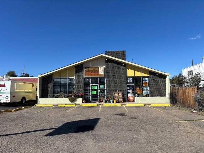
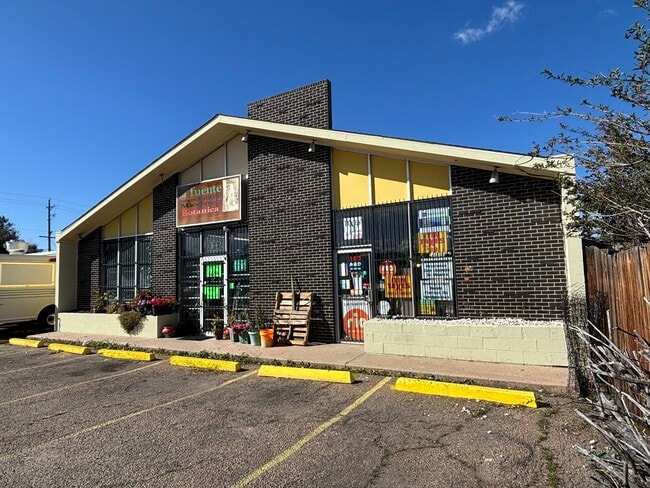
This Property Is For Sale
NEARBY LISTINGS FOR SALE OR LEASE
Property Detail
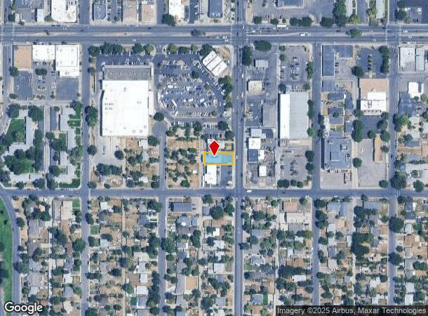
1417 Havana St
Denver-Aurora-Lakewood, CO
Havana Sub Amend Map
1973-03-1-01-009
LOT 3 BLK 3 HAVANA SUB AMENDED MAP
Storebuilding
Arapahoe
X
Colorado
08005C0176K
003,3
2023
0.15 AC
2024
Central
007302
Denver
3,413 SF
DEMOGRAPHICS near 1417 Havana St
1 Mile
3 Mile
5 Mile
2024 Total Population
30,399
172,045
432,730
2029 Population
30,922
175,065
438,710
Pop Growth 2024-2029
+ 1.72%
+ 1.76%
+ 1.38%
Average Age
34
37
37
2024 Total Households
10,203
65,315
173,415
HH Growth 2024-2029
+ 1.72%
+ 1.73%
+ 1.38%
Median Household Inc
$47,754
$66,826
$70,967
Avg Household Size
2.80
2.50
2.40
2024 Avg HH Vehicles
2.00
2.00
2.00
Median Home Value
$359,789
$445,651
$461,260
Median Year Built
1961
1977
1979
Nearby Places
- Restaurants
- Banks
- Shops
- Fitness
- Groceries
PUBLIC TRANSPORTATION
COMMUTER RAIL
Peoria Station Track 2 (Union Station to Denver Airport Station - Regional Transportation District)
DRIVE
WALK
Distance
Peoria Station Track 2 (Union Station to Denver Airport Station - Regional Transportation District)
7 min
3.0 mi
Peoria Station Track 1 (Union Station to Denver Airport Station - Regional Transportation District)
DRIVE
WALK
Distance
Peoria Station Track 1 (Union Station to Denver Airport Station - Regional Transportation District)
7 min
3.1 mi
AIRPORT
Denver International
DRIVE
WALK
Distance
Denver International
25 min
17.9 mi
Freight Ports
Tulsa Port Of Catoosa
DRIVE
WALK
Distance
Tulsa Port Of Catoosa
720 min
700.6 mi
Nearby Properties
Address
Land Use
TOTAL SIZE
Lot Size
Zoning
Address
Land Use
TOTAL SIZE
Lot Size
Zoning
368,450 SF
48.59 AC
Address
Land Use
TOTAL SIZE
Lot Size
Zoning
353,829 SF
4.51 AC
Address
Land Use
TOTAL SIZE
Lot Size
Zoning
719,357 SF
21.47 AC
M-MX-5
Address
Land Use
TOTAL SIZE
Lot Size
Zoning
880,442 SF
67.95 AC
I-B
Address
Land Use
TOTAL SIZE
Lot Size
Zoning
525,050 SF
105.06 AC
Address
Land Use
TOTAL SIZE
Lot Size
Zoning
273,184 SF
1.89 AC
Address
Land Use
TOTAL SIZE
Lot Size
Zoning
390,822 SF
13.47 AC
O-1
Address
Land Use
TOTAL SIZE
Lot Size
Zoning
185,206 SF
9.94 AC
C-MX
Address
Land Use
TOTAL SIZE
Lot Size
Zoning
646,975 SF
32.60 AC
M-IMX-8
Address
Land Use
TOTAL SIZE
Lot Size
Zoning
315,058 SF
36.85 AC
RPCZD
Address
Land Use
TOTAL SIZE
Lot Size
Zoning
33.01 AC
M-IMX-12
Address
Land Use
TOTAL SIZE
Lot Size
Zoning
269,622 SF
12.90 AC
Address
Land Use
TOTAL SIZE
Lot Size
Zoning
253,099 SF
7.15 AC
E-SU-DX
Address
Land Use
TOTAL SIZE
Lot Size
Zoning
343,997 SF
6.36 AC
S-MX-5
Address
Land Use
TOTAL SIZE
Lot Size
Zoning
723,053 SF
32.44 AC
M-IMX-12
Address
Land Use
TOTAL SIZE
Lot Size
Zoning
672,521 SF
0.61 AC
RB3
Address
Land Use
TOTAL SIZE
Lot Size
Zoning
384,886 SF
18.66 AC
R-2-A
Address
Land Use
TOTAL SIZE
Lot Size
Zoning
677,018 SF
5.05 AC
C-MX
Address
Land Use
TOTAL SIZE
Lot Size
Zoning
178,235 SF
1.38 AC
RFBAD
Address
Land Use
TOTAL SIZE
Lot Size
Zoning
384,124 SF
3.25 AC
S-MX-12
Address
Land Use
TOTAL SIZE
Lot Size
Zoning
368,676 SF
17.71 AC
R-2-A
Address
Land Use
TOTAL SIZE
Lot Size
Zoning
400,000 SF
22.91 AC
I-0
Address
Land Use
TOTAL SIZE
Lot Size
Zoning
466,055 SF
24.82 AC
M-IMX-5
Address
Land Use
TOTAL SIZE
Lot Size
Zoning
551,531 SF
5.09 AC
C-MX
Address
Land Use
TOTAL SIZE
Lot Size
Zoning
111,358 SF
1.21 AC
Address
Land Use
TOTAL SIZE
Lot Size
Zoning
277,005 SF
16.37 AC
Address
Land Use
TOTAL SIZE
Lot Size
Zoning
102,833 SF
14.27 AC
R-MU-20
Address
Land Use
TOTAL SIZE
Lot Size
Zoning
107,627 SF
1.59 AC
C-MX-5
Address
Land Use
TOTAL SIZE
Lot Size
Zoning
455,850 SF
18.65 AC
I-B
Address
Land Use
TOTAL SIZE
Lot Size
Zoning
142,708 SF
14.61 AC
The World's #1 Commercial Real Estate Marketplace
Connect with us
© 2025 CoStar Group
The information above has been obtained from sources believed reliable. While we do not doubt its accuracy we have not verified it and make no guarantee, warranty or representation about it. It is your responsibility to independently confirm its accuracy and completeness. Any projections, opinions, assumptions, or estimates used are for example only and do not represent the current or future performance of the property. The value of this transaction to you depends on tax and other factors which should be evaluated by your tax, financial, and legal advisors. You and your advisors should conduct a careful, independent investigation of the property to determine to your satisfaction the suitability of the property for your needs.