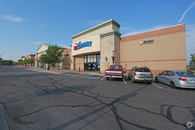
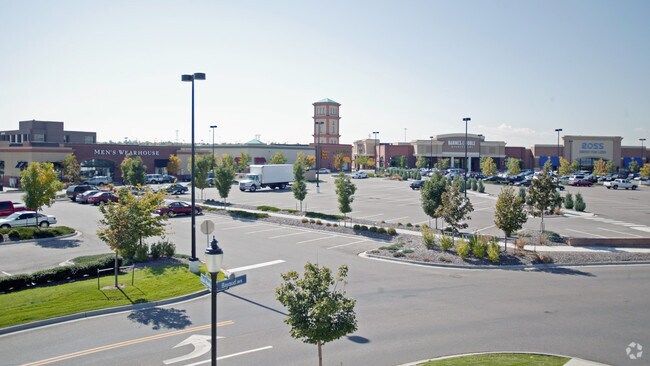
Property Record
14180 E Ellsworth Ave, Aurora, CO 80012


Property Detail
14180 E Ellsworth Ave
1975-07-3-34-001
TOWNSHIP T4S MAPPLATB E212 MAPPLATP 0485 SUBDIVISIONCD 003233 SUBDIVISIONNAME AURORA TOWN CENTER SUBDIVISION FILING NO 4 BLOCK 001 LOT 001 LOT 1 BLK 1 AURORA TOWN CENTER SUB FLG #4
Storebuilding
ARAPAHOE
RPCZD
Colorado
B and X Area of moderate flood hazard, usually the area between the limits of the 100-year and 500-year floods.
1
2025
36.85 AC
2026
Aurora
081001
Denver
315,058 SF
Denver-Aurora-Centennial, CO
NEARBY LISTINGS FOR SALE OR LEASE
DEMOGRAPHICS near 14180 E Ellsworth Ave
1 mile
3 mile
5 mile
2025 Total Population
15,758
183,787
415,180
2030 Population
16,208
188,146
424,548
Pop Growth 2025-2030
+ 2.86%
+ 2.37%
+ 2.26%
Average Age
37
37
38
2025 Total Households
5,925
68,102
160,987
HH Growth 2025-2030
+ 3.11%
+ 2.49%
+ 2.37%
Median Household Inc
$70,391
$70,080
$77,750
Avg Household Size
2.50
2.60
2.50
2025 Avg HH Vehicles
2.00
2.00
2.00
Median Home Value
$425,029
$412,725
$451,793
Median Year Built
1982
1980
1982
Nearby Places
Map Layers
Map Styles
 Street
 Aerial
Layers
 Traffic
 Biking
Places
Listings with unknown addresses are not visible on the map
- Restaurants
- Banks
- Shops
- Fitness
- Groceries
PUBLIC TRANSPORTATION
TRANSIT/SUBWAY
2Nd & Abilene Station (Lincoln Station to Peoria Station - Regional Transportation District)
Drive
Walk
Distance
2Nd & Abilene Station (Lincoln Station to Peoria Station - Regional Transportation District)
2 min
7 min
0.4 mi
Aurora Metro Center Station (Lincoln Station to Peoria Station - Regional Transportation District)
Drive
Walk
Distance
Aurora Metro Center Station (Lincoln Station to Peoria Station - Regional Transportation District)
2 min
14 min
0.8 mi
COMMUTER RAIL
Peoria Station Track 1 (Union Station to Denver Airport Station - Regional Transportation District)
Drive
Walk
Distance
Peoria Station Track 1 (Union Station to Denver Airport Station - Regional Transportation District)
10 min
5.9 mi
Peoria Station Track 2 (Union Station to Denver Airport Station - Regional Transportation District)
Drive
Walk
Distance
Peoria Station Track 2 (Union Station to Denver Airport Station - Regional Transportation District)
10 min
6.0 mi
AIRPORT
Denver International
Drive
Walk
Distance
Denver International
23 min
17.6 mi
Freight Ports
Tulsa Port Of Catoosa
Drive
Walk
Distance
Tulsa Port Of Catoosa
719 min
699.9 mi
Nearby Properties
Address
Land Use
TOTAL SIZE
Lot Size
Zoning
Address
Land Use
TOTAL SIZE
Lot Size
Zoning
368,450 SF
48.59 AC
Address
Land Use
TOTAL SIZE
Lot Size
Zoning
353,829 SF
4.51 AC
Address
Land Use
TOTAL SIZE
Lot Size
Zoning
244,271 SF
15.30 AC
Address
Land Use
TOTAL SIZE
Lot Size
Zoning
525,050 SF
105.06 AC
Address
Land Use
TOTAL SIZE
Lot Size
Zoning
739,979 SF
Address
Land Use
TOTAL SIZE
Lot Size
Zoning
496,493 SF
33.45 AC
Address
Land Use
TOTAL SIZE
Lot Size
Zoning
201,600 SF
44.67 AC
R1
Address
Land Use
TOTAL SIZE
Lot Size
Zoning
273,184 SF
1.89 AC
Address
Land Use
TOTAL SIZE
Lot Size
Zoning
476,186 SF
42.62 AC
Address
Land Use
TOTAL SIZE
Lot Size
Zoning
140.42 AC
Address
Land Use
TOTAL SIZE
Lot Size
Zoning
131,544 SF
3.92 AC
Address
Land Use
TOTAL SIZE
Lot Size
Zoning
47,616 SF
140.42 AC
PUD
Address
Land Use
TOTAL SIZE
Lot Size
Zoning
557,843 SF
21.35 AC
PUD
Address
Land Use
TOTAL SIZE
Lot Size
Zoning
277,985 SF
19.07 AC
Address
Land Use
TOTAL SIZE
Lot Size
Zoning
624,019 SF
4.09 AC
Address
Land Use
TOTAL SIZE
Lot Size
Zoning
178,235 SF
1.38 AC
RFBAD
Address
Land Use
TOTAL SIZE
Lot Size
Zoning
672,521 SF
0.61 AC
RB3
Address
Land Use
TOTAL SIZE
Lot Size
Zoning
176,751 SF
28.75 AC
Address
Land Use
TOTAL SIZE
Lot Size
Zoning
366,800 SF
20.21 AC
Address
Land Use
TOTAL SIZE
Lot Size
Zoning
130,531 SF
3.41 AC
Address
Land Use
TOTAL SIZE
Lot Size
Zoning
540,166 SF
2.80 AC
Address
Land Use
TOTAL SIZE
Lot Size
Zoning
111,358 SF
1.21 AC
Address
Land Use
TOTAL SIZE
Lot Size
Zoning
59,077 SF
2.50 AC
Address
Land Use
TOTAL SIZE
Lot Size
Zoning
386,285 SF
2.72 AC
Address
Land Use
TOTAL SIZE
Lot Size
Zoning
364,024 SF
23.23 AC
PUD
Address
Land Use
TOTAL SIZE
Lot Size
Zoning
521,364 SF
14.88 AC
PUD
Address
Land Use
TOTAL SIZE
Lot Size
Zoning
77,648 SF
6.21 AC
RM1
Address
Land Use
TOTAL SIZE
Lot Size
Zoning
171,602 SF
5.68 AC
The World's #1 Commercial Real Estate Marketplace
Connect with us
© 2026 CoStar Group
The information above has been obtained from sources believed reliable. While we do not doubt its accuracy we have not verified it and make no guarantee, warranty or representation about it. It is your responsibility to independently confirm its accuracy and completeness. Any projections, opinions, assumptions, or estimates used are for example only and do not represent the current or future performance of the property. The value of this transaction to you depends on tax and other factors which should be evaluated by your tax, financial, and legal advisors. You and your advisors should conduct a careful, independent investigation of the property to determine to your satisfaction the suitability of the property for your needs.