Property Record
142 Eldridge Rd, Sugar Land, TX 77478
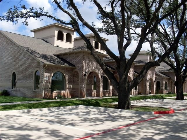

Property Detail
142 Eldridge Rd
9555-00-011-0080-907
ELDRIDGE POINTE OFFICE CONDOMINIUMS, BUILDING 11, UNIT D, 0.8772% COMMON AREA INTEREST
Commercialnec
Fort Bend
B and X Area of moderate flood hazard, usually the area between the limits of the 100-year and 500-year floods.
Texas
2024
7.95 AC
2025
E Fort Bend Co/Sugar Land
672003
Houston
730 SF
Houston-Pasadena-The Woodlands, TX
NEARBY LISTINGS FOR SALE OR LEASE
DEMOGRAPHICS near 142 Eldridge Rd
1 mile
3 mile
5 mile
2025 Total Population
5,316
101,232
323,553
2030 Population
5,994
113,666
357,638
Pop Growth 2025-2030
+ 12.75%
+ 12.28%
+ 10.53%
Average Age
48
41
39
2025 Total Households
2,116
37,318
108,139
HH Growth 2025-2030
+ 13.28%
+ 12.81%
+ 10.98%
Median Household Inc
$102,490
$90,857
$84,141
Avg Household Size
2.50
2.70
2.90
2025 Avg HH Vehicles
2.00
2.00
2.00
Median Home Value
$415,205
$365,395
$337,887
Median Year Built
1985
1992
1992
Nearby Places
Map Layers
Map Styles
 Street
 Aerial
Layers
 Traffic
 Biking
Places
Listings with unknown addresses are not visible on the map
- Restaurants
- Banks
- Shops
- Fitness
- Groceries
PUBLIC TRANSPORTATION
AIRPORT
William P Hobby
Drive
Walk
Distance
William P Hobby
39 min
24.8 mi
George Bush Intcntl/Houston
Drive
Walk
Distance
George Bush Intcntl/Houston
51 min
40.9 mi
Freight Ports
Port of Houston
Drive
Walk
Distance
Port of Houston
40 min
26.9 mi
SALE & LEASE HISTORY
LISTING DATE
SALE/LEASE

Sep 25, 2016
For Lease
Aug 03, 2017
For Lease
Nearby Properties
Address
Land Use
TOTAL SIZE
Lot Size
Zoning
Address
Land Use
TOTAL SIZE
Lot Size
Zoning
448,502 SF
35.66 AC
Address
Land Use
TOTAL SIZE
Lot Size
Zoning
171,425 SF
29.96 AC
Address
Land Use
TOTAL SIZE
Lot Size
Zoning
221,618 SF
6.50 AC
Address
Land Use
TOTAL SIZE
Lot Size
Zoning
7.46 AC
Address
Land Use
TOTAL SIZE
Lot Size
Zoning
109,083 SF
20.81 AC
Address
Land Use
TOTAL SIZE
Lot Size
Zoning
12.98 AC
Address
Land Use
TOTAL SIZE
Lot Size
Zoning
94,547 SF
13.59 AC
Address
Land Use
TOTAL SIZE
Lot Size
Zoning
422,123 SF
39.85 AC
Address
Land Use
TOTAL SIZE
Lot Size
Zoning
Address
Land Use
TOTAL SIZE
Lot Size
Zoning
77,850 SF
8.53 AC
YQZ
Address
Land Use
TOTAL SIZE
Lot Size
Zoning
104,287 SF
13.56 AC
M
Address
Land Use
TOTAL SIZE
Lot Size
Zoning
85,273 SF
11.63 AC
Y
Address
Land Use
TOTAL SIZE
Lot Size
Zoning
88,705 SF
17.04 AC
SY
Address
Land Use
TOTAL SIZE
Lot Size
Zoning
126,308 SF
16.95 AC
Address
Land Use
TOTAL SIZE
Lot Size
Zoning
14,038 SF
23.83 AC
Address
Land Use
TOTAL SIZE
Lot Size
Zoning
260,269 SF
8.53 AC
Address
Land Use
TOTAL SIZE
Lot Size
Zoning
76,385 SF
17.48 AC
Address
Land Use
TOTAL SIZE
Lot Size
Zoning
Address
Land Use
TOTAL SIZE
Lot Size
Zoning
76,306 SF
15.84 AC
Address
Land Use
TOTAL SIZE
Lot Size
Zoning
129,813 SF
8.53 AC
Address
Land Use
TOTAL SIZE
Lot Size
Zoning
127,458 SF
14.21 AC
Address
Land Use
TOTAL SIZE
Lot Size
Zoning
12.22 AC
Address
Land Use
TOTAL SIZE
Lot Size
Zoning
88,682 SF
10.52 AC
ASY
Address
Land Use
TOTAL SIZE
Lot Size
Zoning
343,438 SF
54.92 AC
S
Address
Land Use
TOTAL SIZE
Lot Size
Zoning
61,006 SF
13.16 AC
X
Address
Land Use
TOTAL SIZE
Lot Size
Zoning
149,261 SF
12.15 AC
SJ
Address
Land Use
TOTAL SIZE
Lot Size
Zoning
154,586 SF
10.93 AC
SY
Address
Land Use
TOTAL SIZE
Lot Size
Zoning
254,210 SF
10.59 AC
JT
Address
Land Use
TOTAL SIZE
Lot Size
Zoning
49,976 SF
0.79 AC
X
Address
Land Use
TOTAL SIZE
Lot Size
Zoning
194,593 SF
2.29 AC
X
The World's #1 Commercial Real Estate Marketplace
Connect with us
© 2026 CoStar Group
The information above has been obtained from sources believed reliable. While we do not doubt its accuracy we have not verified it and make no guarantee, warranty or representation about it. It is your responsibility to independently confirm its accuracy and completeness. Any projections, opinions, assumptions, or estimates used are for example only and do not represent the current or future performance of the property. The value of this transaction to you depends on tax and other factors which should be evaluated by your tax, financial, and legal advisors. You and your advisors should conduct a careful, independent investigation of the property to determine to your satisfaction the suitability of the property for your needs.