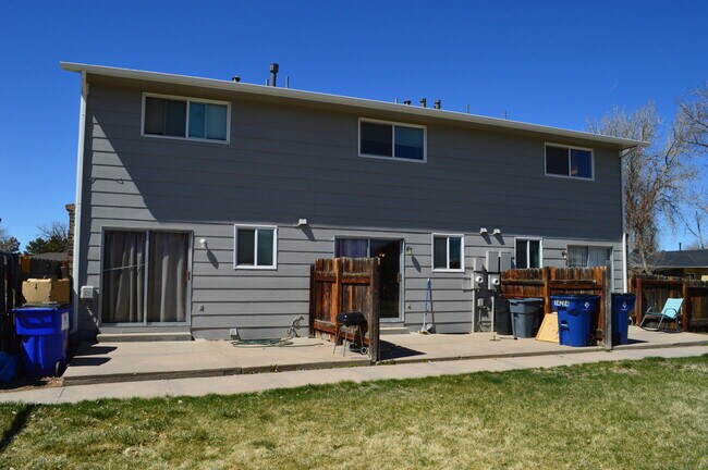
Property Record
14280 E 22Nd Pl, Aurora, CO 80011
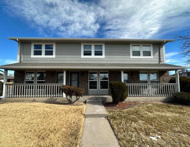
This Property Is For Sale
Property Detail
14280 E 22Nd Pl
Denver-Aurora-Centennial, CO
Sable Village Filing No 1
1821-31-2-18-005
SUB:SABLE VILLAGE FILING NO 1 BLK:2 LOT:17
Triplex
Adams
ARE
Colorado
08005C0039L
17
2024
0.29 AC
2025
Sable Altura Chambers
008308
Denver
4,851 SF
NEARBY LISTINGS FOR SALE OR LEASE
DEMOGRAPHICS near 14280 E 22Nd Pl
1 mile
3 mile
5 mile
2024 Total Population
13,835
130,106
340,052
2029 Population
14,400
132,305
345,027
Pop Growth 2024-2029
+ 4.08%
+ 1.69%
+ 1.46%
Average Age
35
34
36
2024 Total Households
4,622
43,163
121,080
HH Growth 2024-2029
+ 4.69%
+ 1.82%
+ 1.50%
Median Household Inc
$51,702
$61,366
$69,147
Avg Household Size
2.80
2.80
2.70
2024 Avg HH Vehicles
2.00
2.00
2.00
Median Home Value
$336,967
$350,595
$386,958
Median Year Built
1980
1979
1982
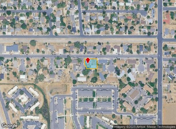
Nearby Places
Map Layers
Map Styles
 Street
 Aerial
Transit
 Traffic
 Biking
Places
Listings with unknown addresses are not visible on the map
- Restaurants
- Banks
- Shops
- Fitness
- Groceries
PUBLIC TRANSPORTATION
COMMUTER RAIL
Drive
Walk
Distance
9 min
3.5 mi
Drive
Walk
Distance
9 min
3.5 mi
AIRPORT
Denver International
Drive
Walk
Distance
Denver International
22 min
14.5 mi
Nearby Properties
Address
Land Use
TOTAL SIZE
Lot Size
Zoning
Address
Land Use
TOTAL SIZE
Lot Size
Zoning
368,450 SF
48.59 AC
Address
Land Use
TOTAL SIZE
Lot Size
Zoning
353,829 SF
4.51 AC
Address
Land Use
TOTAL SIZE
Lot Size
Zoning
880,442 SF
67.95 AC
I-B
Address
Land Use
TOTAL SIZE
Lot Size
Zoning
244,271 SF
15.30 AC
Address
Land Use
TOTAL SIZE
Lot Size
Zoning
525,050 SF
105.06 AC
Address
Land Use
TOTAL SIZE
Lot Size
Zoning
116,490 SF
3.71 AC
PUD
Address
Land Use
TOTAL SIZE
Lot Size
Zoning
161,437 SF
2.22 AC
RCZDC
Address
Land Use
TOTAL SIZE
Lot Size
Zoning
169,941 SF
4.08 AC
I-B
Address
Land Use
TOTAL SIZE
Lot Size
Zoning
97,001 SF
Address
Land Use
TOTAL SIZE
Lot Size
Zoning
87,346 SF
1.76 AC
RFBAD
Address
Land Use
TOTAL SIZE
Lot Size
Zoning
868,780 SF
105.02 AC
Address
Land Use
TOTAL SIZE
Lot Size
Zoning
876,549 SF
46.65 AC
Address
Land Use
TOTAL SIZE
Lot Size
Zoning
335,757 SF
36.88 AC
CMP-EI2
Address
Land Use
TOTAL SIZE
Lot Size
Zoning
102,444 SF
3.76 AC
GTWY
Address
Land Use
TOTAL SIZE
Lot Size
Zoning
691,200 SF
38.09 AC
Address
Land Use
TOTAL SIZE
Lot Size
Zoning
390,822 SF
13.47 AC
O-1
Address
Land Use
TOTAL SIZE
Lot Size
Zoning
57,392 SF
0.72 AC
Address
Land Use
TOTAL SIZE
Lot Size
Zoning
135,803 SF
3.36 AC
Address
Land Use
TOTAL SIZE
Lot Size
Zoning
273,184 SF
1.89 AC
Address
Land Use
TOTAL SIZE
Lot Size
Zoning
140.42 AC
Address
Land Use
TOTAL SIZE
Lot Size
Zoning
111,077 SF
3.06 AC
Address
Land Use
TOTAL SIZE
Lot Size
Zoning
550,031 SF
37.73 AC
Address
Land Use
TOTAL SIZE
Lot Size
Zoning
557,843 SF
21.35 AC
PUD
Address
Land Use
TOTAL SIZE
Lot Size
Zoning
315,058 SF
36.85 AC
RPCZD
Address
Land Use
TOTAL SIZE
Lot Size
Zoning
512,720 SF
42.32 AC
Address
Land Use
TOTAL SIZE
Lot Size
Zoning
131,544 SF
3.92 AC
Address
Land Use
TOTAL SIZE
Lot Size
Zoning
269,622 SF
12.90 AC
Address
Land Use
TOTAL SIZE
Lot Size
Zoning
419,630 SF
24.34 AC
Address
Land Use
TOTAL SIZE
Lot Size
Zoning
277,985 SF
19.07 AC
Address
Land Use
TOTAL SIZE
Lot Size
Zoning
58,997 SF
2.05 AC
S-CC-5X
The World's #1 Commercial Real Estate Marketplace
Connect with us
© 2026 CoStar Group
The information above has been obtained from sources believed reliable. While we do not doubt its accuracy we have not verified it and make no guarantee, warranty or representation about it. It is your responsibility to independently confirm its accuracy and completeness. Any projections, opinions, assumptions, or estimates used are for example only and do not represent the current or future performance of the property. The value of this transaction to you depends on tax and other factors which should be evaluated by your tax, financial, and legal advisors. You and your advisors should conduct a careful, independent investigation of the property to determine to your satisfaction the suitability of the property for your needs.