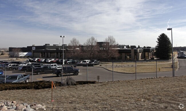
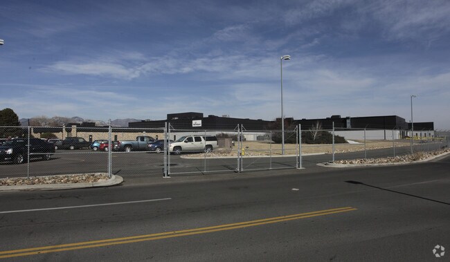
Property Record
14845 W 64Th Ave, Arvada, CO 80007

Property Detail
14845 W 64Th Ave
30-014-01-014
SECTION 01 TOWNSHIP 03 RANGE 70 QTR SE SUBDIVISIONCD 734000 SUBDIVISIONNAME SUNDSTRAND FLUID HANDLING COMPLEX BLOCK 00A LOT SIZE: 750452 TRACT 00A VALUE: 17.228
Commercialnec
JEFFERSON
B and X Area of moderate flood hazard, usually the area between the limits of the 100-year and 500-year floods.
Colorado
2025
17.23 AC
2025
West Denver
009838
Denver
175,599 SF
Denver-Aurora-Centennial, CO
NEARBY LISTINGS FOR SALE OR LEASE
DEMOGRAPHICS near 14845 W 64Th Ave
1 mile
3 mile
5 mile
2025 Total Population
8,763
56,836
144,504
2030 Population
8,717
56,440
143,979
Pop Growth 2025-2030
(0.52%)
(0.70%)
(0.36%)
Average Age
44
43
42
2025 Total Households
3,423
21,809
58,005
HH Growth 2025-2030
(0.64%)
(0.74%)
(0.43%)
Median Household Inc
$145,438
$137,464
$117,578
Avg Household Size
2.50
2.60
2.40
2025 Avg HH Vehicles
2.00
2.00
2.00
Median Home Value
$753,516
$764,262
$742,028
Median Year Built
1996
1990
1979
Nearby Places
Map Layers
Map Styles
 Street
 Aerial
Layers
 Traffic
 Biking
Places
Listings with unknown addresses are not visible on the map
- Restaurants
- Banks
- Shops
- Fitness
- Groceries
PUBLIC TRANSPORTATION
COMMUTER RAIL
Wheat Ridge - Ward Station Track 1 (Union Station to Wheat Ridge Ward Station - Regional Transportation District)
Drive
Walk
Distance
Wheat Ridge - Ward Station Track 1 (Union Station to Wheat Ridge Ward Station - Regional Transportation District)
7 min
3.8 mi
Arvada Ridge Station Track 1 (Union Station to Wheat Ridge Ward Station - Regional Transportation District)
Drive
Walk
Distance
Arvada Ridge Station Track 1 (Union Station to Wheat Ridge Ward Station - Regional Transportation District)
7 min
4.6 mi
AIRPORT
Denver International
Drive
Walk
Distance
Denver International
44 min
33.9 mi
Freight Ports
Tulsa Port Of Catoosa
Drive
Walk
Distance
Tulsa Port Of Catoosa
741 min
719.4 mi
Nearby Properties
Address
Land Use
TOTAL SIZE
Lot Size
Zoning
Address
Land Use
TOTAL SIZE
Lot Size
Zoning
97,944 SF
6.34 AC
Address
Land Use
TOTAL SIZE
Lot Size
Zoning
49,337 SF
4.02 AC
Address
Land Use
TOTAL SIZE
Lot Size
Zoning
72,630 SF
5.08 AC
Address
Land Use
TOTAL SIZE
Lot Size
Zoning
269,013 SF
31.89 AC
Address
Land Use
TOTAL SIZE
Lot Size
Zoning
253,643 SF
50.87 AC
A2
Address
Land Use
TOTAL SIZE
Lot Size
Zoning
353,286 SF
14.49 AC
Address
Land Use
TOTAL SIZE
Lot Size
Zoning
40,163 SF
5.46 AC
Address
Land Use
TOTAL SIZE
Lot Size
Zoning
48,225 SF
1.81 AC
Address
Land Use
TOTAL SIZE
Lot Size
Zoning
227,132 SF
11.95 AC
Address
Land Use
TOTAL SIZE
Lot Size
Zoning
363,989 SF
30.10 AC
Address
Land Use
TOTAL SIZE
Lot Size
Zoning
520,896 SF
24.42 AC
I1
Address
Land Use
TOTAL SIZE
Lot Size
Zoning
192,500 SF
10.97 AC
Address
Land Use
TOTAL SIZE
Lot Size
Zoning
260,325 SF
13.70 AC
Address
Land Use
TOTAL SIZE
Lot Size
Zoning
57,453 SF
2.83 AC
Address
Land Use
TOTAL SIZE
Lot Size
Zoning
215,878 SF
11.82 AC
A2
Address
Land Use
TOTAL SIZE
Lot Size
Zoning
101,761 SF
4.34 AC
Address
Land Use
TOTAL SIZE
Lot Size
Zoning
149,760 SF
8.64 AC
Address
Land Use
TOTAL SIZE
Lot Size
Zoning
223,158 SF
9.42 AC
I1
Address
Land Use
TOTAL SIZE
Lot Size
Zoning
67,520 SF
6.46 AC
Address
Land Use
TOTAL SIZE
Lot Size
Zoning
199,311 SF
10.45 AC
Address
Land Use
TOTAL SIZE
Lot Size
Zoning
81,890 SF
5.34 AC
Address
Land Use
TOTAL SIZE
Lot Size
Zoning
123,448 SF
7.80 AC
Address
Land Use
TOTAL SIZE
Lot Size
Zoning
67,879 SF
9.91 AC
A2
Address
Land Use
TOTAL SIZE
Lot Size
Zoning
82,055 SF
19.39 AC
Address
Land Use
TOTAL SIZE
Lot Size
Zoning
50,852 SF
3.94 AC
Address
Land Use
TOTAL SIZE
Lot Size
Zoning
64,883 SF
4.74 AC
Address
Land Use
TOTAL SIZE
Lot Size
Zoning
68,500 SF
5.84 AC
Address
Land Use
TOTAL SIZE
Lot Size
Zoning
72,000 SF
5.06 AC
Address
Land Use
TOTAL SIZE
Lot Size
Zoning
51,987 SF
15.23 AC
PD
The World's #1 Commercial Real Estate Marketplace
Connect with us
© 2026 CoStar Group
The information above has been obtained from sources believed reliable. While we do not doubt its accuracy we have not verified it and make no guarantee, warranty or representation about it. It is your responsibility to independently confirm its accuracy and completeness. Any projections, opinions, assumptions, or estimates used are for example only and do not represent the current or future performance of the property. The value of this transaction to you depends on tax and other factors which should be evaluated by your tax, financial, and legal advisors. You and your advisors should conduct a careful, independent investigation of the property to determine to your satisfaction the suitability of the property for your needs.