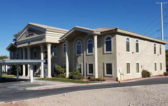
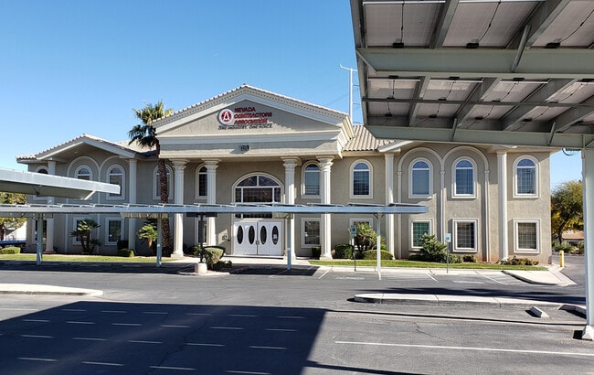
Property Record
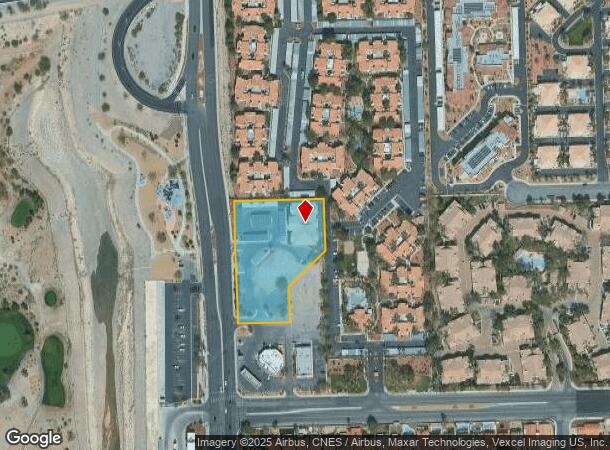
150 N Durango Dr, Las Vegas, NV 89145

Current Lease Availabilities
NEARBY LISTINGS FOR SALE OR LEASE
Property Detail
150 N Durango Dr
Las Vegas-Henderson-North Las Vegas, NV
Parcel Map File 81 Page 4
138-28-401-011
PARCEL MAP FILE 81 PAGE 4 LOT 3 & VAC RD
Commercialnec
Clark
X
Nevada
32003C2145F
3
2026
2.06 AC
2026
Northwest Las Vegas
003254
Las Vegas
17,650 SF
DEMOGRAPHICS near 150 N Durango Dr
1 mile
3 mile
5 mile
2024 Total Population
17,884
169,944
455,327
2029 Population
19,261
182,238
489,114
Pop Growth 2024-2029
+ 7.70%
+ 7.23%
+ 7.42%
Average Age
42
42
41
2024 Total Households
7,408
69,964
178,195
HH Growth 2024-2029
+ 7.71%
+ 7.23%
+ 7.39%
Median Household Inc
$53,233
$60,397
$63,422
Avg Household Size
2.30
2.40
2.50
2024 Avg HH Vehicles
2.00
2.00
2.00
Median Home Value
$277,596
$368,937
$378,635
Median Year Built
1992
1992
1993
Nearby Places
Map Layers
Map Styles
 Street
 Aerial
Transit
 Traffic
 Biking
Places
Listings with unknown addresses are not visible on the map
- Restaurants
- Banks
- Shops
- Fitness
- Groceries
PUBLIC TRANSPORTATION
AIRPORT
Harry Reid International
Drive
Walk
Distance
Harry Reid International
25 min
14.1 mi
Boulder City Municipal
Drive
Walk
Distance
Boulder City Municipal
45 min
34.0 mi
Nearby Properties
Address
Land Use
TOTAL SIZE
Lot Size
Zoning
Address
Land Use
TOTAL SIZE
Lot Size
Zoning
336,142 SF
39.99 AC
PC
Address
Land Use
TOTAL SIZE
Lot Size
Zoning
338,051 SF
49.13 AC
C1
Address
Land Use
TOTAL SIZE
Lot Size
Zoning
157,011 SF
31.41 AC
Address
Land Use
TOTAL SIZE
Lot Size
Zoning
974,131 SF
19.93 AC
Address
Land Use
TOTAL SIZE
Lot Size
Zoning
38.56 AC
PF
Address
Land Use
TOTAL SIZE
Lot Size
Zoning
161.14 AC
CV
Address
Land Use
TOTAL SIZE
Lot Size
Zoning
408,908 SF
15.60 AC
Address
Land Use
TOTAL SIZE
Lot Size
Zoning
157.50 AC
Address
Land Use
TOTAL SIZE
Lot Size
Zoning
52,690 SF
17.65 AC
RU
Address
Land Use
TOTAL SIZE
Lot Size
Zoning
7,292 SF
24.24 AC
R3
Address
Land Use
TOTAL SIZE
Lot Size
Zoning
5,643 SF
10.29 AC
Address
Land Use
TOTAL SIZE
Lot Size
Zoning
5,427 SF
17.57 AC
Address
Land Use
TOTAL SIZE
Lot Size
Zoning
37.31 AC
CV
Address
Land Use
TOTAL SIZE
Lot Size
Zoning
3.66 AC
R3
Address
Land Use
TOTAL SIZE
Lot Size
Zoning
7,148 SF
7.26 AC
Address
Land Use
TOTAL SIZE
Lot Size
Zoning
2,754 SF
17.17 AC
RPD20
Address
Land Use
TOTAL SIZE
Lot Size
Zoning
223,030 SF
18.11 AC
C1
Address
Land Use
TOTAL SIZE
Lot Size
Zoning
14,793 SF
9.57 AC
CPB
Address
Land Use
TOTAL SIZE
Lot Size
Zoning
28,956 SF
75.82 AC
CV
Address
Land Use
TOTAL SIZE
Lot Size
Zoning
4,872 SF
18.22 AC
R3
Address
Land Use
TOTAL SIZE
Lot Size
Zoning
5,979 SF
17.27 AC
RPD21
Address
Land Use
TOTAL SIZE
Lot Size
Zoning
5,057 SF
9.46 AC
RE
Address
Land Use
TOTAL SIZE
Lot Size
Zoning
3,895 SF
15.40 AC
PC
Address
Land Use
TOTAL SIZE
Lot Size
Zoning
12,031 SF
17.45 AC
PC
Address
Land Use
TOTAL SIZE
Lot Size
Zoning
450 SF
48.82 AC
Address
Land Use
TOTAL SIZE
Lot Size
Zoning
3,020 SF
19.68 AC
L:R-PD23
Address
Land Use
TOTAL SIZE
Lot Size
Zoning
8,849 SF
16.80 AC
RPD20
Address
Land Use
TOTAL SIZE
Lot Size
Zoning
151,550 SF
4.50 AC
Address
Land Use
TOTAL SIZE
Lot Size
Zoning
5,396 SF
13.95 AC
R3
Address
Land Use
TOTAL SIZE
Lot Size
Zoning
7,191 SF
16.56 AC
PC
The World's #1 Commercial Real Estate Marketplace
Connect with us
© 2026 CoStar Group
The information above has been obtained from sources believed reliable. While we do not doubt its accuracy we have not verified it and make no guarantee, warranty or representation about it. It is your responsibility to independently confirm its accuracy and completeness. Any projections, opinions, assumptions, or estimates used are for example only and do not represent the current or future performance of the property. The value of this transaction to you depends on tax and other factors which should be evaluated by your tax, financial, and legal advisors. You and your advisors should conduct a careful, independent investigation of the property to determine to your satisfaction the suitability of the property for your needs.