Property Record
15700 E Alameda Pky, Aurora, CO 80017


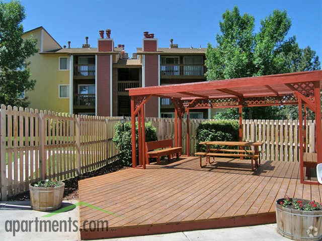

Property Detail
15700 E Alameda Pky
Denver-Aurora-Centennial, CO
SUBDIVISIONCD 062310 SUBDIVISIONNAME TOLLGATE TERRACE SUB 1ST FLG BLOCK 001 LOT 001 LOTS 1 & 2 BLK 1 TOLLGATE TERRACE SUB 1ST FLG
1975-17-2-09-003
Arapahoe
Apartment
Colorado
B and X Area of moderate flood hazard, usually the area between the limits of the 100-year and 500-year floods.
001,1
2025
8.37 AC
2026
Center Pointe
082100
Denver
140,419 SF
NEARBY LISTINGS FOR SALE OR LEASE
DEMOGRAPHICS near 15700 E Alameda Pky
1 mile
3 mile
5 mile
2025 Total Population
20,262
152,578
363,397
2030 Population
20,845
155,472
371,550
Pop Growth 2025-2030
+ 2.88%
+ 1.90%
+ 2.24%
Average Age
35
37
38
2025 Total Households
7,834
56,310
138,363
HH Growth 2025-2030
+ 2.95%
+ 2.05%
+ 2.35%
Median Household Inc
$66,912
$73,971
$76,474
Avg Household Size
2.50
2.60
2.50
2025 Avg HH Vehicles
2.00
2.00
2.00
Median Home Value
$414,825
$415,886
$438,454
Median Year Built
1985
1982
1982
Nearby Places
Map Layers
Map Styles
 Street
 Aerial
Layers
 Traffic
 Biking
Places
Listings with unknown addresses are not visible on the map
- Restaurants
- Banks
- Shops
- Fitness
- Groceries
PUBLIC TRANSPORTATION
TRANSIT/SUBWAY
Aurora Metro Center Station (Lincoln Station to Peoria Station - Regional Transportation District)
Drive
Walk
Distance
Aurora Metro Center Station (Lincoln Station to Peoria Station - Regional Transportation District)
2 min
19 min
1.0 mi
COMMUTER RAIL
40Th Ave & Airport Blvd - Gateway Park Station Track 2 (Union Station to Denver Airport Station - Regional Transportation District)
Drive
Walk
Distance
40Th Ave & Airport Blvd - Gateway Park Station Track 2 (Union Station to Denver Airport Station - Regional Transportation District)
13 min
6.1 mi
Peoria Station Track 1 (Union Station to Denver Airport Station - Regional Transportation District)
Drive
Walk
Distance
Peoria Station Track 1 (Union Station to Denver Airport Station - Regional Transportation District)
11 min
7.1 mi
AIRPORT
Denver International
Drive
Walk
Distance
Denver International
24 min
16.6 mi
Freight Ports
Tulsa Port Of Catoosa
Drive
Walk
Distance
Tulsa Port Of Catoosa
719 min
699.5 mi
Nearby Properties
Address
Land Use
TOTAL SIZE
Lot Size
Zoning
Address
Land Use
TOTAL SIZE
Lot Size
Zoning
244,271 SF
15.30 AC
Address
Land Use
TOTAL SIZE
Lot Size
Zoning
739,979 SF
Address
Land Use
TOTAL SIZE
Lot Size
Zoning
496,493 SF
33.45 AC
Address
Land Use
TOTAL SIZE
Lot Size
Zoning
876,549 SF
46.65 AC
Address
Land Use
TOTAL SIZE
Lot Size
Zoning
201,600 SF
44.67 AC
R1
Address
Land Use
TOTAL SIZE
Lot Size
Zoning
476,186 SF
42.62 AC
Address
Land Use
TOTAL SIZE
Lot Size
Zoning
140.42 AC
Address
Land Use
TOTAL SIZE
Lot Size
Zoning
277,940 SF
31.61 AC
Address
Land Use
TOTAL SIZE
Lot Size
Zoning
47,616 SF
140.42 AC
PUD
Address
Land Use
TOTAL SIZE
Lot Size
Zoning
557,843 SF
21.35 AC
PUD
Address
Land Use
TOTAL SIZE
Lot Size
Zoning
315,058 SF
36.85 AC
RPCZD
Address
Land Use
TOTAL SIZE
Lot Size
Zoning
277,985 SF
19.07 AC
Address
Land Use
TOTAL SIZE
Lot Size
Zoning
178,235 SF
1.38 AC
RFBAD
Address
Land Use
TOTAL SIZE
Lot Size
Zoning
672,521 SF
0.61 AC
RB3
Address
Land Use
TOTAL SIZE
Lot Size
Zoning
176,751 SF
28.75 AC
Address
Land Use
TOTAL SIZE
Lot Size
Zoning
366,800 SF
20.21 AC
Address
Land Use
TOTAL SIZE
Lot Size
Zoning
540,166 SF
2.80 AC
Address
Land Use
TOTAL SIZE
Lot Size
Zoning
364,024 SF
23.23 AC
PUD
Address
Land Use
TOTAL SIZE
Lot Size
Zoning
521,364 SF
14.88 AC
PUD
Address
Land Use
TOTAL SIZE
Lot Size
Zoning
77,648 SF
6.21 AC
RM1
Address
Land Use
TOTAL SIZE
Lot Size
Zoning
171,602 SF
5.68 AC
Address
Land Use
TOTAL SIZE
Lot Size
Zoning
462,048 SF
5.34 AC
RB3
Address
Land Use
TOTAL SIZE
Lot Size
Zoning
122,790 SF
14.52 AC
Address
Land Use
TOTAL SIZE
Lot Size
Zoning
649,712 SF
47.31 AC
Address
Land Use
TOTAL SIZE
Lot Size
Zoning
328,315 SF
8.15 AC
Address
Land Use
TOTAL SIZE
Lot Size
Zoning
186,088 SF
10.15 AC
RZIND
Address
Land Use
TOTAL SIZE
Lot Size
Zoning
562,766 SF
7.77 AC
Address
Land Use
TOTAL SIZE
Lot Size
Zoning
114,539 SF
5.35 AC
The World's #1 Commercial Real Estate Marketplace
Connect with us
© 2026 CoStar Group
The information above has been obtained from sources believed reliable. While we do not doubt its accuracy we have not verified it and make no guarantee, warranty or representation about it. It is your responsibility to independently confirm its accuracy and completeness. Any projections, opinions, assumptions, or estimates used are for example only and do not represent the current or future performance of the property. The value of this transaction to you depends on tax and other factors which should be evaluated by your tax, financial, and legal advisors. You and your advisors should conduct a careful, independent investigation of the property to determine to your satisfaction the suitability of the property for your needs.