Property Record
1698 Perimeter Rd, Greenville, SC 29605


NEARBY LISTINGS FOR SALE OR LEASE
Property Detail
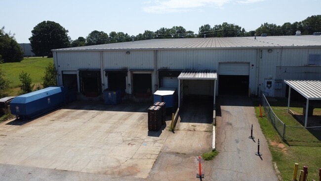
1698 Perimeter Rd
Greenville-Anderson-Mauldin, SC
L A Square
0400.01-01-105.00
MAP 0400.01
Warehouse
Greenville
AE
South Carolina
45045C0476E
105.00
2025
8.25 AC
2024
I-85 South/Donaldson
003401
Greenville/Spartanburg
DEMOGRAPHICS near 1698 Perimeter Rd
1 Mile
3 Mile
5 Mile
2024 Total Population
974
19,393
76,023
2029 Population
1,078
21,565
84,662
Pop Growth 2024-2029
+ 10.68%
+ 11.20%
+ 11.36%
Average Age
36
38
39
2024 Total Households
355
7,219
29,586
HH Growth 2024-2029
+ 10.70%
+ 11.22%
+ 11.45%
Median Household Inc
$58,461
$63,734
$63,854
Avg Household Size
2.70
2.60
2.50
2024 Avg HH Vehicles
2.00
2.00
2.00
Median Home Value
$201,042
$177,571
$208,914
Median Year Built
1981
1996
1994
Nearby Places
Map Layers
Map Styles
 Street
 Aerial
- Restaurants
- Banks
- Shops
- Fitness
- Groceries
PUBLIC TRANSPORTATION
AIRPORT
Greenville Spartanburg International
DRIVE
WALK
Distance
Greenville Spartanburg International
29 min
19.7 mi
Freight Ports
North Charleston Terminal
DRIVE
WALK
Distance
North Charleston Terminal
224 min
198.4 mi
SALE & LEASE HISTORY
LISTING DATE
SALE/LEASE

Sep 25, 2016
For Lease
Sep 23, 2016
For Sale
Nov 26, 2019
For Lease
Nov 22, 2019
For Lease
Nov 22, 2019
For Sale
Mar 24, 2017
For Sale
Jun 06, 2017
For Sale
Aug 28, 2024
For Sale
Nearby Properties
Address
Land Use
TOTAL SIZE
Lot Size
Zoning
Address
Land Use
TOTAL SIZE
Lot Size
Zoning
78.04 AC
C2
Address
Land Use
TOTAL SIZE
Lot Size
Zoning
977.33 AC
I1
Address
Land Use
TOTAL SIZE
Lot Size
Zoning
46.07 AC
I2
Address
Land Use
TOTAL SIZE
Lot Size
Zoning
29.91 AC
Address
Land Use
TOTAL SIZE
Lot Size
Zoning
32.34 AC
Address
Land Use
TOTAL SIZE
Lot Size
Zoning
58.95 AC
Address
Land Use
TOTAL SIZE
Lot Size
Zoning
41.48 AC
I2
Address
Land Use
TOTAL SIZE
Lot Size
Zoning
12.87 AC
I2
Address
Land Use
TOTAL SIZE
Lot Size
Zoning
14.13 AC
Address
Land Use
TOTAL SIZE
Lot Size
Zoning
387.84 AC
S1
Address
Land Use
TOTAL SIZE
Lot Size
Zoning
31.52 AC
I2
Address
Land Use
TOTAL SIZE
Lot Size
Zoning
8.97 AC
Address
Land Use
TOTAL SIZE
Lot Size
Zoning
13.90 AC
I1
Address
Land Use
TOTAL SIZE
Lot Size
Zoning
33.60 AC
I1
Address
Land Use
TOTAL SIZE
Lot Size
Zoning
13.52 AC
I2
Address
Land Use
TOTAL SIZE
Lot Size
Zoning
28.29 AC
I2
Address
Land Use
TOTAL SIZE
Lot Size
Zoning
12.41 AC
RS
Address
Land Use
TOTAL SIZE
Lot Size
Zoning
385.69 AC
R10
Address
Land Use
TOTAL SIZE
Lot Size
Zoning
Address
Land Use
TOTAL SIZE
Lot Size
Zoning
12.85 AC
I1
Address
Land Use
TOTAL SIZE
Lot Size
Zoning
50 AC
I2
Address
Land Use
TOTAL SIZE
Lot Size
Zoning
13.36 AC
I1
Address
Land Use
TOTAL SIZE
Lot Size
Zoning
11 AC
I1
Address
Land Use
TOTAL SIZE
Lot Size
Zoning
128.50 AC
I1
Address
Land Use
TOTAL SIZE
Lot Size
Zoning
45.10 AC
I1
Address
Land Use
TOTAL SIZE
Lot Size
Zoning
23.10 AC
S1
Address
Land Use
TOTAL SIZE
Lot Size
Zoning
12.84 AC
S1
Address
Land Use
TOTAL SIZE
Lot Size
Zoning
91.92 AC
I1
Address
Land Use
TOTAL SIZE
Lot Size
Zoning
8.14 AC
I1
Address
Land Use
TOTAL SIZE
Lot Size
Zoning
75.52 AC
I1
The World's #1 Commercial Real Estate Marketplace
Connect with us
© 2026 CoStar Group
The information above has been obtained from sources believed reliable. While we do not doubt its accuracy we have not verified it and make no guarantee, warranty or representation about it. It is your responsibility to independently confirm its accuracy and completeness. Any projections, opinions, assumptions, or estimates used are for example only and do not represent the current or future performance of the property. The value of this transaction to you depends on tax and other factors which should be evaluated by your tax, financial, and legal advisors. You and your advisors should conduct a careful, independent investigation of the property to determine to your satisfaction the suitability of the property for your needs.